More From Contributor

£17.50
Umbria Cycling Atlas with around 1020km cycling routes across the region presented by the Verlag Esterbauer in guide with maps at 1:75, 000 showing the routes & their variants. Extensive information is conveyed by symbols, indicating road surface, campsites & other accommodation, repair workshops, recreational facilities, places of interest, etc. A list of various types of accommodation facilities is included.IMPORTANT
- PLEASE NOTE BEFORE ORDERING
- ALL THE TEXT IN THIS TITLE IS GERMAN ONLY. MAP LEGEND

Includes::
ENGLISH (please see our sample image) & the information provided on the maps is sufficient to use this title without any knowledge of German.ABOUT THE BIKELINE SERIES: all the titles have been meticulously researched & are highly regarded in their native Germany. Most titles, as indicated in their individual descriptions, also include a separate section listing selected accommodation, from hotels to campsites, youth hostels & rooms in private houses, all with addresses, telephone numbers & price range. Information on towns along each route

Includes::
a list of places of interest, with opening hours, etc. Several of the guides also have street plans. To see the list of other titles in the Bikeline series please click on the series link.


...
Archived Product
£12.99
Umbria Eyewitness travel guide from Dorling Kindersley is a lavishly illustrated book concerned with providing the visitor with detailed background information to sightseeing in the country & a broad cultural introduction. Popular historical buildings & museums are often described with cutaway diagrams allowing you to view ...
Archived Product
£12.99
The ideal travel companion, full of insider advice on what to see & do, plus detailed itineraries & comprehensive maps for exploring this fascinating region. Take a leisurely boat trip on Lake Trasimeno, marvel at the gushing waters of the Cascata delle Marmore or admire the region`s many spectacular churches: everything you need to know is clearly laid out within colour-coded chapters. Discover the best of Umbria with this indispensable travel guide. Inside DK Eyewitness Travel Guide Umbria:- Over 10 colour maps help you navigate with ease- Simple layout makes it easy to find the information you need- Comprehensive tours & itineraries of Umbria, designed for every interest & budget- Illustrations & floorplans show in detail the Palazzo dei Consoli, the Basilica de San Francesco, the Palazzo dei Priori, the Galleria Nazionale dell` Umbria, Orvieto`s Duomo & more- Colour photographs of charming towns, picturesque villages, spectacular churches, historic buildings, famous art, stunning countryside & more- Detailed chapters, with area maps, cover Northern Umbria & Southern Umbria- Historical & cultural context gives you a richer travel experience: learn about Umbria`s history, way of life, art, architecture, religious traditions, outdoor activities & more- Essential travel tips: our expert choices of where to stay, eat, shop & sightsee, plus useful phrases, & transport, visa & health information DK Eyewitness Travel Guide Umbria is a detailed, easy-to-use guide designed to help you get the most from your visit to Umbria.DK Eyewitness: winner of the Top Guidebook Series in the Wanderlust Reader Travel Awards 2017. ” No other guide whets your appetite quite like this one”
- The Independent Planning a longer trip around Italy? Try our DK Eyewitness Travel Guide Italy. About DK Eyewitness Travel: DK`s highly visual Eyewitness guides show you what others only tell you, with easy-to-read maps, tips, & tours to inform & enrich your holiday. DK is the world`s leading illustrated reference publisher, producing beautifully designed books for adults & children in over 120 countries.
...
Archived Product
£12.99
Umbria Eyewitness travel guide from Dorling Kindersley is a lavishly illustrated book concerned with providing the visitor with detailed background information to sightseeing in the country & a broad cultural introduction. Popular historical buildings & museums are often described with cutaway diagrams allowing you to view “inside” your destination, sites are shown with bird’s eye plans & small, more conventional maps contextualise regions & pinpoint places of interest. The guide looks at northern & southern Umbria seperately. A travellers’ needs section details places to stay, eat & shop, as well as looking at entertainment, nightlife & outdoor activities. A survival guide features practical tips for preparation, logistics & health & safety, whilst a mini phrase section at the back of the book helps you with useful communication phrases. ...
Archived Product
£4.99
Umbria on a laminated, tear-resistant Insight Flexi Map, with a road map of the region & street plans of central Perugia plus Assisi & Orvieto, all indexed & highlighting numerous places of interest, plus extensive tourist information. On one side is a road map of Umbria at 1:300, 000, including Arezzo, part of the Marches with Urbino, & extending south to include Rieti & Viterbo. Topography is shown by relief shading, with numerous spot heights & names of main peaks & mountain ranges. The map presents the region ...
Archived Product
£10.00
When Patricia Clough bought a house in Umbria, she knew that buying her dream home did not mean that life would become a dream. By the end of this book, in which she describes the journey of making Umbria her home, she is sure that if one has basic requirements for being happy, then Umbria provides some of the best surroundings for happiness. Clough pores over Umbria`s enchanting countryside, its tumultuous history, its ancient culture & sumptuous food, & laments that for a long time Umbria was mistaken for its fashionable neighbour, Tuscany. This is not a guide to buying home a in Italy, nor a guidebook for your holiday
- though it would be useful as both of these things
- but a story in which a woman discovers & marvels at the place she begins to call home.

...
Archived Product
£16.99
Sverigeserien is an outdoor map series consisting of 116 sheets with coverage of southern & central Sweden & the northern coastline. The map is suitable for outdoor activities such as hiking, excursions, trail running, hunting, fishing, riding, cycling, mountain biking, paddling, skating & much more. Every sheet covers an area of 45x 68km. These topographical maps in scale 1:50 000 contain all the information needed for outdoor activities: Terrain information, hiking trails, illuminated tracks, camping, shelters, golf courses, leisure baths, historical remains, roads in different categories, railway lines & much more. Easy to read topography with contour lines, vertical interval 5 m. Sverigeserien is a high-quality map series & is durable for frequent use! Updated content with map data from Lantmäteriet (National Land Survey of Sweden) & printed on Polyart which is water & tear resistant. This means that the map can be folded repeatedly without breaking & can withstand the challenging weather in Sweden during both winter & summer. Legend is in Swedish, English & German. ...
Archived Product
£16.99
Topographic survey of Sweden at 1:100, 000, the Vägkartan, from the Lantmäteriet, covering most of the country in 79 double-sided maps. Please note: the mountainous regions of central & northern Sweden are not covered by this series but presented in a separate “ Fjällkartan
- Mountain Map” series also listed on our website. Each 1:100, 000 topographic survey map covers an area of 75 x 80km. The maps have contours at 10 metre intervals, plus relief shading & colouring for different types of landscape: open l&, forests, alvar, marshes, etc. Boundaries of national parks & nature reserves, areas prohibited to cross-country vehicles, & restricted entry military zones are marked. The maps indicate privately maintained local roads, cycle paths with wind shelters, footpaths, etc, & include all other information expected of topographic survey at this scale. The maps have a 2-km UTM grid, plus latitude & longitude lines 10’ intervals. Map legend

Includes::
English. For coverage of the country’s most visited hiking areas in central & northern Sweden please see Lantmäteriet’s Mountain Map series, listed separately on our website.


...
Archived Product
£16.99
Topographic survey of Sweden at 1:50, 000, the Terrängkartan, from the Lantmäteriet, covering most of the country in 244 double-sided maps. Please note: the mountainous regions of central & northern Sweden are not covered by this series but presented in a separate “ Fjällkartan
- Mountain Map” series also listed on our website. Each 1:50, 000 topographic survey map covers an area of 37.5 x 40km. The maps have contours at 5 metre intervals, plus relief shading & graphics for rocky outcrops & boulders. Further graphics and/or colouring show different types of land use or vegetation (forests, arable l&, orchards, marshes, peat bogs, etc). An unusual feature of this survey is the colouring indicating buildings below or above two storeys high & “leisure/holiday homes”. The maps indicate privately maintained roads & include all other information expected of topographic survey at this scale. The maps have a 1-km UTM grid, plus latitude & longitude lines 5’ intervals. Map legend

Includes::
English. For coverage of the country’s most visited hiking areas in central & northern Sweden please see Lantmäteriet’s Mountain Map series, listed separately on our website.


...
Archived Product
£29.99
Map No. 3128, Umtata, in South Africa’s official topographic survey at 1:250, 000 from the country’s national survey organization, the Chief Directorate of Surveys & Mapping. The maps have altitude colouring & contours at 50m or 100m intervals, depending on the map edition, plus spot heights. Deserts, marshes, dry pans, perennial & seasonal water features, etc, as well as protected areas are shown. The maps present the country’s road & rail networks & include the usual information expected on topographic mapping at this scale, although in more rapidly developing areas road information may not necessarily be up to date. Also indicated are magisterial district & provincial boundaries. Latitude & longitude values are shown in the margins at 5` intervals together with South African grid co-ordinates. Typically, each sheet covers an area of one degree of latitude & two degrees of longitude. The projection used is Gauss Conformal. The legend is in English & Afrikaans. ...
Archived Product

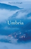
Umbria: A Cultural Guide

Umbria, `the Green Heart of Italy`, is a fascinating region of Etruscan and Roman monuments, medieval castles and cathedrals, and the Renaissance art of Giotto, Perugino and the young Raphael. Everywhere, vibrant cities, evocative hill-towns and tranquil villages are set amid glorious landscapes. This superb cultural guide makes the perfect traveller`s companion. Ian Campbell Ross tells the story of Umbria from the days of the ancient Umbri, a thousand years before Christ, through to the unification of Italy and up to the present day. He shows how Etruscans, Romans, early Christians and Longobards all left their mark, and how powerful city-states like Perugia, Spoleto and Orvieto, as well as smaller towns and villages, took pride in cultural achievements visitors still
enjoy. St. Francis and his followers transformed Assisi into a spiritual centre embracing one of the greatest collections of late medieval and early Renaissance art and architecture in Europe. This thoroughly revised edition, newly illustrated, provides a compelling narrative along with chapters on the region`s art and the local food and wine.A gazetteer gives visitors full details of what to see in the cities, hill-towns and mountain and lakeside villages of one of Italy`s most beautiful regions.
RIP - This product is no longer available on our network. It was last seen on 25.09.2019

This page now acts as a permanent archive for this product. Add more information using the comments box below to ensure it can still be found by future generations.

Use our search facility to see if it is available from an alternative contributor.
  • External links may include paid for promotion
  • Availability: Out Of Stock
  • Supplier: Stanfords
  • SKU: 9781908493859
Availability: In Stock
£14.99

Product Description

Umbria, `the Green Heart of Italy`, is a fascinating region of Etruscan & Roman monuments, medieval castles & cathedrals, & the Renaissance art of Giotto, Perugino & the young Raphael. Everywhere, vibrant cities, evocative hill-towns & tranquil villages are set amid glorious landscapes. This superb cultural guide makes the perfect traveller`s companion. Ian Campbell Ross tells the story of Umbria from the days of the ancient Umbri, a thousand years before Christ, through to the unification of Italy & up to the present day. He shows how Etruscans, Romans, early Christians & Longobards all left their mark, & how powerful city-states like Perugia, Spoleto & Orvieto, as well as smaller towns & villages, took pride in cultural achievements visitors still enjoy. St. Francis & his followers transformed Assisi into a spiritual centre embracing one of the greatest collections of late medieval & early Renaissance art & architecture in Europe. This thoroughly revised edition, newly illustrated, provides a compelling narrative along with chapters on the region`s art & the local food & wine.A gazetteer gives visitors full details of what to see in the cities, hill-towns & mountain & lakeside villages of one of Italy`s most beautiful regions.

Reviews/Comments

Add New

Intelligent Comparison

Oooops!
We couldn't find anything!
Perhaps this product's unique.... Or perhaps we are still looking for comparisons!
Click to bump this page and we'll hurry up.

Price History

Vouchers

No voucher codes found.
Do you know a voucher code for this product or supplier? Add it to Insights for others to use.

Facebook

Jargon Buster

Wine - An alcoholic drink made from fermented grapes.
Day - The time it takes a planet or other space objects to complete one rotation.
Set - a group of items usually related to one another. Some objects cannot function without the complete set of items.
Heart - An organ that pumps blood around the body. Usually related to love.
Italy - a country in Europe.

Supplier Information

Stanfords
Stanfords was established in 1853 and opened their iconic Covent Garden flagship store in 1901. They have become the top retailer of maps, travel books and accessories in the UK and arguably offer the largest selection of maps and travel books worldwide. Famous names such as Captain Robert Falcon Scott, Ranulph Fiennes and Michael Palin have purchased from Stanfords. They now have a shop in Bristol and both stores together with other venues operate a calendar of events including talks, book signings and exhibitions. As a specialist map retailer, the map selection is comprehensive and includes road maps, street maps and walking maps from worldwide destinations, as well as a selection of world atlases and wall maps. Books include travel guides and travel literature. Stanfords also stock globes, from miniatures made of blue marble to magnificent floor-standing globes. The website features a selection of interesting articles on travel topics.
Page Updated: 2023-11-12 20:15:36

Community Generated Product Tags

Oh No! The productWIKI community hasn't generated any tags for this product yet!
Menu