-
Home
-
Contributors
-
International
-
Account
-
Information
More From Contributor
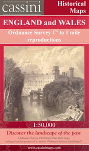
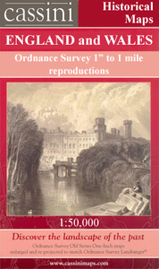
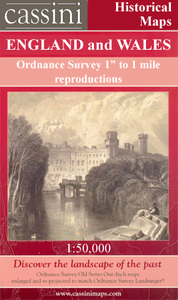
Includes:: notes on the development of Ordnance Survey & the various series produced by them. For those interested in maps & cartography in general, the Cassini series also provides a fascinating insight into how Ordnance Survey cartographic style has developed over a period of over 100 years. Coverage in this title
Includes:: present day Torquay, Totnes, Newton Abbot, Paignton, Brixham, Dartmouth, Salcombe, Kingsbridge, Ivybridge, Buckfastleigh, Ashburton, Darlington, Cornworthy, East Allington, Slapton, Torcross, East Prawle, South Pool, Ringmore, Bigbury-on-Sea, Modbury, Brownston, Aveton Gifford, Holbeton, Yealmpton, Lee Mill, Wotter, Hallwell, Habertonford, South Brent, Broadhempston, Rattery, Bittaford, Cornwood, Didworthy, Holne & Sheepstor, together with the southern part of the Dartmoor National Park. PLEASE NOTE: Stanfords can also print on request mapping from all four series centring the map on a location of your choice. For more information please click on the link below. ...
Includes:: notes on the development of Ordnance Survey & the various series produced by them. For those interested in maps & cartography in general, the Cassini series also provides a fascinating insight into how Ordnance Survey cartographic style has developed over a period of over 100 years. Coverage in this title
Includes:: present day Torquay, Totnes, Newton Abbot, Paignton, Brixham, Dartmouth, Salcombe, Kingsbridge, Ivybridge, Buckfastleigh, Ashburton, Darlington, Cornworthy, East Allington, Slapton, Torcross, East Prawle, South Pool, Ringmore, Bigbury-on-Sea, Modbury, Brownston, Aveton Gifford, Holbeton, Yealmpton, Lee Mill, Wotter, Hallwell, Habertonford, South Brent, Broadhempston, Rattery, Bittaford, Cornwood, Didworthy, Holne & Sheepstor, together with the southern part of the Dartmoor National Park.* PLEASE NOTE: Stanfords can also print on request mapping from all four series *centring the map on a location of your choice.* For more information please click on the link below. ...
Includes:: Ashburton, Bovey Tracey, Buckfastleigh, Dawlish, Kingsbridge, Kingskerswell, Newton Abbot, Salcombe, Teignmouth, Bishopsteignton, Kingsteignton & Shaldon. Current edition of this title was published in 2012. To see other titles in this series of A-Z street atlases of towns & cities please click on the series link. A-Z also publish a series of County Street Atlases
- for a list of titles in that series please search for SI00000917.A-Z street atlases present motorways plus A & B roads highlighted by colouring & shown with route numbers. One way or restricted access streets & car parks are marked, as are in more recently published titles locations of speed cameras. Also shown are selected cycleway routes. Where appropriate, A & B roads are annotated with selected house numbers for easier identification of addresses. Railway lines are shown with stations & level crossings. Colouring indicates different types of buildings: educational, hospitals & healthcare, industrial, leisure & recreational, shopping centres & markets, public buildings, & places of interest. Symbols mark locations of facilities usually indicated on street mapping: post offices, emergency services, public toilets, etc. Also marked are postcode & local authority boundaries. Each page has the lines & coordinates of the British National Grid. The indexes list streets, places & areas, hospitals, industrial estates, blocks of flats on housing estates, railway stations, & selected places o interest; the latter are printed in contrasting colouring to make them easier to find. ...

Torbay And South Dartmoor OS ACTIVE MAP
available on our website in a waterproof and tear-resistant version.Maps in this series are only published folded. Stanfords can also print flat versions of Ordnance Survey maps through the OS Select system, centring the map on a location of your choice and with a picture provided by you on the cover. For more information please click on the link at the bottom of this description.About Ordnance Survey
This page now acts as a permanent archive for this product. Add more information using the comments box below to ensure it can still be found by future generations.
Use our search facility to see if it is available from an alternative contributor.
- External links may include paid for promotion
- Availability: Out Of Stock
- Supplier: Stanfords
- SKU: 9780319480281
Product Description
Map No. 202, Torbay & South Dartmoor, in the OS Active version of the Ordnance Survey Landranger series at 1:50, 000, including Torquay, Totnes, Newton Abbot, Paignton, Brixham, Dartmouth, Salcombe, Kingsbridge, Ivybridge, Buckfastleigh, Ashburton, Darlington, Cornworthy, East Allington, Slapton, Torcross, East Prawle, South Pool, Ringmore, Bigbury-on-Sea, Modbury, Brownston, Aveton Gifford, Holbeton, Yealmpton, Lee Mill, Wotter, Hallwell, Habertonford, South Brent, Broadhempston, Rattery, Bittaford, Cornwood, Didworthy, Holne & Sheepstor, together with the south part of the Dartmoor National Park & a section of the South West Coast Path. Edition D1; Revised 2002; Revised for selected changes 2008; Copyright date 2009 This title is also available on our website in a waterproof & tear-resistant version. Maps in this series are only published folded. Stanfords can also print flat versions of Ordnance Survey maps through the OS Select system, centring the map on a location of your choice & with a picture provided by you on the cover. For more information please click on the link at the bottom of this description. About Ordnance Survey
Reviews/Comments
Add New
Intelligent Comparison
Price History
Vouchers
Do you know a voucher code for this product or supplier? Add it to Insights for others to use.


 United Kingdom
 France
 Germany
 Netherlands
 Sweden
 USA
USA
 Italy
Italy
 Spain
Spain


 Denmark