
 United Kingdom
 France
 Germany
 Netherlands
 Sweden
 USA
USA
 Italy
Italy
 Spain
Spain
More From Contributor


Torbay And South Dartmoor CURRENT EDITION - TO BE REPLACED IN
SEPTEMBER 2012
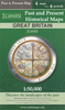
Map No. 202, Torbay and South Dartmoor, in the Ordnance Survey Landranger series at 1:50, 000, including Torquay, Totnes, Newton Abbot, Paignton, Brixham, Dartmouth, Salcombe, Kingsbridge, Ivybridge, Buckfastleigh, Ashburton, Darlington, Cornworthy, East Allington, Slapton, Torcross, East Prawle, South Pool, Ringmore, Bigbury-on-Sea, Modbury, Brownston, Aveton Gifford, Holbeton, Yealmpton, Lee Mill, Wotter, Hallwell, Habertonford, South Brent, Broadhempston, Rattery, Bittaford, Cornwood, Didworthy, Holne and Sheepstor, together with the south part of the Dartmoor National Park and a section of the South West Coast Path.Edition D1; Publication date February 2009About Ordnance Survey
Product Description
Reviews/Comments
Add New
Intelligent Comparison
Archived Product
Truro And Falmouth CURRENT EDITION - TO BE REPLACED IN OCTOBER 2012 Stanfords
£5.59
Archived Product
Torbay And South Dartmoor NEW EDITION DUE OUT SEPTEMBER 2012 Stanfords
£6.99
Archived Product
Purbeck & South Dorset CURRENT EDITION - TO BE REPLACED IN JUNE 2012 Stanfords
£6.39
Archived Product

London South CURRENT EDITION - TO BE REPLACED IN JUNE 2012 Stanfords
£6.39
Archived Product
Plymouth And Launceston CURRENT EDITION - TO BE REPLACED IN SEPTEMBER 2012 Stanfords
£5.59
Archived Product
Torbay And South Dartmoor OS ACTIVE Map NEW EDITION DUE OUT SEPTEMBER 2012 Stanfords
£9.09
Archived Product
London South OS ACTIVE Map CURRENT EDITION - TO BE REPLACED IN JUNE 2012 Stanfords
£11.19
Archived Product
Reading And Windsor CURRENT EDITION - TO BE REPLACED IN JUNE 2012 Stanfords
£5.59
Vouchers
No voucher codes found.
Do you know a voucher code for this product or supplier? Add it to Insights for others to use.
Do you know a voucher code for this product or supplier? Add it to Insights for others to use.
 Denmark