
 United Kingdom
 France
 Germany
 Netherlands
 Sweden
 USA
USA
 Italy
Italy
 Spain
Spain
More From Contributor


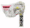


Tokyo City Map
Tokyo at 1:15, 000 on a pocket-size, indexed street plan from MairDumont printed on durable, waterproof and tear-resistant synthetic paper, with a diagram of the city’s metro and railway network, plus a small road map of the city’s environs. The plan covers the city’s central districts and clearly shows metro and railway lines and stations. Important buildings and places of interest are marked, with 10 best sights prominently highlighted. Names of districts and selected main streets are also shown in Japanese; all other place names are in the Latin alphabet only and, where appropriate, in English. Multilingual map legend includes English.The index is on the reverse side and includes extensive lists of useful contact details for tourist information offices, hotel reservation,
car hire, places of entertainment, emergency services, etc. The map also includes a diagram of the metro and railway network and a small road map of the city’s environs including Yokohama.
car hire, places of entertainment, emergency services, etc. The map also includes a diagram of the metro and railway network and a small road map of the city’s environs including Yokohama.

Product Description
Reviews/Comments
Add New
Vouchers
No voucher codes found.
Do you know a voucher code for this product or supplier? Add it to Insights for others to use.
Do you know a voucher code for this product or supplier? Add it to Insights for others to use.
 Denmark