More From Contributor
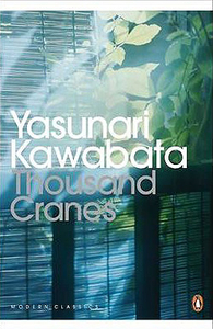
£14.99
Throughout their history, the Guardian & the Observer have avidly reported the worlds of exploration & adventure travel. In the 19th century, they covered the British & European explorers who were trying to fill in the 'blanks on the map'
- crossing deserts, racing to the poles, searching for the source of the Nile & trying to be the first to master the peaks of the Alps, &, later, the Himalaya. By the turn of the 20th century, interest turned to Everest, the 'third pole', to the deserts that needed to be conquered, & also to the new ways of exploring that opened up a whole new world of adventure
- airships over the North Pole & Citroen driving across the Sahara in the 1920s, to name but two. In the post-war period, explorers upped the ante
- who would be the first to row across the great oceans? Travel unsupported to the Poles? Climb Everest without oxygen? Add to this the vogue for recreating great voyages (the most famous being the Kon Tiki & Vinland expedition to Greenland) & soon the newspapers were brimming with tales of derring-do. This collection draws together a unique collection of first person accounts, news reports &
- inevitably
- obituaries that demonstrate the awe-inspiring lengths to which explorers & adventurers have gone to push back the boundaries of human endeavour. This title collects: Gordon Laing's doomed journey to Timbuctoo in 1828; Captain Webb's epic swim across the English Channel in 1875; Wilfrid Thesiger's 1940s crossing of the Rub' al Khali; &, Aron Ralston's harrowing experience in 2003, when he amputated his lower right arm in order to free himself from a rockfall. Capturing not only the adrenaline rush the adventurers feel when stepping out into the unknown but also the fear & trepidation that set in when things start to go wrong, Those Who Dared is an adventure anthology that will satisfy the yearnings of the hardened explorer & armchair traveller alike.


...
Archived Product
£12.99
In this third Neapolitan novel, Elena & Lila have become women. Both have attempted pushing against the walls of a prison that would have seen them living a life of misery, ignorance & submission. They are afloat on the great sea of opportunities that opened up during the 1970s. Yet they are still very much bound to each other by a strong, unbreakable bond. From the bestselling author of My Brilliant Friend, Elena Ferrante. ...
Archived Product
£12.99
Topographic survey of France at 1:25, 000 in IGN`s excellent TOP25 / Série Bleue series. All the maps are GPS compatible, with a 1km UTM grid plus latitude & longitude lines at 5’ intervals. Contours are at 5m intervals except for mountainous areas where the maps have contours at 10m intervals, vividly enhanced by hill shading & graphics for rocky terrain. Colouring with graphics indicates different types of vegetation or land use (deciduous or coniferous forests, moors, orchards, vineyards, etc). PLEASE NOTE: coverage of France at this scale is currently being revised – the format & the presentation of each title are indicated by the letters at the end of its Sheet Reference number (e.g. 0416ET, 3531ETR, 1923SB, etc.)MAPS WITH FULL TOURIST OVERPRINT & AN ENGLISH MAP LEGEND: all TOP25 maps & the SB editions of Série Bleue have an overprint highlighting waymarked walking trails including long-distance GR routes &, where appropriate, ski routes. Symbols indicate campsites, gîtes d’etape, refuges, equestrian centres & other recreational facilities or sites, tourist information centres, cultural heritage, etc. Towns & locations of particular interest are highlighted.- ET or OT = single-sided TOP25 map covering approx. 29x 21 km / 18x 13 miles.- ETR or OTR = waterproof & tear resistant TOP25 map covering the same area as the corresponding ET or OT number, but double-sided, printed on a smaller size sheet with a good overlap between the sides.- SB = Série Bleue map with full tourist overprint; these maps, first introduced in summer 2014, each cover approx. 29x 24km / 18x 15 miles.SÉRIE BLEUE maps with numbers ending in E (Est) or O (Ouest): most editions now indicate the GR routes, but do not show any other tourist information. Map legend is in French only. Each map covers approx. 14x 20km / 9x 12 miles. ...
Archived Product
£7.99
Thrace, the European part of Turkey, at 1:320, 000 in a series of regional maps from Mepmedya Yayinlari also covering the Mediterranean coast & the region around Ankara. The map is published in a handy double-sided format of 98 x 33cm when opened, easy to use when travelling. The map emphasizes main road connections but also

Includes::
local roads. Railway lines are shown with stations. Rather basic relief shading with a few spot heights is used to present the topography. Symbols highlight various places of interest. Also marked are internal administrative boundaries. The map is indexed & has no geographical coordinates. Map legend

Includes::
English.


...
Archived Product
£10.99
Thrace & Eastern Macedonia at 1:200, 000 in a series of regional road maps of Greece from Terrain Editions, printed on light, waterproof & tear-resistant synthetic paper. The map is double-sided, with a small overlap between the sides, & included the islands of Thasos & Samothrace (Samothraki) as well as part of the Khalkidhiki Peninsula with Mt Athos & Sithonia. Topography is shown by relief shading with light altitude colouring & plenty of names of mountain ranges. All place names are in both Greek & Latin alphabets. Presentation of the road network differentiates between smooth & rough dirt roads, & shows driving distances on many local roads plus locations of petrol stations. Scenic routes are highlighted. Railway lines & ferry routes are included. A range of symbols indicate various places of interest including campsites & mountain refuges, archaeological sites, churches & monasteries, skiing areas, etc. The map has a 10km UTM grid, with latitude & longitude shown by margin ticks & crosshairs at 10’. Map legend

Includes::
English. The index, separate for the Greek & Latin alphabet place names & with lists of monasteries & archaeological sites, is on the map itself &, unlike in most other titles in this series, no street plans are included.

...
Archived Product
£2.95
Thrapston in 1899 in a fascinating series of reproductions of old Ordnance Survey plans in the Alan Godfrey Editions, ideal for anyone interested in the history of their neighbourhood or family. Selected towns in Great Britain & Ireland are covered by maps showing the extent of urban development in the last decades of the 19th & early 20th century. In this title: the map gives good coverage of Thrapston, extending from the town centre southward to the Midland Railway station. Features include St James church, Thrapston House, LNWR railway with station, Midland Railway with station, ironstone quarry with tramway, Workhouse, Nene Side Iron Works, Cattle Market, Thrapston Bridge, St Nicholas church Islip (at top edge of map), Thrapston Mill etc. An 1898 directory of Thrapston is also included. About the Alan Godfrey Editions of the 25 ...
Archived Product
£3.50
Thrapston in 1899 in a fascinating series of reproductions of old Ordnance Survey plans in the Alan Godfrey Editions, ideal for anyone interested in the history of their neighbourhood or family. The map gives good coverage of Thrapston, extending from the town centre southward to the Midland Railway station. Features include St James church, Thrapston House, LNWR railway with station, Midland Railway with station, ironstone quarry with tramway, Workhouse, Nene Side Iron Works, Cattle Market, Thrapston Bridge, St Nicholas church Islip (at top edge of map), Thrapston Mill etc. An 1898 directory of Thrapston is on the reverse. About the Alan Godfrey Editions of the 25” OS Series: Selected towns in Great Britain & Ireland are covered by maps showing the extent of urban development in the last decades of the 19th & early 20th century. The plans have been taken from the Ordnance Survey mapping & reprinted at about 15 inches to one mile (1:4, 340). On the reverse most maps have historical notes & many also include extracts from contemporary directories. Most maps cover about one mile (1.6kms) north/south, one & a half miles (2.4kms) across; adjoining sheets can be combined to provide wider coverage.FOR MORE INFORMATION & A COMPLETE LIST OF ALL AVAILABLE TITLES PLEASE CLICK ON THE SERIES LINK. ...
Archived Product
£8.99
The enthralling novel from Victoria Hislop, the million-copy bestselling author of THE ISLAND & THE RETURN. Thessaloniki, 1917. As Dimitri Komninos is born, a devastating fire sweeps through the thriving Greek city where Christians, Jews & Muslims live side by side. Five years later, Katerina Sarafoglou`s home in Asia Minor is destroyed by the Turkish army. Losing her mother in the chaos, she flees across the sea to an unknown destination in Greece. Soon her life will become entwined with Dimitri`s, & with the story of the city itself, as war, fear & persecution begin to divide its people. Thessaloniki, 2007. A young Anglo-Greek hears his grandparents` life story for the first time & realises he has a decision to make. For many decades, they have looked after the memories & treasures of the people who were forced to leave. Should he become their next custodian & make this city his home? ...
Archived Product

Thousand Cranes

Kikuji has been invited to a tea ceremony by a mistress of his dead father. He is shocked to find there the mistress`s rival and successor, Mrs. Ota, and that the ceremony has been awkwardly arranged for him to meet his potential future bride. But he is most shocked to be drawn into a relationship with Mrs. Ota - a relationship that will bring only suffering and destruction to all of them. Thousand Cranes reflects the tea ceremony`s poetic precision with understated, lyrical style and beautiful prose.
RIP - This product is no longer available on our network. It was last seen on 25.09.2019

This page now acts as a permanent archive for this product. Add more information using the comments box below to ensure it can still be found by future generations.

Use our search facility to see if it is available from an alternative contributor.
  • Availability: Out Of Stock
  • Supplier: Stanfords
  • SKU: 9780141192604
Availability: In Stock
£9.99

Product Description

Kikuji has been invited to a tea ceremony by a mistress of his dead father. He is shocked to find there the mistress`s rival & successor, Mrs. Ota, & that the ceremony has been awkwardly arranged for him to meet his potential future bride. But he is most shocked to be drawn into a relationship with Mrs. Ota
- a relationship that will bring only suffering & destruction to all of them. Thousand Cranes reflects the tea ceremony`s poetic precision with understated, lyrical style & beautiful prose.

Reviews/Comments

Add New

Price History

Vouchers

No voucher codes found.
Do you know a voucher code for this product or supplier? Add it to Insights for others to use.

Facebook

Jargon Buster

Tea - A hot beverage made from the leaves of a tea plant
Understated - Something that is subtle yet comes across in an effective way.

Supplier Information

Stanfords
Stanfords was established in 1853 and opened their iconic Covent Garden flagship store in 1901. They have become the top retailer of maps, travel books and accessories in the UK and arguably offer the largest selection of maps and travel books worldwide. Famous names such as Captain Robert Falcon Scott, Ranulph Fiennes and Michael Palin have purchased from Stanfords. They now have a shop in Bristol and both stores together with other venues operate a calendar of events including talks, book signings and exhibitions. As a specialist map retailer, the map selection is comprehensive and includes road maps, street maps and walking maps from worldwide destinations, as well as a selection of world atlases and wall maps. Books include travel guides and travel literature. Stanfords also stock globes, from miniatures made of blue marble to magnificent floor-standing globes. The website features a selection of interesting articles on travel topics.
Page Updated: 2023-11-12 20:15:36

Community Generated Product Tags

Oh No! The productWIKI community hasn't generated any tags for this product yet!
Menu