More From Contributor

£6.99
The sheep on the hillside were munching away, Much as they always did, day after day, When suddenly something went zoom! overhead. ” Let`s go & see what it is!” they all said. & so begins a ripping, round-the-world adventure as the sheep take to skies in a magnificent yellow flying machine... ...
Archived Product
£11.99
The sheep on the hillside were munching away, Much as they always did, day after day, When suddenly something went zoom! overhead. ” Let`s go & see what it is!” they all said. & so begins a ripping, round-the-world adventure as the sheep take to skies in a magnificent yellow flying machine. ” Stylish & funny with a fantastic read-aloud text.” (The Bookseller). ...
Archived Product
£9.99
In 1804 Captain Meriwether Lewis & Captain William Clark, acting as the eyes & ears of President Thomas Jefferson, led an expedition to explore the Louisiana Purchase. One was contingency for which they were not prepared was the awesome geography of the Rocky Mountains. Including excerpts from Lewis & Clark`s journals & putting their scientific achievements in context, the author presents the story of this journey. ...
Archived Product
£7.99
A RICHARD & JUDY BOOK CLUB PICK DCI. Serena Flanagan is forced to confront a disturbing case from her past: the murder conviction of a 12-year-old-boy who has just been released from prison DCI Serena Flanagan hasn`t heard the boy`s name in years. Not since the blood on the wall & the body in the bedroom. Not since she listened as he confessed to brutally murdering his foster father. But now Ciaran Devine is out of prison & back in her life. & so is his brother, Thomas
- the brother that Flanagan always suspected of hiding something. When Ciaran`s probation officer comes Flanagan with fresh fears about the Devines, the years of lies begin to unravel, setting a deadly chain of events in motion. ” Deeply chilling, but full of tenderness...utterly compelling... The best book yet from a hugely talented writer”. (Sunday Mirror). ”A quietly superb, sensitive plot”. (The Times). ”A must read.” (Irish Times). ”DCI Serena Flanagan is the hero for whom we`ve all been waiting”. (Megan Abbott).
...
Archived Product
£14.99
Throughout their history, the Guardian & the Observer have avidly reported the worlds of exploration & adventure travel. In the 19th century, they covered the British & European explorers who were trying to fill in the 'blanks on the map'
- crossing deserts, racing to the poles, searching for the source of the Nile & trying to be the first to master the peaks of the Alps, &, later, the Himalaya. By the turn of the 20th century, interest turned to Everest, the 'third pole', to the deserts that needed to be conquered, & also to the new ways of exploring that opened up a whole new world of adventure
- airships over the North Pole & Citroen driving across the Sahara in the 1920s, to name but two. In the post-war period, explorers upped the ante
- who would be the first to row across the great oceans? Travel unsupported to the Poles? Climb Everest without oxygen? Add to this the vogue for recreating great voyages (the most famous being the Kon Tiki & Vinland expedition to Greenland) & soon the newspapers were brimming with tales of derring-do. This collection draws together a unique collection of first person accounts, news reports &
- inevitably
- obituaries that demonstrate the awe-inspiring lengths to which explorers & adventurers have gone to push back the boundaries of human endeavour. This title collects: Gordon Laing's doomed journey to Timbuctoo in 1828; Captain Webb's epic swim across the English Channel in 1875; Wilfrid Thesiger's 1940s crossing of the Rub' al Khali; &, Aron Ralston's harrowing experience in 2003, when he amputated his lower right arm in order to free himself from a rockfall. Capturing not only the adrenaline rush the adventurers feel when stepping out into the unknown but also the fear & trepidation that set in when things start to go wrong, Those Who Dared is an adventure anthology that will satisfy the yearnings of the hardened explorer & armchair traveller alike.


...
Archived Product
£12.99
Topographic survey of France at 1:25, 000 in IGN`s excellent TOP25 / Série Bleue series. All the maps are GPS compatible, with a 1km UTM grid plus latitude & longitude lines at 5’ intervals. Contours are at 5m intervals except for mountainous areas where the maps have contours at 10m intervals, vividly enhanced by hill shading & graphics for rocky terrain. Colouring with graphics indicates different types of vegetation or land use (deciduous or coniferous forests, moors, orchards, vineyards, etc). PLEASE NOTE: coverage of France at this scale is currently being revised – the format & the presentation of each title are indicated by the letters at the end of its Sheet Reference number (e.g. 0416ET, 3531ETR, 1923SB, etc.)MAPS WITH FULL TOURIST OVERPRINT & AN ENGLISH MAP LEGEND: all TOP25 maps & the SB editions of Série Bleue have an overprint highlighting waymarked walking trails including long-distance GR routes &, where appropriate, ski routes. Symbols indicate campsites, gîtes d’etape, refuges, equestrian centres & other recreational facilities or sites, tourist information centres, cultural heritage, etc. Towns & locations of particular interest are highlighted.- ET or OT = single-sided TOP25 map covering approx. 29x 21 km / 18x 13 miles.- ETR or OTR = waterproof & tear resistant TOP25 map covering the same area as the corresponding ET or OT number, but double-sided, printed on a smaller size sheet with a good overlap between the sides.- SB = Série Bleue map with full tourist overprint; these maps, first introduced in summer 2014, each cover approx. 29x 24km / 18x 15 miles.SÉRIE BLEUE maps with numbers ending in E (Est) or O (Ouest): most editions now indicate the GR routes, but do not show any other tourist information. Map legend is in French only. Each map covers approx. 14x 20km / 9x 12 miles. ...
Archived Product
£9.99
Kikuji has been invited to a tea ceremony by a mistress of his dead father. He is shocked to find there the mistress`s rival & successor, Mrs. Ota, & that the ceremony has been awkwardly arranged for him to meet his potential future bride. But he is most shocked to be drawn into a relationship with Mrs. Ota
- a relationship that will bring only suffering & destruction to all of them. Thousand Cranes reflects the tea ceremony`s poetic precision with understated, lyrical style & beautiful prose.
...
Archived Product
£7.99
Thrace, the European part of Turkey, at 1:320, 000 in a series of regional maps from Mepmedya Yayinlari also covering the Mediterranean coast & the region around Ankara. The map is published in a handy double-sided format of 98 x 33cm when opened, easy to use when travelling. The map emphasizes main road connections but also

Includes::
local roads. Railway lines are shown with stations. Rather basic relief shading with a few spot heights is used to present the topography. Symbols highlight various places of interest. Also marked are internal administrative boundaries. The map is indexed & has no geographical coordinates. Map legend

Includes::
English.


...
Archived Product

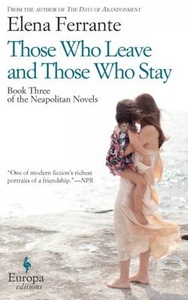
Those Who Leave And Those Who Stay

In this third Neapolitan novel, Elena and Lila have become women. Both have attempted pushing against the walls of a prison that would have seen them living a life of misery, ignorance and submission. They are afloat on the great sea of opportunities that opened up during the1970s. Yet they are still very much bound to each other by a strong, unbreakable bond. From the bestselling author of My Brilliant Friend, Elena Ferrante.
RIP - This product is no longer available on our network. It was last seen on 25.09.2019

This page now acts as a permanent archive for this product. Add more information using the comments box below to ensure it can still be found by future generations.

Use our search facility to see if it is available from an alternative contributor.
  • Availability: Out Of Stock
  • Supplier: Stanfords
  • SKU: 9781609452339
Availability: In Stock
£12.99

Product Description

In this third Neapolitan novel, Elena & Lila have become women. Both have attempted pushing against the walls of a prison that would have seen them living a life of misery, ignorance & submission. They are afloat on the great sea of opportunities that opened up during the 1970s. Yet they are still very much bound to each other by a strong, unbreakable bond. From the bestselling author of My Brilliant Friend, Elena Ferrante.

Reviews/Comments

Add New

Intelligent Comparison

Oooops!
We couldn't find anything!
Perhaps this product's unique.... Or perhaps we are still looking for comparisons!
Click to bump this page and we'll hurry up.

Price History

Vouchers

No voucher codes found.
Do you know a voucher code for this product or supplier? Add it to Insights for others to use.

Facebook

Jargon Buster

strong - A descriptive word for an item that has physical strength

Supplier Information

Stanfords
Stanfords was established in 1853 and opened their iconic Covent Garden flagship store in 1901. They have become the top retailer of maps, travel books and accessories in the UK and arguably offer the largest selection of maps and travel books worldwide. Famous names such as Captain Robert Falcon Scott, Ranulph Fiennes and Michael Palin have purchased from Stanfords. They now have a shop in Bristol and both stores together with other venues operate a calendar of events including talks, book signings and exhibitions. As a specialist map retailer, the map selection is comprehensive and includes road maps, street maps and walking maps from worldwide destinations, as well as a selection of world atlases and wall maps. Books include travel guides and travel literature. Stanfords also stock globes, from miniatures made of blue marble to magnificent floor-standing globes. The website features a selection of interesting articles on travel topics.
Page Updated: 2023-11-12 20:15:36

Community Generated Product Tags

Oh No! The productWIKI community hasn't generated any tags for this product yet!
Menu