More From Contributor
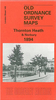
£14.99
Thornbury, Dursley, Yate, Berkeley & Wotton-under-Edge area on a detailed topographic & GPS compatible map No. 167, waterproof version, from the Ordnance Survey’s 1:25, 000 Explorer series. MOBILE DOWNLOADS: this title & all the other OS Explorer maps include a code for downloading after purchase the digital version onto your smartphone or tablet for viewing on the OS smartphone app.OS EXPLORER SERIES: to see the list of all the titles in the OS Explorer series, both paper & waterproof versions, please click on the series link. The Explorer series, Ordnance Survey’s most detailed maps recommended for anyone enjoying outdoor activities, provides topographic coverage of Great Britain at 1:25, 000 on GPS compatible maps with hiking trails, cycling routes & extensive tourist information. Each printed map is available either on paper or as a waterproof & tear-resistant OS Active Map, as indicated in its title. Britain’s National Parks & other areas of particular tourist interest are presented on often double-sided OL (Outdoor Leisure) maps, whilst most standard format Explorers cover an area of 30 x 20km (approx. 19 x 12 miles). All three versions (paper, waterproof & digital) are the same & provide plenty of recreational & tourist information, indicating the traditional public right of way paths (except in Scotland where different laws apply), including bridleways & byways. National Trails & other long-distance paths are marked, as well as permissive footpaths or bridleways & on-road or traffic-free cycle routes with, where appropriate, their National/ Regional Cycle Network numbers. Boundaries of access land are clearly marked. A wide range of symbols provides additional tourist information, highlighting camping & caravanning sites, information offices & visitors’ centres, parking & picnicking places, country pubs, sport & recreational facilities including cycle hire locations & mountain biking trails, historic buildings & museums, etc. Exceptionally clear presentation of the landscape is provided by contours at 5m or in the uplands at 10m intervals, with additional spot heights plus colouring and/or graphics for different types of woodlands, orchards, heath, marshl&, scree or boulders, & other topographic features. For GPS users the maps have British National Grid lines at 1km intervals, with latitude & longitude given by margin ticks at 1`. Clearly laid out map legend

Includes::
French & German translations for the tourist information symbols.

...
Archived Product
£3.50
Thornhill Lees in 1905 in a fascinating series of reproductions of old Ordnance Survey plans in the Alan Godfrey Editions, ideal for anyone interested in the history of their neighbourhood or family. The map covers Thornhill Lees, an industrial village that grew up between Thornhill & Dewsbury. Most of the village is shown, including Thornhill station, Providence Glass Works, Thornhill Iron Works, Calder & Hebble Canal, Holy Innocents church, Ratcliffe Mills, Kilners Cottages, Lees Hall, Hebble Mills, Slaithwaite, Lees Moor, St John the Baptists church. The map extends south to Inghams Pit, east to Thornhill UDC Office, west to Ravensthorpe station. A small portion of Ravensthorpe is also covered. In the top right corner are the Savile Town Glass Works, the Midland Railway shown `under construction`, & the railway carriage works. Directories of Thornhill Lees & Ravensthorpe are on the reverse. About the Alan Godfrey Editions of the 25” OS Series: Selected towns in Great Britain & Ireland are covered by maps showing the extent of urban development in the last decades of the 19th & early 20th century. The plans have been taken from the Ordnance Survey mapping & reprinted at about 15 inches to one mile (1:4, 340). On the reverse most maps have historical notes & many also include extracts from contemporary directories. Most maps cover about one mile (1.6kms) north/south, one & a half miles (2.4kms) across; adjoining sheets can be combined to provide wider coverage.FOR MORE INFORMATION & A COMPLETE LIST OF ALL AVAILABLE TITLES PLEASE CLICK ON THE SERIES LINK. ...
Archived Product
£8.95
This is the story of two journeys, one which makes its way towards the slopes & summit of Mount Kilimanjaro & another which takes a curving inner path into the soul of the narrator. Encouraged by his wife, who accompanies him, Hamish Malcolm undertakes a journey to the summit of Kilimanjaro, not only to return his father`s Bible but also to scatter his father`s ashes
- one of his father`s final wishes. The outer journey is one in which he comes to know Kilimanjaro, its subtleties, its extremes & the crippling effects of altitude sickness. It leads to a dramatic life-threatening encounter with another climber, introducing him to a figure from his past: someone he wanted to forget. This story speaks to people individually & draws attention to one of our greatest challenges as human beings, to be first & foremost self-questioning.
...
Archived Product
£2.95
Thornton Cleveleys in 1910 in a fascinating series of reproductions of old Ordnance Survey plans in the Alan Godfrey Editions, ideal for anyone interested in the history of their neighbourhood or family. Selected towns in Great Britain & Ireland are covered by maps showing the extent of urban development in the last decades of the 19th & early 20th century. In this title: the map is double-sided &

Includes::
both sheets 42.12 & 43.09. (Note that the cover erroneously states 43.10.) Sheet 42.12 covers the coastal area, including Cleveleys Hydro Hotel, Victoria Road, Beach Road, St Andrew's church, Rossall Mount, Rossall Preparatory School. The area around Victoria Road is today's town centre, though here only partly built up; coverage extends south to Anchorsholme Lane. On the reverse adjacent sheet 43.09 is the main map & takes coverage eastward to Thornton. Coverage here

Includes::
Cleveleys Park, The Towers, Trunnah, Holmes, Burn Naze (top right corner), Marsh Mill, RC church, St Peter's Mission Church, Christ Church, Poolfoot Farm. These are fascinating maps, especially showing Cleveleys when development into a seaside resort had only just begun. About the Alan Godfrey Editions of the 25


...
Archived Product
£3.50
Thornton Cleveleys in 1910 in a fascinating series of reproductions of old Ordnance Survey plans in the Alan Godfrey Editions, ideal for anyone interested in the history of their neighbourhood or family. The map is double-sided &

Includes::
both sheets 42.12 & 43.09. (Note that the cover erroneously states 43.10.) Sheet 42.12 covers the coastal area, including Cleveleys Hydro Hotel, Victoria Road, Beach Road, St Andrew`s church, Rossall Mount, Rossall Preparatory School. The area around Victoria Road is today`s town centre, though here only partly built up; coverage extends south to Anchorsholme Lane. On the reverse adjacent sheet 43.09 is the main map & takes coverage eastward to Thornton. Coverage here

Includes::
Cleveleys Park, The Towers, Trunnah, Holmes, Burn Naze (top right corner), Marsh Mill, RC church, St Peter`s Mission Church, Christ Church, Poolfoot Farm, etc. About the Alan Godfrey Editions of the 25” OS Series: Selected towns in Great Britain & Ireland are covered by maps showing the extent of urban development in the last decades of the 19th & early 20th century. The plans have been taken from the Ordnance Survey mapping & reprinted at about 15 inches to one mile (1:4, 340). On the reverse most maps have historical notes & many also include extracts from contemporary directories. Most maps cover about one mile (1.6kms) north/south, one & a half miles (2.4kms) across; adjoining sheets can be combined to provide wider coverage.FOR MORE INFORMATION & A COMPLETE LIST OF ALL AVAILABLE TITLES PLEASE CLICK ON THE SERIES LINK.


...
Archived Product
£3.50
Thornton Heath & Norbury in 1894 in a fascinating series of reproductions of old Ordnance Survey plans in the Alan Godfrey Editions, ideal for anyone interested in the history of their neighbourhood or family. Two versions for this area have been published to show how it developed across the years
- the two maps are from different series, for Surrey & for London, & so the sheetlines are somewhat different. This London series map No.149 from 1894 covers an area from Pollards Hill North at Norbury eastward to Whitehorse Road & Decimus Burton Road at Thornton Heath; & from Beulah Crescent southward to Holmesdale Road & Brigstock Road. Features include Thornton Heath station, New Thornton Heath, & a long stretch of London Road through Norbury; streets at Thornton Heath include High Street, Bensham Manor Road, Beulah Road & others. There is a very good selection of street directory entries on the reverse. The Surrey sheet 14.02 from 1911 is centred somewhat further east, although it does overlap considerably with the London map. This later map is more built up & covers an area from Bridport Road & Beverstone Road eastward to South Norwood Hill & Whitworth Road; & from Beulah Crescent southward to Ecclesbourne Road & Dagnall Park. Features include tramways, Grangewood, Thornton Heath station, Falkland Park, Ross Road, Whitehorse Road etc. That map has good street directory extracts, listing many of the occupants. About the Alan Godfrey Editions of the 25” OS Series: Selected towns in Great Britain & Ireland are covered by maps showing the extent of urban development in the last decades of the 19th & early 20th century. The plans have been taken from the Ordnance Survey mapping & reprinted at about 15 inches to one mile (1:4, 340). On the reverse most maps have historical notes & many also include extracts from contemporary directories. Most maps cover about one mile (1.6kms) north/south, one & a half miles (2.4kms) across; adjoining sheets can be combined to provide wider coverage.FOR MORE INFORMATION & A COMPLETE LIST OF ALL AVAILABLE TITLES PLEASE CLICK ON THE SERIES LINK.
...
Archived Product
£3.50
Thorpe Hesley & Scholes in 1901 in a fascinating series of reproductions of old Ordnance Survey plans in the Alan Godfrey Editions, ideal for anyone interested in the history of their neighbourhood or family. The map is double-sided. The main map covers the area from Thorpe Hesley eastward to Scholes, & beyond that to Scholes Paddock & Middle Common. Features include Holy Trinity church, Holmes Farm, Scholes Colliery & Scholes Old Colliery, etc. On the reverse is half of the adjacent sheet 288.04 extending coverage west to include Hesley Hall, Smithy Wood & Smithy Wood Colliery. About the Alan Godfrey Editions of the 25” OS Series: Selected towns in Great Britain & Ireland are covered by maps showing the extent of urban development in the last decades of the 19th & early 20th century. The plans have been taken from the Ordnance Survey mapping & reprinted at about 15 inches to one mile (1:4, 340). On the reverse most maps have historical notes & many also include extracts from contemporary directories. Most maps cover about one mile (1.6kms) north/south, one & a half miles (2.4kms) across; adjoining sheets can be combined to provide wider coverage.FOR MORE INFORMATION & A COMPLETE LIST OF ALL AVAILABLE TITLES PLEASE CLICK ON THE SERIES LINK. ...
Archived Product
£20.99
Þórsmörk
- Landmannalaugar region at 1:100, 000 in a series of special detailed hiking & touring maps based on the Icelandic topographic
...
Archived Product
£7.99
Hazel Bannock is the owner of the Bannock Oil Corp, one of the major global oil producers. While cruising in the Indian Ocean, her yacht is hijacked by Somalian pirates & her nineteen year old daughter Cayla kidnapped. Major Hector Cross is an ex-SAS operative & the man behind Cross Bow Security, the company contracted to Bannock Oil to provide all their security. His loyalty to the Bannock family goes beyond the call of duty. The pirates demand a crippling ransom for Cayla`s release, & complicated political & diplomatic sensitivities render the major powers incapable of intervening. With growing evidence of the horrific torture to which Cayla is being subjected, Hazel calls on Hector to help her rescue her daughter. Between them, Hazel & Hector are determined to take the law into their own hands. ...
Archived Product
£6.99
The sheep on the hillside were munching away, Much as they always did, day after day, When suddenly something went zoom! overhead. ” Let`s go & see what it is!” they all said. & so begins a ripping, round-the-world adventure as the sheep take to skies in a magnificent yellow flying machine... ...
Archived Product

Thornton Heath 1911

Thornton Heath 1911 in a fascinating series of reproductions of old Ordnance Survey plans in the Alan Godfrey Editions, ideal for anyone interested in the history of their neighbourhood or family. Two versions for this area have been published to show how it developed across the years - the two maps are from different series, for Surrey and for London, and so the sheetlines are somewhat different. The London series map No.149 from 1894 covers an area from Pollards Hill North at Norbury eastward to Whitehorse Road and Decimus Burton Road at Thornton Heath; and from Beulah Crescent southward to Holmesdale Road and Brigstock Road. Features include Thornton Heath station, New Thornton Heath, and a long stretch of London Road through Norbury; streets at Thornton Heath include High Street,
Bensham Manor Road, Beulah Road and others. There is a very good selection of street directory entries on the reverse. This Surrey sheet 14.02 from 1911 is centred somewhat further east, although it does overlap considerably with the London map. This later map is more built up and covers an area from Bridport Road and Beverstone Road eastward to South Norwood Hill and Whitworth Road; and from Beulah Crescent southward to Ecclesbourne Road and Dagnall Park. Features include tramways, Grangewood, Thornton Heath station, Falkland Park, Ross Road, Whitehorse Road etc. This map has good street directory extracts, listing many of the occupants. About the Alan Godfrey Editions of the 25” OS Series:Selected towns in Great Britain and Ireland are covered by maps showing the extent of
urban development in the last decades of the 19th and early 20th century. The plans have been taken from the Ordnance Survey mapping and reprinted at about 15 inches to one mile (1:4, 340). On the reverse most maps have historical notes and many also include extracts from contemporary directories. Most maps cover about one mile (1.6kms) north/south, one and a half miles (2.4kms) across; adjoining sheets can be combined to provide wider coverage.FOR MORE INFORMATION AND A COMPLETE LIST OF ALL AVAILABLE TITLES PLEASE CLICK ON THE SERIES LINK.
RIP - This product is no longer available on our network. It was last seen on 25.09.2019

This page now acts as a permanent archive for this product. Add more information using the comments box below to ensure it can still be found by future generations.

Use our search facility to see if it is available from an alternative contributor.
  • External links may include paid for promotion
  • Availability: Out Of Stock
  • Supplier: Stanfords
  • SKU: 9780850549348
Availability: In Stock
£3.50

Product Description

Thornton Heath 1911 in a fascinating series of reproductions of old Ordnance Survey plans in the Alan Godfrey Editions, ideal for anyone interested in the history of their neighbourhood or family. Two versions for this area have been published to show how it developed across the years
- the two maps are from different series, for Surrey & for London, & so the sheetlines are somewhat different. The London series map No.149 from 1894 covers an area from Pollards Hill North at Norbury eastward to Whitehorse Road & Decimus Burton Road at Thornton Heath; & from Beulah Crescent southward to Holmesdale Road & Brigstock Road. Features include Thornton Heath station, New Thornton Heath, & a long stretch of London Road through Norbury; streets at Thornton Heath include High Street, Bensham Manor Road, Beulah Road & others. There is a very good selection of street directory entries on the reverse. This Surrey sheet 14.02 from 1911 is centred somewhat further east, although it does overlap considerably with the London map. This later map is more built up & covers an area from Bridport Road & Beverstone Road eastward to South Norwood Hill & Whitworth Road; & from Beulah Crescent southward to Ecclesbourne Road & Dagnall Park. Features include tramways, Grangewood, Thornton Heath station, Falkland Park, Ross Road, Whitehorse Road etc. This map has good street directory extracts, listing many of the occupants. About the Alan Godfrey Editions of the 25” OS Series: Selected towns in Great Britain & Ireland are covered by maps showing the extent of urban development in the last decades of the 19th & early 20th century. The plans have been taken from the Ordnance Survey mapping & reprinted at about 15 inches to one mile (1:4, 340). On the reverse most maps have historical notes & many also include extracts from contemporary directories. Most maps cover about one mile (1.6kms) north/south, one & a half miles (2.4kms) across; adjoining sheets can be combined to provide wider coverage.FOR MORE INFORMATION & A COMPLETE LIST OF ALL AVAILABLE TITLES PLEASE CLICK ON THE SERIES LINK.

Reviews/Comments

Add New

Price History

Vouchers

No voucher codes found.
Do you know a voucher code for this product or supplier? Add it to Insights for others to use.

Facebook

Jargon Buster

Contemporary - Modern era design
Contemporary - A design reference to indicate post war modern design
History - Anything that happens in the past. An acedemic subject.
Road - a manmade lane or a path that is used to speed up travel.
Contemporary - An object that is living in the same time.
Ideal - Something that satisfies a perfect criteria.
Family - A group of people that live together made up from parents and children.

Supplier Information

Stanfords
Stanfords was established in 1853 and opened their iconic Covent Garden flagship store in 1901. They have become the top retailer of maps, travel books and accessories in the UK and arguably offer the largest selection of maps and travel books worldwide. Famous names such as Captain Robert Falcon Scott, Ranulph Fiennes and Michael Palin have purchased from Stanfords. They now have a shop in Bristol and both stores together with other venues operate a calendar of events including talks, book signings and exhibitions. As a specialist map retailer, the map selection is comprehensive and includes road maps, street maps and walking maps from worldwide destinations, as well as a selection of world atlases and wall maps. Books include travel guides and travel literature. Stanfords also stock globes, from miniatures made of blue marble to magnificent floor-standing globes. The website features a selection of interesting articles on travel topics.
Page Updated: 2023-11-12 20:15:36

Community Generated Product Tags

Oh No! The productWIKI community hasn't generated any tags for this product yet!
Menu