
 United Kingdom
 France
 Germany
 Netherlands
 Sweden
 USA
USA
 Italy
Italy
 Spain
Spain
More From Contributor


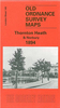

Thornton Cleveleys 1910
Thornton Cleveleys in 1910 in a fascinating series of reproductions of old Ordnance Survey plans in the Alan Godfrey Editions, ideal for anyone interested in the history of their neighbourhood or family. The map is double-sided and includes both sheets 42.12 and 43.09. (Note that the cover erroneously states 43.10.) Sheet 42.12 covers the coastal area, including Cleveleys Hydro Hotel, Victoria Road, Beach Road, St Andrew`s church, Rossall Mount, Rossall Preparatory School. The area around Victoria Road is today`s town centre, though here only partly built up; coverage extends south to Anchorsholme Lane. On the reverse adjacent sheet 43.09 is the main map and takes coverage eastward to Thornton. Coverage here includes Cleveleys Park, The Towers, Trunnah, Holmes, Burn Naze (top
right corner), Marsh Mill, RC church, St Peter`s Mission Church, Christ Church, Poolfoot Farm, etc. About the Alan Godfrey Editions of the 25” OS Series:Selected towns in Great Britain and Ireland are covered by maps showing the extent of urban development in the last decades of the 19th and early 20th century. The plans have been taken from the Ordnance Survey mapping and reprinted at about 15 inches to one mile (1:4, 340). On the reverse most maps have historical notes and many also include extracts from contemporary directories. Most maps cover about one mile (1.6kms) north/south, one and a half miles (2.4kms) across; adjoining sheets can be combined to provide wider coverage.FOR MORE INFORMATION AND A COMPLETE LIST OF ALL AVAILABLE TITLES PLEASE CLICK ON THE SERIES LINK.
right corner), Marsh Mill, RC church, St Peter`s Mission Church, Christ Church, Poolfoot Farm, etc. About the Alan Godfrey Editions of the 25” OS Series:Selected towns in Great Britain and Ireland are covered by maps showing the extent of urban development in the last decades of the 19th and early 20th century. The plans have been taken from the Ordnance Survey mapping and reprinted at about 15 inches to one mile (1:4, 340). On the reverse most maps have historical notes and many also include extracts from contemporary directories. Most maps cover about one mile (1.6kms) north/south, one and a half miles (2.4kms) across; adjoining sheets can be combined to provide wider coverage.FOR MORE INFORMATION AND A COMPLETE LIST OF ALL AVAILABLE TITLES PLEASE CLICK ON THE SERIES LINK.
Product Description
Reviews/Comments
Add New
Vouchers
No voucher codes found.
Do you know a voucher code for this product or supplier? Add it to Insights for others to use.
Do you know a voucher code for this product or supplier? Add it to Insights for others to use.
 Denmark