More From Contributor

£6.99
Topher & his father are trying to get over the death of Topher`s mother, an Egyptologist, when they take in a stray cat. This cat bears an uncanny resemblance to a cat ornament given to Topher by his mother & so they name it ” Ka”, meaning ”double”. Topher becomes very attached to Ka & is puzzled by her mysterious absences. One day when he is playing a computer game with an Egyptian theme, Ka jumps on the keys & spells out the name Bubastis, which was the centre of cat worship in Ancient Egypt. Could Ka really be leading a double life & what is she trying to tell Topher? ...
Archived Product
£6.99
Ka, the time-travelling cat, has disappeared, leaving just one clue. Topher soon realises that she has gone back to Elizabethan Engl&, & he fears that Ka is in terrible danger. Cats were tortured in Tudor Engl&, so Topher must try to find her before it is too late. In doing so, he meets Queen Elizabeth & Doctor Dee, the court magician & astronomer, who thinks Ka can help him find the elusive Philosopher`s Stone. An exciting & transporting fantasy, exploring both contemporary & ancient issues. ...
Archived Product
£9.99
A super-sized challenge for crossword lovers, selected by the times 2 Crossword Editor John Grimshaw. This Crossword appears weekly in the Saturday edition of The Times. The puzzles offer the same challenge as The Times 2 daily crossword but the larger grid packs an extra punch! The clues are also a little more testing than the daily times 2 crossword, to stretch the crossword enthusiast just a bit further, & provide hours of entertainment. ...
Archived Product
£90.00
The Times Atlas of Britain is a national reference atlas of Engl&, Scotl&, Wales & Northern Ireland with authoritative current cartography of the countries & relevant additional geographical information. This is the first comprehensive national atlas of Britain to be published for more than 40 years. Reference maps, statistics, photographic & illustrative images, & historical mapping are included alongside comprehensive contemporary cartographic coverage of Engl&, Scotl&, Wales & Northern Irel&. The atlas is comprised of 160 pages of Times reference mapping, 17 city centre maps, 450 photographic images, 90 historical maps & over 100, 000 words of explanatory & descriptive text. Pages on each country contain modern map cartography in the Times mapping style, the national flag/crest, at a glance statistics, photographs, historical maps of counties from the Bartholomew archive with descriptions from John Bartholomew ...
Archived Product
£30.00
This second edition of The Times Atlas of Britain is perfect for finding out more about Britain, discovering your county or just exploring the country.

Includes::
Engl&, Wales, Scotland & Northern Irel&. An authoritative & prestigious atlas with detailed mapping & geographical information about Britain. Engl&, Wales, Scotland & Northern Ireland are given comprehensive coverage along with every county. Fully up-to-date reference maps, statistics, images & historical mapping give an exceptionally detailed view of Britain. A unique atlas in the Times atlas range covering the whole of Great Britain. The following features are included in this unique atlas: * Times reference mapping * Photographs * Historical maps * Comprehensive index Statistics on each county contain the following: * flag/crest * at a glance statistics * modern map in Times mapping style * list of well-known people born in the county *"es from celebrities about the county `I love maps & atlases & The Times Atlas is the best for the clarity of the cartography` Chris Bonington

...
Archived Product
£30.00
Christopher Somerville has covered the length & breadth of the UK on foot, & has written & broadcast about its history, landscape, wildlife & people for over 25 years. Now, in this extensive new volume, he selects his top 200 routes from his hugely popular Times column, A Good Walk. More than just a basic guidebook, this is a meditation on our relationship with the landscape & a celebration of all that Britain has to offer. From Cornwall to Shetland via Pembrokeshire & Barrowdale, this is the most comprehensive collection of walks in the United Kingdom available in one book, & features trails to suit all skill levels & references, whether you want a gentle ramble to the pub or something much more challenging. Each of the featured walks contains: Detailed description as featured in The Times column Postcode & OS grid reference start point Instructions on how to get there Distance & grade so readers can suit walks to their ability, fitness & mood Simple step-by-step walk instructions Beautiful colour photograph for each walk Full colour, clear & up-to-date map Food & accommodation details for the hungry traveller Featuring stunning photography & using Christopher`s trademark wit & lyricism, this is the perfect gift for ramblers anywhere. ...
Archived Product
£16.99
Christopher Somerville has covered the length & breadth of the UK on foot, & has written & broadcast about its history, landscape, wildlife & people for over 25 years. Now, in this extensive new volume, he selects his top 200 routes from his hugely popular Times column, A Good Walk. More than just a basic guidebook, this is a meditation on our relationship with the landscape & a celebration of all that Britain has to offer. From Cornwall to Shetland via Pembrokeshire & Barrowdale, this is the most comprehensive collection of walks in the United Kingdom available in one book, & features trails to suit all skill levels & references, whether you want a gentle ramble to the pub or something much more challenging. Each of the featured walks contains:* Detailed description as featured in The Times column* Postcode & OS grid reference start point* Instructions on how to get there* Distance & grade so readers can suit walks to their ability, fitness & mood* Simple step-by-step walk instructions* Beautiful colour photograph for each walk* Full colour, clear & up-to-date map* Food & accommodation details for the hungry traveller Featuring stunning photography & using Christopher`s trademark with & lyricism, this is the perfect gift for ramblers anywhere. ...
Archived Product
£30.00
Follow the routes of 50 long-closed & derelict railways across some of our most beautiful countryside & discover the hidden railways of Britain. Each route is highlighted on historical Bartholomew’s mapping, showing which parts can still be followed today. The carefully researched text is accompanied by historical photographs showing each line in operation prior to its closure, as well as specially commissioned images from the present day. Routes include:• Yatton to Witham – Strawberry Line• Crab & Winkle Line – Canterbury to Whitstable• Jersey railway – St Helier to La Corbière• Mawddach Trail – Barmouth to Dolgellau• South Tyne Trail – Haltwhistle to Alston• Dava Way – Forres to Aviemore ...
Archived Product
£150.00
The world’s most authoritative atlas, beautifully re-designed & fully updated in a new 15th edition. A unique & timeless gift for all occasions. Our world as it is today in one beautiful volume. Fully updated mapping with over 200, 000 place names. New world topics include migration, health & resources. The 15th edition of The Times Comprehensive Atlas of the World has been beautifully redesigned. At 45 cm high, this impressive large scale atlas will become a treasured possession. It is a benchmark of cartographic excellence, trusted by governments, media & international organisations as well as being a trusted reference source for households across the country. ...
Archived Product
£100.00
The Times Comprehensive Atlas of the World
- 14th Edition published in September 2014: The latest edition of the world`s most prestigious
...
Archived Product

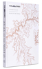
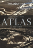
The Times Atlas Of The World: Concise Edition

A fully revised and updated twelfth edition of this major world atlas in the authoritative and prestigious Times Atlas range. This beautifully designed atlas has all the information you need, whether planning a trip, keeping in touch with world news, solving quizzes and crosswords or just exploring the world from your armchair. Comprehensive reference mapping provides an amazingly detailed view of the world, and the illustrated thematic content covers the most important geographical issues of the day, making this atlas a valuable addition to any reference collection. Updates include: Over 4, 000 name changes throughout the world Addition of newly named Queen Elizabeth Land in Antarctica New administrative divisions in India, Bangladesh, Chad and Finland Populations of major cities
updated using latest UN figures Major new railways added in China, Saudi Arabia, Spain, Algeria and Brazil Major new roads added in France, Poland and India Realigned International Date Line around Samoa and Tokelau Historical maps of the world show the political make-up of the world over the last 150 years and the atlas also includes plans of 41 of the world's major cities.An expanded satellite imagery section contains an overview image of each continent, and is complemented with a detailed image. Produced in the same style as the Times Comprehensive Atlas of the World, with a slate grey finish and a beautiful image.
RIP - This product is no longer available on our network. It was last seen on 25.09.2019

This page now acts as a permanent archive for this product. Add more information using the comments box below to ensure it can still be found by future generations.

Use our search facility to see if it is available from an alternative contributor.
  • Availability: Out Of Stock
  • Supplier: Stanfords
  • SKU: 9780007506514
Availability: In Stock
£90.00

Product Description

A fully revised & updated twelfth edition of this major world atlas in the authoritative & prestigious Times Atlas range. This beautifully designed atlas has all the information you need, whether planning a trip, keeping in touch with world news, solving quizzes & crosswords or just exploring the world from your armchair. Comprehensive reference mapping provides an amazingly detailed view of the world, & the illustrated thematic content covers the most important geographical issues of the day, making this atlas a valuable addition to any reference collection. Updates include: Over 4, 000 name changes throughout the world Addition of newly named Queen Elizabeth Land in Antarctica New administrative divisions in India, Bangladesh, Chad & Finland Populations of major cities updated using latest UN figures Major new railways added in China, Saudi Arabia, Spain, Algeria & Brazil Major new roads added in France, Poland & India Realigned International Date Line around Samoa & Tokelau Historical maps of the world show the political make-up of the world over the last 150 years & the atlas also

Includes::
plans of 41 of the world's major cities. An expanded satellite imagery section contains an overview image of each continent, & is complemented with a detailed image. Produced in the same style as the Times Comprehensive Atlas of the World, with a slate grey finish & a beautiful image.

Reviews/Comments

Add New

Intelligent Comparison

Oooops!
We couldn't find anything!
Perhaps this product's unique.... Or perhaps we are still looking for comparisons!
Click to bump this page and we'll hurry up.

Price History

Vouchers

No voucher codes found.
Do you know a voucher code for this product or supplier? Add it to Insights for others to use.

Facebook

Jargon Buster

India - A subcontinent in Asia
Grey - A colour often associated with old age (going grey)
Date - A day on a calendar
Date - A social activity whith a current or potential partner
Spain - A country within the EU.
Brazil - A country in South America
France - A state situated in Western Europe with several overseas territories.
Railways - A set of tracks that have been laid for the purpose of trains to travel up and down them
World - A physical grouping, commonly used to describe earth and everything associated with ti
Day - The time it takes a planet or other space objects to complete one rotation.
Reference - To prove evidence with a back up source.

Supplier Information

Stanfords
Stanfords was established in 1853 and opened their iconic Covent Garden flagship store in 1901. They have become the top retailer of maps, travel books and accessories in the UK and arguably offer the largest selection of maps and travel books worldwide. Famous names such as Captain Robert Falcon Scott, Ranulph Fiennes and Michael Palin have purchased from Stanfords. They now have a shop in Bristol and both stores together with other venues operate a calendar of events including talks, book signings and exhibitions. As a specialist map retailer, the map selection is comprehensive and includes road maps, street maps and walking maps from worldwide destinations, as well as a selection of world atlases and wall maps. Books include travel guides and travel literature. Stanfords also stock globes, from miniatures made of blue marble to magnificent floor-standing globes. The website features a selection of interesting articles on travel topics.
Page Updated: 2023-11-12 20:15:36

Community Generated Product Tags

Oh No! The productWIKI community hasn't generated any tags for this product yet!
Menu