More From Contributor
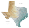
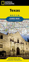
£16.99
If you’re looking for the best riding in Texas, head to Hill Country. Woven through fields of of bluebonnets & mature oaks are some of the most enjoyable motorcycling roads found anywhere. If your ride is as much about food, drink & culture this is the place for you. Towns like Bandera, Boerne, Kerrville & New Braunfels will welcome you with open arms after a long day in the saddle. ...
Archived Product
£9.99
Texas Hill Country on a detailed road map at 1:578, 640 from the National Geographic, with plenty of tourist information & printed on light, waterproof & tear-resistant synthetic paper. Coverage extends westwards from the road linking Austin with San Antonio to include the sparsely populated Edwards Plateau. The base map is taken from satellite imagery; protected areas are highlighted. Detailed presentation of the road network

Includes::
small local farm, ranch or county roads. Symbols highlight camp grounds, caves, vineyards & wineries, etc, & many places of interest are annotated with notes. Latitude & longitude lines are drawn at 1° intervals. On the reverse is extensive tourist information including a street plan of central Austin, maps of bike trails in Fredericksburg (the Cycling Capital of Texas) & of the Fredericksburg Wine Road 290, a list of visitor centres, plus notes on the region’s heritage & outdoor opportunities.

...
Archived Product
£15.99
This new edition of Insight Guide Texas is a comprehensive, full-colour travel guide packed with inspiration & information. It is packed with engrossing features on everything from Texan cowboys & Spanish missions to the Houston`s Space Center. A detailed history section covers its American Indian & Spanish heritage & the fight for independence & explains how it evolved into one of the most influential US states. A revamped Best of Texas section lists the state`s must-see attractions, from national parks to historic sites & art galleries to festivals. With a new chapter on Austin, the Places section covers the state`s principal cities & the deserts, mountains & coastal areas between. Specially commissioned photographs vividly capture Texas` arid, but beautiful landscape, the dynamic architecture of its cities, & its surprisingly diverse population. Detailed full-colour maps help you get around, while the travel tips section is packed with useful information on transport, climate, festivals & outdoor activities, & provides answers to such questions as when to go, where to stay & what to budget for your trip. ...
Archived Product
£15.99
Texas has it all: sophisticated cities, beautiful beaches, colourful deserts, sleepy border towns, wide open plains, & dramatic mountains. This new edition covers everything from its wild rodeos & honky-tonks to its fine museums & elegant restaurants.· Over 328 pages of insider knowledge from local experts· In-depth on history & culture, from Texas Rangers & cowboys to musical traditions & the state`s varied architecture · Enjoy special features on the Spanish Missions, Houston`s Space Center & wildlife in Texas·

Includes::
innovative extras that are unique in the market
- all Insight Guides to countries & regions come with a free e Book & app that`s regularly updated with new hotel, bar, restaurant, shop & local event listings· Invaluable maps, travel tips & practical information ensure effortless planning · Inspirational colour photography throughout· Inventive design makes for an engaging reading experience


...
Archived Product
£24.95
Texas Recreational Atlas & Gazetteer at 1:393, 000 approx. in a series of large format paperback state atlases from De Lorme, with detailed, contoured, GPS compatible topographic mapping plus extensive recreational information, with lists of sites & facilities, etc. Each title covers one state & presents it on impressively detailed mapping at scales much more detailed than used on most state road maps. Particularly popular areas are often also presented on enlargements. The maps are contoured, show variation of terrain (deserts, glaciers, wetlands, woodlands, etc) & have latitude & longitude and/or UTM grid lines for GPS use. Various types of protected areas are distinguished by the colouring of their boundaries, e.g. national or state parks, forests, etc. Also marked are Indian Reservations & restricted entry military zones. Road network is shown in much more detail than on other state mapping, with local roads, unsurfaced back roads & tracks, forest trails, etc. Where appropriate, old historical routes are marked. Railway lines & local airports or landing strips are included & the maps also indicate administrative boundaries. Symbols highlight various recreational areas & facilities such as campgrounds, unique natural features, etc. Each title contains extensive lists of outdoor adventure sites (grouped into activities such as hiking, biking, paddling, fishing, skiing, etc.), diverse family outing sites, campgrounds, & tables showing what facilities can be found in the state ...
Archived Product
£24.99
Texas Recreational Atlas & Gazetteer at 1:393, 000 approx. in a series of large format paperback state atlases from De Lorme, with detailed, contoured, GPS compatible topographic mapping, plus indexed street plans of over 70 cities & towns in Texas, including coverage of the urban conurbations around Dallas, Houston & San Antonio. Recreational information

Includes::
lists of information centres, Texas Travel Trails, amusements, museums, historic sites, unique natural features, hiking trails. Tables present facilities in state & national lands & campgrounds, plus wildlife viewing, fishing (fresh & salt water) or hunting areas with lists of species. Each title in this De Lorme series covers one state & presents it at a scale much more detailed than used on most state road maps. Particularly popular areas are often also presented on enlargements. The maps are contoured, show variation of terrain (deserts, glaciers, wetlands, woodlands, etc) & have latitude & longitude and/or UTM grid lines for GPS use. Various types of protected areas are distinguished by the colouring of their boundaries, e.g. national or state parks, forests, etc. Also marked are Indian Reservations & restricted entry military zones. Road network is shown in much more detail than on other state mapping, with local roads, unsurfaced back roads & tracks, forest trails, etc. Where appropriate, old historical routes are marked. Railway lines & local airports or landing strips are included & the maps also indicate administrative boundaries. Symbols highlight various recreational areas & facilities such as campgrounds, unique natural features, etc. Each title contains extensive lists of outdoor adventure sites (grouped into activities such as hiking, biking, paddling, fishing, skiing, etc.), diverse family outing sites, campgrounds, & tables showing what facilities can be found in the state’s recreational areas. Each atlas also has an index of localities. To see the list of titles in this series please click on the series link.

...
Archived Product
£30.00
Detailed physical wall map of Texas State at a scale of 1:1, 000, 000. The cartography shows relief through a stunning, ...
Archived Product
£13.99
Texas at 1:1, 000, 000 in a series of indexed touring road maps of USA from Hallwag, with each title conveniently covering a large region & providing enlargement (s) of most visited areas, city maps & other useful tourist information. Enlargements in this title show in greater detail the Houston & the Dallas
- Fort Worth conurbations, plus San Antonio, Austin, Galveston – Texas City, & El Paso. The northern part of the state beyond Swisher is shown on an inset. The map is part of Hallwag’s series covering USA at 1:1, 000, 000. The series has been revised from its earlier version & now uses cartography from Hema which provides an excellent combination of information about the terrain, the road network & places of interest. The base map has effective but unobtrusive relief shading with plenty of names of mountain ranges, peaks (heights in feet), deserts, etc. Colouring prominently highlights national or state parks, forests & other protected areas, as well as Indian Reservations & military zones. Road network clearly shows road numbers, indicates free & toll highways with locations of services, & gives driving distances on interstate & primary routes. The maps also show Amtrak railway lines with stations, local airports, state borders & time zone boundaries. An extensive range of symbols indicate various places of tourist interest. Each map is indexed & for GPS navigation has latitude & longitude lines drawn at 30’ intervals. Each title also

Includes::
enlargements of most visited areas – please see individual descriptions for more information – & useful tourist information such as metric conversion tables, traffic signs, phone numbers/websites for many organizations including recommended accommodations, etc. Map legends & all the text include English.


...
Archived Product
£8.99
Texel Island in the Dutch Frisian Islands in a series of walking & cycling maps at 1:25, 000 – 1:35, 000, published by Falk BV in cooperation with Staatsbosbeheer – Dutch government’s organization for forestry & the management of nature reserves. Colouring indicates different types of vegetation or terrain: woodl&, pastures, heath or sand dunes. Given the topography of most of the country, the maps have no contour lines. The maps show local hiking trails, indicating their waymarking & include cycle paths & horse riding. Many local crossroads are annotated with the numbers of ANWB signposts & ‘mushrooms’ – a useful aid when navigating in Dutch countryside. Symbols indicate various tourist facilities & places of interest, including different types of accommodation, cafes, windmills, etc. The maps have no geographical coordinates. Map legend is in Dutch only. On the reverse each title has supplementary information, in Dutch only, about the region`s attractions. To see other titles in this series please click on the series link. ...
Archived Product

Texas NGS Guide Map

Expertly researched and loaded with helpful information, National Geographic`s Texas Guide Map is a must-have for travelers exploring ”The Lone Star State.” In addition to a state map, inset maps provide detail on the Texas Panhandle and the cities of Dallas, Fort Worth, Houston, Amarillo, Abilene, Lubbock, Waco, Laredo, Beaumont, El Paso, Odessa-Midland, McAllen, Corpus Christi, San Antonio, and Austin. Cities and towns are easy to find with the map`s helpful index and hundreds of attractions are noted. Road network designations are clear and distances in miles on major highways are shown.Additional information and maps feature the recreation activities available in Big Bend National Park and the attractions along the Hill Country scenic drive. The Alamo, the Space
Center Houston, the San Antonio Riverwalk, and Guadalupe Mountains National Park are just some of the many points of interest that are highlighted. A handy chart of park service sites and climate information are also included.
RIP - This product is no longer available on our network. It was last seen on 25.09.2019

This page now acts as a permanent archive for this product. Add more information using the comments box below to ensure it can still be found by future generations.

Use our search facility to see if it is available from an alternative contributor.
  • External links may include paid for promotion
  • Availability: Out Of Stock
  • Supplier: Stanfords
  • SKU: 9781566957298
Availability: In Stock
£9.99

Product Description

Expertly researched & loaded with helpful information, National Geographic`s Texas Guide Map is a must-have for travelers exploring ” The Lone Star State.” In addition to a state map, inset maps provide detail on the Texas Panhandle & the cities of Dallas, Fort Worth, Houston, Amarillo, Abilene, Lubbock, Waco, Laredo, Beaumont, El Paso, Odessa-Midl&, Mc Allen, Corpus Christi, San Antonio, & Austin. Cities & towns are easy to find with the map`s helpful index & hundreds of attractions are noted. Road network designations are clear & distances in miles on major highways are shown. Additional information & maps feature the recreation activities available in Big Bend National Park & the attractions along the Hill Country scenic drive. The Alamo, the Space Center Houston, the San Antonio Riverwalk, & Guadalupe Mountains National Park are just some of the many points of interest that are highlighted. A handy chart of park service sites & climate information are also included.

Reviews/Comments

Add New

Intelligent Comparison

Oooops!
We couldn't find anything!
Perhaps this product's unique.... Or perhaps we are still looking for comparisons!
Click to bump this page and we'll hurry up.

Price History

Vouchers

No voucher codes found.
Do you know a voucher code for this product or supplier? Add it to Insights for others to use.

Facebook

Jargon Buster

star - A giant ball of plasma held together by gravity.
Network - A link and communication between things. Often computers or people.
Road - a manmade lane or a path that is used to speed up travel.
Feature - An attribute that makes something stand out.

Supplier Information

Stanfords
Stanfords was established in 1853 and opened their iconic Covent Garden flagship store in 1901. They have become the top retailer of maps, travel books and accessories in the UK and arguably offer the largest selection of maps and travel books worldwide. Famous names such as Captain Robert Falcon Scott, Ranulph Fiennes and Michael Palin have purchased from Stanfords. They now have a shop in Bristol and both stores together with other venues operate a calendar of events including talks, book signings and exhibitions. As a specialist map retailer, the map selection is comprehensive and includes road maps, street maps and walking maps from worldwide destinations, as well as a selection of world atlases and wall maps. Books include travel guides and travel literature. Stanfords also stock globes, from miniatures made of blue marble to magnificent floor-standing globes. The website features a selection of interesting articles on travel topics.
Page Updated: 2023-11-12 20:15:36

Community Generated Product Tags

Oh No! The productWIKI community hasn't generated any tags for this product yet!
Menu