
 United Kingdom
 France
 Germany
 Netherlands
 Sweden
 USA
USA
 Italy
Italy
 Spain
Spain
More From Contributor


Texas Insight Guide
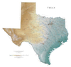
Texas has it all: sophisticated cities, beautiful beaches, colourful deserts, sleepy border towns, wide open plains, and dramatic mountains. This new edition covers everything from its wild rodeos and honky-tonks to its fine museums and elegant restaurants.· Over 328 pages of insider knowledge from local experts· In-depth on history and culture, from Texas Rangers and cowboys to musical traditions and the state`s varied architecture · Enjoy special features on the Spanish Missions, Houston`s Space Center and wildlife in Texas· Includes innovative extras that are unique in the market - all Insight Guides to countries and regions come with a free eBook and app that`s regularly updated with new hotel, bar, restaurant, shop and local event listings· Invaluable maps, travel tips
and practical information ensure effortless planning · Inspirational colour photography throughout· Inventive design makes for an engaging reading experience
and practical information ensure effortless planning · Inspirational colour photography throughout· Inventive design makes for an engaging reading experience

Product Description
Reviews/Comments
Add New
Vouchers
No voucher codes found.
Do you know a voucher code for this product or supplier? Add it to Insights for others to use.
Do you know a voucher code for this product or supplier? Add it to Insights for others to use.
 Denmark