More From Contributor
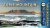
£6.99
Tabby Mc Tat is purr-fectly happy, singing along all day with Fred the busker. But when Fred gives chase to a thief, the two are separated. Will they ever find each other again? A heart-warming story of friendship, loyalty
- & kittens! ` Our five-year-old gave it the thumbs up, & that`s about the best endorsement you can get.` News of the World
...
Archived Product
£6.99
Tabby Mc Tat loves singing along with Fred the busker, as people throw coins in their hat. But when Fred has an accident, the two are separated. Will they ever find each other again? Tabby Mc Tat`s story has captured the imagination of hundreds of thousands of children. It is now available in sturdy board book format, perfect for Tabby Mc Tat`s youngest fans. Praise for Tabby Mc Tat: ` Absolutely purr-fect stuff` The Times ` Our five-year-old gave it the thumbs up, & that`s about the best endorsement you can get` News of the World ...
Archived Product
£6.95
Topographic coverage of mainland Spain at 1:50, 000 in the MTN50 (Mapa Topográfico Nacional) series from the Centro Nacional de Información Geografica, the country’s civilian survey organization. The maps have contours at 20m intervals, enhanced by relief shading, plus colouring and/or graphics to show different types of terrain, vegetation or land use. Boundaries of national parks & other protected areas are marked. In addition to all the usual information featured on topographic mapping at this scale, detailed presentation of the road & rail networks, rural tracks & paths, etc, the maps also show campsites & mountain refuges. On more recent editions some GRs, the official long-distance hiking routes, are also marked (although not as clearly as on hiking maps from other publishers). Each map covers 29.5x 18.5 km (with adjustments in the border or coastal areas). The maps have a 1-km UTM grid, plus margin ticks for latitude & longitude at 1` intervals. Map legend is in Spanish only.HOW TO CHOOSE THE RIGHT 50K MAP: all the titles in CNIG’s 200K Provincial Road Maps series at 1:200, 000 are overprinted with the grid for the 1:50, 000 maps & can be used to see the area covered by each 50K title. TO SEE THE LIST OF TITLES IN THIS SERIES PLEASE CLICK ON THE SERIES LINK.PLEASE NOTE
- MAP TITLES: the grids shown on our website serve both the civilian & the military 1:50, 000 topographic series. Although the areas covered by maps in both series are identical (apart from some border or coastal sheets), occasionally map titles differ – only one title is shown on the grid, usually the military one. In Galicia, the Basque country & in the Catalan speaking areas the tendency now is to use local place names rather than the often better known Castilian ones. Where possible, both versions are included in our titles. Map titles listed on our website are based on information received by us at the time of publication, but sometimes maps arrive showing a completely different title! As long as the map number is as ordered, the correct map has been supplied.
...
Archived Product
£6.50
Topographic coverage of mainland Spain at 1:25, 000 published by the Centro Nacional de Información Geograficá, the country’s civilian survey organization. The maps have contours at 10m intervals & colouring and/or graphics to show different types of vegetation or land use. Boundaries of national parks & other protected areas are marked. In addition to all the usual information shown on topographic maps at this scale, detailed presentation of the road & rail networks, rural tracks & paths, etc, the maps also show campsites. The maps have a 1-km UTM grid, with margin ticks for latitude & longitude at 1` intervals. Map legend is in Spanish only.PLEASE NOTE: our grid for the whole of Spain is in preparation
- in the meantime, for areas other than those shown on the attached grid please use CNIG’s topographic survey at 1:50, 000 by searching for ‘SI00000832’. Each 25K map covers one quarter of the corresponding 50K map, with the numbering system: I = NW quarter, II = NE quarter, III = SW quarter & IV = SE quarter. CNIG maps in the Provincial Road Maps series at 1:200, 000 are overprinted with the grid for the 1:50, 000 survey & can be used to see the area covered by each 50K or 25K title in more detail. To see the list of titles in this series please click on the series grid
- for map numbers not yet listed on our website please contact us by email.

...
Archived Product
£13.95
Table Mountain at 1:20, 000 on an A2-size, waterproof & tear-resistant map from Slingsby Maps, with details of 23 hiking routes. Contour lines are drawn at 10m intervals, with several different types of vegetation & terrain indicated on the map, e.g. renosterveld/grassl&, different kinds of fynbos, marshes, plantations, gum belts, etc. Boundaries of the Table Mountain National Park & of the restricted Orange Kloof area are marked. Road network

Includes::
untarred public roads, private roads indicating access open to pedestrians or mountain bikers, signposts, parking areas, etc. Many road junctions & other important locations are annotated with GPS waypoints. The map shows numerous hiking trails, indicating dangerous or restricted access sections. Extensive overprint highlights other places of interest, picnic areas, benches & natural shelters, restaurants & drinking water, recreational facilities, etc. Both UTM grid lines at 200m & latitude/longitude lines at 1

...
Archived Product
£19.99
Table Mountain at 1:20, 000 on an A2-size, waterproof & tear-resistant map from Slingsby Maps, with details of 23 hiking routes. Contour lines are drawn at 10m intervals, with several different types of vegetation & terrain indicated on the map, e.g. renosterveld/grassl&, different kinds of fynbos, marshes, plantations, gum belts, etc. Boundaries of the Table Mountain National Park & of the restricted Orange Kloof area are marked. Road network

Includes::
untarred public roads, private roads indicating access open to pedestrians or mountain bikers, signposts, parking areas, etc. Many road junctions & other important locations are annotated with GPS waypoints. The map shows numerous hiking trails, indicating dangerous or restricted access sections. Extensive overprint highlights other places of interest, picnic areas, benches & natural shelters, restaurants & drinking water, recreational facilities, etc. Both UTM grid lines at 200m & latitude/longitude lines at 1’ intervals are drawn across the map. On the reverse there are brief descriptions of 23 hiking routes indicating approximate time needed to cover each route, general information & safety advice for tourists, panorama view from Maclear’s Beacon, & drawings of local fauna & flora. The map was researched & drawn by Peter Slingsby
- renowned environmental educator & cartographer.


...
Archived Product
£10.99
The Cape Peninsula plus an enlargement for the Table Mountain National Park & a street plan of Cape Town on a double-sided map from Map Studio. Extensive lists provide information on best locations for various outdoor activities etc. On one side is a contoured map of the whole Cape Peninsula at 1:55, 000, highlighting main hiking trails, numerous places of interest, etc. The map is surrounded by several panels, all cross-referenced to the map, providing information on various outdoor activities in the area: diving, surfing, kite surfing, sea kayaking, paragliding, climbing, nature watching, etc. The map has contours at 20m intervals with numerous spot heights. Geographical coordinates are provided by margin ticks at 5 ...
Archived Product
£8.99
A.A. Gill knows food, & loves food. A meal is never just a meal. It has a past, a history, connotations. It is a metaphor for life. A.A. Gill delights in decoding what lies behind the food on our plates: famously, his reviews are as much ruminations on society at large as they are about the restaurants themselves. So alongside the concepts, customers & cuisines, ten years of writing about restaurants has yielded insights on everything from yaks to cowboys, picnics to politics. TABLE TALK is an idiosyncratic selection of A.A. Gill`s writing about food, taken from his Sunday Times & Tatler columns. Sometimes inspired by the traditions of a whole country, sometimes by a single ingredient, it is a celebration of what great eating can be, an excoriation of those who get it wrong, & an education about our own appetites. Because it spans a decade, the book focuses on A.A. Gill`s general dining experiences rather than individual restaurants
- food fads, tipping, chefs, ingredients, eating in town & country & abroad, & the best & worst dining experiences. Fizzing with wit, it is a treat for gourmands, gourmets & anyone who relishes good writing.
...
Archived Product
£24.95
The Tablet Case by Wild & Wolf featuring a historical map of London with decorative turquoise ribbon & push button opening, is the perfect accessory to protect your tablet & avoid scratches. Made of synthetic leather, with padded grey inner felt lining, the envelope style case is conveniently sized & flat compact &

Includes::
a fabric loop fixed on the side. The London map extracts feature on one side the central part of London around Holborn & on the other side the vicinity of Marylebone, Maida Vale & Regent

...
Archived Product

Table Mountain

Table Mountain on an A2-size, waterproof and tear-resistant map from Slingsby Maps, with details of 23 hiking routes. Contour lines are drawn at 10m intervals, with several different types of vegetation and terrain indicated on the map, e.g. renosterveld/grassland, different kinds of fynbos, marshes, plantations, gum belts, etc. Boundaries of the Table Mountain National Park and of the restricted Orange Kloof area are marked.Road network includes untarred public roads, private roads indicating access open to pedestrians or mountain bikers, signposts, parking areas, etc. Footpaths are clearly shown, including dangerous or restricted access sections, and the Table Mountain Challenge Route. Extensive overprint highlights other places of interest, picnic areas, benches and
natural shelters, restaurants and drinking water, recreational facilities, etc. Both UTM grid lines at 200m and latitude/longitude lines at 1
RIP - This product is no longer available on our network. It was last seen on 25.09.2019

This page now acts as a permanent archive for this product. Add more information using the comments box below to ensure it can still be found by future generations.

Use our search facility to see if it is available from an alternative contributor.
  • Availability: Out Of Stock
  • Supplier: Stanfords
  • SKU: 9781920377106
Availability: In Stock
£12.95

Product Description

Table Mountain on an A2-size, waterproof & tear-resistant map from Slingsby Maps, with details of 23 hiking routes. Contour lines are drawn at 10m intervals, with several different types of vegetation & terrain indicated on the map, e.g. renosterveld/grassl&, different kinds of fynbos, marshes, plantations, gum belts, etc. Boundaries of the Table Mountain National Park & of the restricted Orange Kloof area are marked. Road network

Includes::
untarred public roads, private roads indicating access open to pedestrians or mountain bikers, signposts, parking areas, etc. Footpaths are clearly shown, including dangerous or restricted access sections, & the Table Mountain Challenge Route. Extensive overprint highlights other places of interest, picnic areas, benches & natural shelters, restaurants & drinking water, recreational facilities, etc. Both UTM grid lines at 200m & latitude/longitude lines at 1

Reviews/Comments

Add New

Price History

Vouchers

No voucher codes found.
Do you know a voucher code for this product or supplier? Add it to Insights for others to use.

Facebook

Jargon Buster

Hiking - An outdoor activity envolving walking in nature
water - A chemical substance. Chemical formula H2O.
Waterproof - Resistant to water, usualy specified by depth in metres
Size - is the measurement of how big an object is in space.
Natural - not manmade
Network - A link and communication between things. Often computers or people.
Road - a manmade lane or a path that is used to speed up travel.
Resistant - Something that can repel against something.

Supplier Information

Stanfords
Stanfords was established in 1853 and opened their iconic Covent Garden flagship store in 1901. They have become the top retailer of maps, travel books and accessories in the UK and arguably offer the largest selection of maps and travel books worldwide. Famous names such as Captain Robert Falcon Scott, Ranulph Fiennes and Michael Palin have purchased from Stanfords. They now have a shop in Bristol and both stores together with other venues operate a calendar of events including talks, book signings and exhibitions. As a specialist map retailer, the map selection is comprehensive and includes road maps, street maps and walking maps from worldwide destinations, as well as a selection of world atlases and wall maps. Books include travel guides and travel literature. Stanfords also stock globes, from miniatures made of blue marble to magnificent floor-standing globes. The website features a selection of interesting articles on travel topics.
Page Updated: 2023-11-12 20:15:36

Community Generated Product Tags

Oh No! The productWIKI community hasn't generated any tags for this product yet!
Menu