More From Contributor
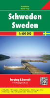
£22.99
Swartberg & Klein-Karoo region on a contoured & GPS compatible, double-sided, waterproof & tear-resistant map at 1:160, 000 from Slingsby Maps, with excellent topographic detail & plenty of tourist information, including street plans of ten main towns. The map provides a very detailed picture of this mountainous terrain, with altitude colouring, shading, contours at 20m intervals & numerous spot heights. For GPS navigation important road junctions & various other features are annotated with waypoints & the map has latitude & longitude lines at 5’ intervals. Road information is very finely graded, indicating road surface, private roads with public access, 4WD only tracks, cattle grids & game gates, locations of fuel supplies, etc. Also marked are routes found by publishers as enjoyable, or conversely as dull. Railway lines are shown with stations. For hikers the map indicates waymarked paths & shows other trails. A very wide range of symbols highlight various places of interest & tourist facilities: different types of accommodation from hotels to campsites, picnic places, farm stalls, wineries, restaurants, sport & recreational sites, animal viewing sites, etc. The map also

Includes::
street plans of ten of the region’s main towns: Laingsburg, Ladismith, Van Wyksdorp, Calitzdrop, De Rust, Oudtshoorn, Schoemanshoek, Prince Albert, Uniondale & Willowmore, all annotated with accommodation & other tourist facilities of places of interest. To see other titles in this series please click on the series link.

...
Archived Product
£13.99
Swaziland on a double-side road map from South African publishers International Motoring Productions with GPS waypoints for selected road junctions, small towns or settlements, places of interest & recommended accommodation. The map, one of a series of similar maps covering countries & selected regions of southern Africa, has rather simple cartography with somewhat basic elevation tinting, occasional spot heights & rivers (not named). Main protected areas are highlighted. Roads are classified as national, major, minor or tracks & show driving distances on main routes & locations of fuel stations. Border crossings to South African & Mozambique indicate opening times. Local airfields are marked & symbols indicate various places of interest & accommodation. The map

Includes::
lists of GPS waypoints for selected towns & villages, as well as for important road junctions. Recommended accommodation, including campsites, inns, lodges, etc, is also shown with GPS coordinates, as well as contact details & symbols indicating various facilities available there. The map also

Includes::
very basic plans of Mbabane & Manzini showing locations of selected hotels & various facilities.


...
Archived Product
£9.95
The kingdom of Swaziland is a friendly, compact & enchanting country to visit. Its landscapes range from dramatic mountain peaks to deep river valleys, from lush rolling hills to evocative bushveld plains. Add to this a thriving cultural heartbeat, a traditional monarchy going back hundreds of years & a proud national identity, & you have a really special vacation destination. Swaziland also boasts some top-notch adventure activities, such as river-rafting, quad-biking, mountain-biking, hiking, big game-viewing & horse-riding trails. There are plenty of accommodation options, ranging from 5-star international hotels to quaint B& Bs, to backpackers, to home-stays in traditional beehive huts. & there is a wide choice of places to eat, handmade crafts to buy & things to do. This book is the first travel guide entirely devoted to the kingdom of Swazil&. It

Includes::
a compelling account of the country`s fascinating history & cultural heritage. There are full listings of accommodation, eating & activity options. Suggested travel itineraries are included to help you make the most of your time in the Kingdom. Whatever your interests, whatever the season, Swaziland is a delight, just waiting for you.

...
Archived Product
£15.99
Swaziland in the Travel Guide series from Bradt; encompassing a comprehensive range of titles to destinations worldwide, with a particular focus on Africa, Central & South America. Bradt are one of the country’s leading independent publishers & have an ethos that focuses on responsible travel, in alliance with a philosophy of sustainability; both in the destinations the guides cover but also in encouraging tourists to limit the impact they have on the local environment. Bradt guides have a reputation for appealing to more independent travelers & often cover destinations that are not available from other publishers. Each guide opens with two comprehensive chapters on Background & Practical Information, covering details of the country’s geography, culture, natural history, government & politics, economy, people, language, religion, education & culture. Important practical advice

Includes::
when to visit, highlights, suggested itineraries, tour operators, red tape, embassies & consulates, getting there & away, health, safety, what to take, money, budgeting, getting around, accommodation, eating & drinking, public holidays, shopping, arts & entertainment, media & communications, business, travel culture & cultural etiquette. Individual sections are organized geographically by region & typically open with information on practicalities & orientation, before focusing on what to see & where to go. Information on what to see, where to stay, where to eat & how to find your way around is provided, with a range of budgets catered for. Simple black & white maps locate key visitor sites & places of accommodation. Bradt Travel Guides include appendices that provide an in-depth introduction to the language of each country, a glossary of terms & a listing of books & internet resources providing further information on the destination.

...
Archived Product
£9.99
General map of the country with a street plan of Mbabane, an index of place names, a distance table, & notes on the country’s geography, history, economy & tourism. Altitude colouring shows Swaziland’s topography. Internal administrative boundaries are shown with names of the provinces. Road network

Includes::
unsurfaced roads & tracks. National parks & reserves are marked & symbols indicate the location of petrol stations, tourist offices, hotels, rest houses & campsites, museums & places of interest, etc. Latitude & longitude grid is shown at 15` intervals. The map also

Includes::
an inset with a street plan of Mbabane, a distance table, extensive notes on the country’s history, etc, & annual rainfall & temperature charts. Outside Swaziland’s boundaries information is limited to main connecting roads only, with no topography.


...
Archived Product
£5.99
The Michelin National road map of Sweden at 1:1, 200, 000 scale is ideal for route planning. The map gives comprehensive coverage of national road networks showing all major motorways, dual carriageways, national & regional main roads & some single-lane roads. Also shows unsurfaced roads & tracks & major footpaths. The map is divided by grid showing latitude & longitude. Distances between major locations are marked along roads, with total distance & several intermediate distances shown. A quick-reference chart of distances & driving times between major locations is also included. The map also

Includes::
a grid-referenced index of principal place names. Clear, easy-to read cartography shows roads in reds, yellows & white with black outlines. Major topography is indicated with relief shading. Woodland & forest is marked with green shading. Built-up urban areas are clearly marked in yellow. Airports, ferries, railways are also marked. National divisions are marked. Places of interest Also

Includes::
a quick reference panel giving national driving regulations, including speed limits, equipment requirements (e.g. bulb kits, warning triangles) & seatbelt rules. Town plans & regional enlargements:- Stockholm at 1:300, 000 scale- Gothenburg at 1:300, 000 scale- Malmo at 1:300, 000 scale


...
Archived Product
£19.95
This 74x 160cm wallmap shows roads & railways, with the main towns clearly marked & classified roughly by population. The map also shows provincial boundaries, relief shading & forest areas. Legend is in Swedish only. The publishers, Norstedts Kartf ...
Archived Product
£12.79
Sweden in the Countries & Regions series from Lonely Planet, market-leading comprehensive guides aimed at independent travellers & serving a large range of international destinations. Frank & informal in style, the guides explore an extensive range of sights, activities, accommodation, restaurants & nightlife & are designed for practical use while travelling on the road. Written & researched by a team of experts, each book is independent in its recommendations & suggestions, often offering individual takes on individual destinations. Widely recognised for their reliability, each Lonely Planet country & region guide has the same layout. Introductory sections profile the destination with individual chapters on particular highlights, getting started, (including when to go) itineraries, history, culture, arts, food & drink & the environment. Each guide is organised geographically by region, with individual sections detailing an extensive range of sights, places of interest, attractions, restaurants, nightlife, accommodation & any local activities. The guides have detailed explanations of historical context where relevant. There is also practical guidance on ...
Archived Product
£14.99
Sweden in the Countries, Regions & Cities series from Rough Guides; comprehensively detailed guidebooks specifically designed for independent travellers & serving a range of worldwide destinations. Widely recognised for their free editorial style, Rough Guide authors are allowed to express their personal opinions on a range of subjects. Although sometimes controversial, this editorial stance allows readers to experience more detailed & personal takes on each destination, a feature often more limited in other guidebooks. Cultural & historical nuances are explored in significant depth throughout the text & descriptions on the ambience of individual settings alongside personal recommendations, particularly in cities, are notably prevalent. Each Rough Guide in the Countries, Regions & Cities series has a similar layout. A ...
Archived Product
£9.99
Sweden is a synthesis of the natural & cultural wealth of all Scandinavia: immense forests, placid rivers & rushing streams, & the midnight sun over the empty fjords & white sandy beaches, & the ancient, nature-filled cities where a multi-racial population embraces tolerance & co-operation. Now that it is a member of the European Union, Sweden is a country in full transformation. Since Albin Hansson began to build a society based on wellbeing for all in the 1930s, many things have changed. The original & perhaps inimitable ' Swedish model' has adapted as much as possible but was unable to survive in the end. The welfare economy has changed & the society that grew up with it. Swedish industry requires a large market to stay afloat & that means Europe. Although most of the population is permeated by the ideals of the welfare state, they increasingly look to international customs & behaviour, fashions & culture. As in other Scandinavian countries, the cultural cement of an increasingly multi-racial society follows from common adhesion to traditional values: respect for state institutions, pride in the country's ancient & noble nation, & an unwavering love of nature. The natural environment is considered a national heritage or as a national 'genetic' inheritance. The immense forests, ice-covered lakes, slow-running rivers, romantic fjords & white sandy beaches are close to the heart of every Swede. ...
Archived Product

Sweden

Sweden at 1:1, 500, 000 is an indexed map with additional street plans and enlargements of popular regions on the reverse. The publisher has chosen to concentrate on creating a map which will primarily be of use for a tourist navigating between main points of interest as opposed to stressing more detailed cartography.Motorways, national, main and secondary roads are extremely clearly marked, as are airports, airfields and ferry routes. A plan of the Stockholm transport system is provided and national and regional boundaries are demarcated.In keeping with the publisher
RIP - This product is no longer available on our network. It was last seen on 25.09.2019

This page now acts as a permanent archive for this product. Add more information using the comments box below to ensure it can still be found by future generations.

Use our search facility to see if it is available from an alternative contributor.
  • External links may include paid for promotion
  • Availability: Out Of Stock
  • Supplier: Stanfords
  • SKU: 9781843306542
Availability: In Stock
£4.99

Product Description

Sweden at 1:1, 500, 000 is an indexed map with additional street plans & enlargements of popular regions on the reverse. The publisher has chosen to concentrate on creating a map which will primarily be of use for a tourist navigating between main points of interest as opposed to stressing more detailed cartography. Motorways, national, main & secondary roads are extremely clearly marked, as are airports, airfields & ferry routes. A plan of the Stockholm transport system is provided & national & regional boundaries are demarcated. In keeping with the publisher

Reviews/Comments

Add New

Price History

Vouchers

No voucher codes found.
Do you know a voucher code for this product or supplier? Add it to Insights for others to use.

Facebook

Jargon Buster

Popular - Something that is admired and liked by many people.
Regional - An adjective to describe a set geographic area.
Transport - Something that carries people or goods.

Supplier Information

Stanfords
Stanfords was established in 1853 and opened their iconic Covent Garden flagship store in 1901. They have become the top retailer of maps, travel books and accessories in the UK and arguably offer the largest selection of maps and travel books worldwide. Famous names such as Captain Robert Falcon Scott, Ranulph Fiennes and Michael Palin have purchased from Stanfords. They now have a shop in Bristol and both stores together with other venues operate a calendar of events including talks, book signings and exhibitions. As a specialist map retailer, the map selection is comprehensive and includes road maps, street maps and walking maps from worldwide destinations, as well as a selection of world atlases and wall maps. Books include travel guides and travel literature. Stanfords also stock globes, from miniatures made of blue marble to magnificent floor-standing globes. The website features a selection of interesting articles on travel topics.
Page Updated: 2023-11-12 20:15:36

Community Generated Product Tags

Oh No! The productWIKI community hasn't generated any tags for this product yet!
Menu