
 United Kingdom
 France
 Germany
 Netherlands
 Sweden
 USA
USA
 Italy
Italy
 Spain
Spain
More From Contributor


Sweden SUPERCEDED
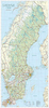
Explore Sweden with Lonely Planet. With our 4th edition you'll discover the many sides to this diverse country - camp out by the shores of lovely Lake Siljan, peruse the latest fashions in Stockholm's trendy Sodermalm, hike up the Sami holy mountain of Atoklimpen, visit an artist's home at Carl Larsson-Garden.
Lonely Planet guides are written by experts who get to the heart of every destination they visit. This fully updated edition is packed with accurate, practical and honest advice, designed to give you the information you need to make the most of your trip.
In This Guide:
Unique color section on Swedish culture, from Vikings to design
Includes tailor-made itineraries to inspire you on your visit
Unique Green Index for easy reference to sustainable options
Product Description
Reviews/Comments
Add New
Vouchers
No voucher codes found.
Do you know a voucher code for this product or supplier? Add it to Insights for others to use.
Do you know a voucher code for this product or supplier? Add it to Insights for others to use.
 Denmark