More From Contributor
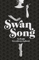
£14.99
The northernmost of the Yorkshire Dales, Swaledale can well claim to be the most beautiful; certainly to be the wildest & most romantic. It is, a local writer claimed `as close to Heaven as you get on Earth` & it has been celebrated by Yorkshiremen & others for over two hundred years. Stretching from the wilds around Muker & remote Arkengarthdale, through a landscape once scarred by lead mining, but now marked out by regular grey field walls & barns, & picturesque villages, to the splendour of Richmond with its great Medieval castle & its graceful eighteenth century bridge, theatre & houses, Swaledale is the classic Yorkshire dale, & here is a photographic portrait of it in all seasons & all weathers by a local photographer, ...
Archived Product
£7.99
John, Susan, Titty & Roger return to the lake for another summer camping on their island with their old allies, Nancy & Peggy, otherwise known as the Amazon pirates. But immediately disaster strikes when the Swallows find themselves marooned ashore by the shipwreck of their boat. But if they can`t have the isl&, there`s always Swallowdale, the secret valley, hidden from the world & containing an extra secret concealed within it. ...
Archived Product
£8.99
Wiola lives in a close-knit agricultural community. Wiola has a black cat called Blackie. Wiola`s father was a deserter but now he is a taxidermist. Wiola`s mother tells her that killing spiders brings on storms. Wiola must never enter the seamstress`s `secret` room. Wiola collects matchbox labels. Wiola is a good Catholic girl brought up with fables & nurtured on superstition. Wiola lives in a Poland that is both very recent & lost in time. Swallowing Mercury is about the ordinary passing of years filled with extraordinary days. In vivid prose filled with texture, colour & sound, it describes the adult world encroaching on the child`s. From childhood to adolescence, Wiola dances to the strange music of her own imagination. ...
Archived Product
£7.99
The ultimate children`s classic
- long summer days filled with adventure. John, Susan, Titty & Roger sail their boat, Swallow,
...
Archived Product
£10.00
” An utter delight”
- Jennifer Tetlow. In the Encounters in the Wild series, renowned nature writer Jim Crumley gets up close
...
Archived Product
£11.00
This book was formerly available as one part of a two-volume set, detailing limestone cliff climbs in Dorset. This single volume is a reprint of the 1995 edition of Vol. 2, which covers covers Swanage to St Aldhelms Head &

Includes::
a section on the Isle of White. Some brief additional notes for 2002 are included in an appendix. About this series: Specialist climbing guides published by the Climbers' Club, established in 1898, a founder of & affiliated to the British Mountaineering Council. These guides are extremely comprehensive, individual titles list hundreds of climbs, each with brief descriptions. They are written in accordance with the Climbers' Club policy, which is: to reflect the best style matched to the ethos & traditions of British Climbing.

...
Archived Product
£3.50
Swanage in 1900 in a fascinating series of reproductions of old Ordnance Survey plans in the Alan Godfrey Editions, ideal for anyone interested in the history of their neighbourhood or family. Coverage extends from the coast & Peveril Point westward to Herston & northward to Caldron Barn Farm, about half a mile north of the town. Features include the town centre, station, pier, High Street, Newton Manor, Herston including St Mark`s church, Purbeck stone quarries, St Mary`s church, St Aldhem`s church & Prospect Farm. There is a directory on the reverse. About the Alan Godfrey Editions of the 25” OS Series Selected towns in Great Britain & Ireland are covered by maps showing the extent of urban development in the last decades of the 19th & early 20th century. The plans have been taken from the Ordnance Survey mapping & reprinted at about 15 inches to one mile (1:4, 340). On the reverse most maps have historical notes & many also include extracts from contemporary directories. Most maps cover about one mile (1.6kms) north/south, one & a half miles (2.4kms) across; adjoining sheets can be combined to provide wider coverage.FOR MORE INFORMATION & A COMPLETE LIST OF ALL AVAILABLE TITLES PLEASE CLICK ON THE SERIES LINK. ...
Archived Product
£6.39
A detailed topographic map of Swansea from the Ordnance Survey Explorer series, covering Neath & Port Talbot. Edition A2; Publication date March 2012 About this series: These highly detailed maps show all the administrative boundaries, settlements as small as isolated farms, the road network down to unfenced roads & country tracks, & field boundaries (hedges & drystone walls) which make navigation across the countryside much easier. Steep gradients on roads are indicated. Various landmarks, e.g. powerlines, archaeological sites, windmills, churches & lighthouses are shown & additional graphics indicate natural terrain features such as cliffs, scree, mud & vegetation variations. The contour interval is 5 metres in the lower parts of the country & 10 metres in the uplands, & spot heights are marked. Each map covers an area of 30 x 20km (i.e. approx. 19 x 12 miles), with some double-sided maps covering more, as indicated in the individual descriptions. The maps are fully GPS compatible, with the National Grid shown at 1km intervals & latitude & longitude indicated by margin ticks at 1'. The Explorer series has replaced the earlier, green-cover Pathfinder maps. The Explorer series is now complete & covers all of Engl&, Wales & Scotl&. Some sheets for popular areas like the National Parks are still branded as Outdoor Leisure (OL) maps, but are now included in this series as the cartography is the same as that in the Explorer Maps. The Explorer maps offer a substantial improvement on the Pathfinder series, with greater use of colour, larger area per map, & stronger emphasis on information for ramblers & tourists. This series is ideal for walking & other outdoor pursuits & each map shows a large amount of information for ramblers & tourists. Public rights of way are shown (except in Scotland), together with other routes with public access: National Trails & Recreational Paths, permitted paths & bridleways, & selected cycle routes. Open access land created under the Countryside & Rights of Way Act 2000 is marked. Tourist information

Includes::
caravan & campsites, Park & Ride locations, recreation/leisure/sport centres, museums, historic buildings, English Heritage & National Trust sites, rural pubs, etc. The map legend is in English only, except for the tourist information content which is also in French & German.

...
Archived Product
£14.99
Swansea, Neath & Port Talbot area on a detailed topographic & GPS compatible map No. 165, waterproof version, from the Ordnance Survey’s 1:25, 000 Explorer series.MOBILE DOWNLOADS: this title & all the other OS Explorer maps include a code for downloading after purchase the digital version onto your smartphone or tablet for viewing on the OS smartphone app.OS EXPLORER SERIES: to see the list of all the titles in the OS Explorer series, both paper & waterproof versions, please click on the series link. The Explorer series, Ordnance Survey’s most detailed maps recommended for anyone enjoying outdoor activities, provides topographic coverage of Great Britain at 1:25, 000 on GPS compatible maps with hiking trails, cycling routes & extensive tourist information. Each printed map is available either on paper or as a waterproof & tear-resistant OS Active Map, as indicated in its title. Britain’s National Parks & other areas of particular tourist interest are presented on often double-sided OL (Outdoor Leisure) maps, whilst most standard format Explorers cover an area of 30 x 20km (approx. 19 x 12 miles). All three versions (paper, waterproof & digital) are the same & provide plenty of recreational & tourist information, indicating the traditional public right of way paths (except in Scotland where different laws apply), including bridleways & byways. National Trails & other long-distance paths are marked, as well as permissive footpaths or bridleways & on-road or traffic-free cycle routes with, where appropriate, their National/ Regional Cycle Network numbers. Boundaries of access land are clearly marked. A wide range of symbols provides additional tourist information, highlighting camping & caravanning sites, information offices & visitors’ centres, parking & picnicking places, country pubs, sport & recreational facilities including cycle hire locations & mountain biking trails, historic buildings & museums, etc. Exceptionally clear presentation of the landscape is provided by contours at 5m or in the uplands at 10m intervals, with additional spot heights plus colouring and/or graphics for different types of woodlands, orchards, heath, marshl&, scree or boulders, & other topographic features. For GPS users the maps have British National Grid lines at 1km intervals, with latitude & longitude given by margin ticks at 1`. Clearly laid out map legend

Includes::
French & German translations for the tourist information symbols.

...
Archived Product
£8.99
Swansea, Neath & Port Talbot area on a detailed topographic & GPS compatible map No. 165, paper version, from the Ordnance Survey’s 1:25, 000 Explorer series.MOBILE DOWNLOADS: this title & all the other OS Explorer maps include a code for downloading after purchase the digital version onto your smartphone or tablet for viewing on the OS smartphone app.OS EXPLORER SERIES: to see the list of all the titles in the OS Explorer series, both paper & waterproof versions, please click on the series link. The Explorer series, Ordnance Survey’s most detailed maps recommended for anyone enjoying outdoor activities, provides topographic coverage of Great Britain at 1:25, 000 on GPS compatible maps with hiking trails, cycling routes & extensive tourist information. Each printed map is available either on paper or as a waterproof & tear-resistant OS Active Map, as indicated in its title. Britain’s National Parks & other areas of particular tourist interest are presented on often double-sided OL (Outdoor Leisure) maps, whilst most standard format Explorers cover an area of 30 x 20km (approx. 19 x 12 miles). All three versions (paper, waterproof & digital) are the same & provide plenty of recreational & tourist information, indicating the traditional public right of way paths (except in Scotland where different laws apply), including bridleways & byways. National Trails & other long-distance paths are marked, as well as permissive footpaths or bridleways & on-road or traffic-free cycle routes with, where appropriate, their National/ Regional Cycle Network numbers. Boundaries of access land are clearly marked. A wide range of symbols provides additional tourist information, highlighting camping & caravanning sites, information offices & visitors’ centres, parking & picnicking places, country pubs, sport & recreational facilities including cycle hire locations & mountain biking trails, historic buildings & museums, etc. Exceptionally clear presentation of the landscape is provided by contours at 5m or in the uplands at 10m intervals, with additional spot heights plus colouring and/or graphics for different types of woodlands, orchards, heath, marshl&, scree or boulders, & other topographic features. For GPS users the maps have British National Grid lines at 1km intervals, with latitude & longitude given by margin ticks at 1`. Clearly laid out map legend

Includes::
French & German translations for the tourist information symbols.

...
Archived Product

Swan Song

`A completely fascinating novel and a marvellously skilful re-imagining of real people, times and places. Outstanding.` - William Boyd They told him everything. He told everyone else. Over countless martini-soaked Manhattan lunches, they shared their deepest secrets and greatest fears. On exclusive yachts sailing the Mediterranean, on private jets streaming towards Jamaica, on Yucatan beaches in secluded bays, they gossiped about sex, power, money, love and fame. They never imagined he would betray them so absolutely. In the autumn of 1975, after two decades of intimate friendships, Truman Capote detonated a literary grenade, forever rupturing the elite circle he`d worked so hard to infiltrate. Why did he do it, knowing what he stood to lose? Was it to punish them? To make them
pay for their manners, money and celebrated names? Or did he simply refuse to believe that they could ever stop loving him? Whatever the motive, one thing remains indisputable: nine years after achieving wild success with In Cold Blood, Capote committed an act of professional and social suicide with his most lethal of weapons... Words. A dazzling debut about the line between gossip and slander, self-creation and self-preservation, SWAN SONG is the tragic story of the literary icon of his age and the beautiful, wealthy, vulnerable women he called his Swans. `Writers write. And one can`t be surprised if they write what they know.` `A dazzlingly assured first novel.` - Sunday Times `Scandalous, frenetic, amusing and tragic.` - Daily Mail `A whirlwind of a first novel...a wonderful
blaze of eccentricity. Outstanding.` - Rose Tremain `Our generation`s The Secret History` - Pendora `Brilliantly written, deeply researched, funny, sharp and moving.` - Kate Williams, bestselling author of Josephine
RIP - This product is no longer available on our network. It was last seen on 25.09.2019

This page now acts as a permanent archive for this product. Add more information using the comments box below to ensure it can still be found by future generations.

Use our search facility to see if it is available from an alternative contributor.
  • Availability: Out Of Stock
  • Supplier: Stanfords
  • SKU: 9781786331052
Availability: In Stock
£12.99

Product Description

`A completely fascinating novel & a marvellously skilful re-imagining of real people, times & places. Outstanding.`
- William Boyd They told him everything. He told everyone else. Over countless martini-soaked Manhattan lunches, they shared their deepest secrets & greatest fears. On exclusive yachts sailing the Mediterranean, on private jets streaming towards Jamaica, on Yucatan beaches in secluded bays, they gossiped about sex, power, money, love & fame. They never imagined he would betray them so absolutely. In the autumn of 1975, after two decades of intimate friendships, Truman Capote detonated a literary grenade, forever rupturing the elite circle he`d worked so hard to infiltrate. Why did he do it, knowing what he stood to lose? Was it to punish them? To make them pay for their manners, money & celebrated names? Or did he simply refuse to believe that they could ever stop loving him? Whatever the motive, one thing remains indisputable: nine years after achieving wild success with In Cold Blood, Capote committed an act of professional & social suicide with his most lethal of weapons... Words. A dazzling debut about the line between gossip & slander, self-creation & self-preservation, SWAN SONG is the tragic story of the literary icon of his age & the beautiful, wealthy, vulnerable women he called his Swans. ` Writers write. & one can`t be surprised if they write what they know.` `A dazzlingly assured first novel.`
- Sunday Times ` Scandalous, frenetic, amusing & tragic.`
- Daily Mail `A whirlwind of a first novel...a wonderful blaze of eccentricity. Outstanding.`
- Rose Tremain ` Our generation`s The Secret History`
- Pendora ` Brilliantly written, deeply researched, funny, sharp & moving.`
- Kate Williams, bestselling author of Josephine

Reviews/Comments

Add New

Intelligent Comparison

Oooops!
We couldn't find anything!
Perhaps this product's unique.... Or perhaps we are still looking for comparisons!
Click to bump this page and we'll hurry up.

Price History

Vouchers

No voucher codes found.
Do you know a voucher code for this product or supplier? Add it to Insights for others to use.

Facebook

Jargon Buster

Rose - Commonly associated with a light pink colour
Rose - A fragrant garden plant
Jamaica - A small island situated in the Caribbean
Mail - Or post is a service for transmitting physical objects or letters between locations
History - Anything that happens in the past. An acedemic subject.
professional - A term used to describe products or people which may be focused on specialist educational training
Love - Someone who shows deep affection for someone else.
Professional - A person that is trained within a profession.
Autumn - A season which falls between summer and winter.
Exclusive - Something that is not including other things.
Blood - A red liquid that circulates around the body for all the bodies needs.
Wonderful - Another word for describing something that is extremely good, marvellous.

Supplier Information

Stanfords
Stanfords was established in 1853 and opened their iconic Covent Garden flagship store in 1901. They have become the top retailer of maps, travel books and accessories in the UK and arguably offer the largest selection of maps and travel books worldwide. Famous names such as Captain Robert Falcon Scott, Ranulph Fiennes and Michael Palin have purchased from Stanfords. They now have a shop in Bristol and both stores together with other venues operate a calendar of events including talks, book signings and exhibitions. As a specialist map retailer, the map selection is comprehensive and includes road maps, street maps and walking maps from worldwide destinations, as well as a selection of world atlases and wall maps. Books include travel guides and travel literature. Stanfords also stock globes, from miniatures made of blue marble to magnificent floor-standing globes. The website features a selection of interesting articles on travel topics.
Page Updated: 2023-11-12 20:15:36

Community Generated Product Tags

Oh No! The productWIKI community hasn't generated any tags for this product yet!
Menu