More From Contributor
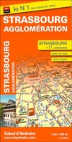
£9.09
Map No. 82, Stranraer & Glenluce, in the waterproof & tear-resistant OS Active version of the Ordnance Survey Landranger series at 1:50, 000, including Kirkcolm, Leswalt, Cairnryan, New Luce, Kircowan, Dunragit, Stoneykirk, Portpatrick, Auchenmaig, Elrig, Port William, Sandhead, Ardwell, Port Logan & Drummore, with Loch Ryan, Milleur Point, Black Loch, White Loch, Castle Lock, Mochrum Loch, The Rhins, Mull of Galloway, Luce Bay & the Southern Upland Way. Edition C2; Publication date April 2012 About Ordnance Survey ...
Archived Product
£10.39
Map No. 82, Stranraer & Glenluce, in a waterproof & tear-resistant version of the Ordnance Survey Landranger series at 1:50, 000, including Kirkcolm, Leswalt, Cairnryan, New Luce, Kircowan, Dunragit, Stoneykirk, Portpatrick, Auchenmaig, Elrig, Port William, Sandhead, Ardwell, Port Logan & Drummore, with Loch Ryan, Milleur Point, Black Loch, White Loch, Castle Lock, Mochrum Loch, The Rhins, Mull of Galloway, Luce Bay & the Southern Upland Way. Edition C2; Revised for selected changes 2006; Copyright date 2007 This title is also available on our website in a paper version. Maps in this series are only published folded. Stanfords can also print flat versions of Ordnance Survey maps through the OS Select system, centring the map on a location of your choice & with a picture provided by you on the cover. For more information please click on the link at the bottom of this description. About Ordnance Survey ...
Archived Product
£14.99
Waterproof & tear-resistant OS Active version of map No. 82 from the Ordnance Survey’s Landranger series at 1:50, 000, with contoured & GPS compatible topographic mapping plus tourist information.MOBILE DOWNLOADS: As well as the physical edition of the map, each Landranger title now

Includes::
a code for downloading after purchase its digital version onto your smartphone or tablet for viewing on the OS smartphone app.OS LANDRANGER SERIES: to see the list of all the titles in the OS Landranger series, both paper & waterproof versions, please click on the series link. Maps in the Landranger series provide plenty of recreational & tourist information, indicating the traditional public right of way paths (except in Scotland where different laws apply), including bridleways & byways restricted or open to motorized traffic. National Trails & selected other long-distance paths are marked, as well as on-road & traffic-free cycle routes with their National/ Regional Cycle Network numbers. National Trust/ National Trust for Scotland & Forestry Commission land is clearly marked, indicating open or restricted access. A range of symbols highlights camping & caravanning sites, youth hostels, tourist information offices & visitors’ centres, parking & picnicking places, World Heritage sites, sport & recreational facilities, etc. The maps provide detailed presentation of topography with contours at 10m intervals, numerous spot heights & additional colouring and/or graphics for different types of woodlands, orchards or parkl&, rock features including scree & cliffs, water features inland & along the sea shore with marshl&, dunes, s&, mud, shingle & the high water mark. All the standard information expected of survey mapping at this scale is included: finely graded road network, railway lines with stations, cuttings, embankments, etc; individual isolated buildings; archaeological & historical sites, etc. For GPS users the British National Grid is shown at 1km intervals, with latitude & longitude given by margin ticks at 1` & cross hairs on the map at 5`. Each map covers an area of 40 x 40km, (approx. 25 x 25 miles).

...
Archived Product
£8.99
Paper version of map No. 82 from the Ordnance Survey’s Landranger series at 1:50, 000, with contoured & GPS compatible topographic mapping plus tourist information.MOBILE DOWNLOADS: As well as the physical edition of the map, each Landranger title now

Includes::
a code for downloading after purchase its digital version onto your smartphone or tablet for viewing on the OS smartphone app.OS LANDRANGER SERIES: to see the list of all the titles in the OS Landranger series, both paper & waterproof versions, please click on the series link. Maps in the Landranger series provide plenty of recreational & tourist information, indicating the traditional public right of way paths (except in Scotland where different laws apply), including bridleways & byways restricted or open to motorized traffic. National Trails & selected other long-distance paths are marked, as well as on-road & traffic-free cycle routes with their National/ Regional Cycle Network numbers. National Trust/ National Trust for Scotland & Forestry Commission land is clearly marked, indicating open or restricted access. A range of symbols highlights camping & caravanning sites, youth hostels, tourist information offices & visitors’ centres, parking & picnicking places, World Heritage sites, sport & recreational facilities, etc. The maps provide detailed presentation of topography with contours at 10m intervals, numerous spot heights & additional colouring and/or graphics for different types of woodlands, orchards or parkl&, rock features including scree & cliffs, water features inland & along the sea shore with marshl&, dunes, s&, mud, shingle & the high water mark. All the standard information expected of survey mapping at this scale is included: finely graded road network, railway lines with stations, cuttings, embankments, etc; individual isolated buildings; archaeological & historical sites, etc. For GPS users the British National Grid is shown at 1km intervals, with latitude & longitude given by margin ticks at 1` & cross hairs on the map at 5`. Each map covers an area of 40 x 40km, (approx. 25 x 25 miles).

...
Archived Product
£3.50
Stranton & Southern Hartlepool in 1896 in a fascinating series of reproductions of old Ordnance Survey plans in the Alan Godfrey Editions, ideal for anyone interested in the history of their neighbourhood or family. The map covers the area from Burbank Street & All Saints church southward to Foggy Furze & Longhill Farm. Various iron & steel works with their railway sidings & furnaces are major features. Other features include the Lion Brewery, Bellevue, St Aidan`s church, Hartlepools Paper Works, Baltic Saw Mills, Carr House, Longhill, etc. Street directory entries for Burbank Street, Burn Road, Lister Street, Oxford Street, Stockton Road & Stockton Street are on the reverse. About the Alan Godfrey Editions of the 25” OS Series: Selected towns in Great Britain & Ireland are covered by maps showing the extent of urban development in the last decades of the 19th & early 20th century. The plans have been taken from the Ordnance Survey mapping & reprinted at about 15 inches to one mile (1:4, 340). On the reverse most maps have historical notes & many also include extracts from contemporary directories. Most maps cover about one mile (1.6kms) north/south, one & a half miles (2.4kms) across; adjoining sheets can be combined to provide wider coverage.FOR MORE INFORMATION & A COMPLETE LIST OF ALL AVAILABLE TITLES PLEASE CLICK ON THE SERIES LINK. ...
Archived Product
£5.99
Strasbourg at 1:15, 000 on a pocket-size street plan from Mair Dumont printed on durable, waterproof & tear-resistant synthetic paper, with an enlargement presenting the city centre in greater detail, tram & bus routes shown with stops & line numbers, one way streets, a diagram of the city ...
Archived Product
£8.50
Street plan of the Strasbourg agglomeration at 1:10, 800 plus in a separate booklet an enlargement showing the town centre in greater detail, street index, information on sights & hotels, etc. This title is part of an extensive series of street plans of French towns from Blay-Foldex, the country’s largest, oldest & most experienced publisher of urban mapping. Blay plans include outer suburbs &, where appropriate, adjoining localities forming part of the urban agglomeration & provide brief descriptions of the town’s main sights, contact details for hotels & other places of interest, etc. The plans show one way streets, car parks & pedestrian zones. Important public buildings are clearly marked & identified. Blay street maps are usually double-sided & include an enlargement for the town centre & a street index with separate lists of “edifices publics”: main public buildings, places of worship, schools, sport facilities, stations, etc. Each of the outer suburbs or the adjoining localities, identified with its postcode, has a separate index. Many titles also provide a road map of the environs. All the text is in French only.PLEASE NOTE: to see the list of Blay-Foldex street plans of French towns & cities please click on the series link – the series description also

Includes::
a comparison between Blay & IGN street plans.

...
Archived Product
£6.99
Strasbourg
- Mulhouse Michelin Centenary Map-Pack, a set of two maps showing the area at 1:200, 000: a current road map from
...
Archived Product
£7.50
Strasbourg & its Environs in a series of detailed road maps at 1:80, 000 from the IGN, designed to highlight places of interest & recreational possibilities, with a city centre street plan & an enlargement of a selected hiking area. Cartography is an enlargement from 1:100, 000 to 1:80, 000 of the publisher’s highly popular TOP100 series, with very detailed presentation of the road network, including classification of local roads according to lanes, rest areas, access restrictions, etc. Railway lines are shown with stations. Topography is shown by relief shading, with spot heights & colouring for woodlands, vineyards, orchards, etc. Cycle tracks & long-distance GR routes are marked. A wide range of symbols indicate various places of interest & recreational facilities, historical & cultural sites, golf courses, rock climbing, nature reserves, etc. Refuges & gîtes d’etape are marked, but no campsites. The maps have no geographical coordinates for GPS. Each title has an index of communes. Map legend

Includes::
English.A special feature of this series is the inclusion of a large city centre street plan & an enlargement of a particularly interesting recreational area. Presentation of these features varies, so please check the individual descriptions for more information.* IN THIS TITLE: a street plan of central Strasbourg highlighting main traffic arteries & indicating one way streets. An additional panel presents at the same scale part of the Vosges Mountains south-west of the city between Gérardmer, Le Hohneck, La Bresse & Cornimont. (Please note: the main map incorrectly indicates which area is presented on the panel).

...
Archived Product
£12.99
Topographic survey of France at 1:25, 000 in IGN`s excellent TOP25 / Série Bleue series. All the maps are GPS compatible, with a 1km UTM grid plus latitude & longitude lines at 5’ intervals. Contours are at 5m intervals except for mountainous areas where the maps have contours at 10m intervals, vividly enhanced by hill shading & graphics for rocky terrain. Colouring with graphics indicates different types of vegetation or land use (deciduous or coniferous forests, moors, orchards, vineyards, etc). PLEASE NOTE: coverage of France at this scale is currently being revised – the format & the presentation of each title are indicated by the letters at the end of its Sheet Reference number (e.g. 0416ET, 3531ETR, 1923SB, etc.)MAPS WITH FULL TOURIST OVERPRINT & AN ENGLISH MAP LEGEND: all TOP25 maps & the SB editions of Série Bleue have an overprint highlighting waymarked walking trails including long-distance GR routes &, where appropriate, ski routes. Symbols indicate campsites, gîtes d’etape, refuges, equestrian centres & other recreational facilities or sites, tourist information centres, cultural heritage, etc. Towns & locations of particular interest are highlighted.- ET or OT = single-sided TOP25 map covering approx. 29x 21 km / 18x 13 miles.- ETR or OTR = waterproof & tear resistant TOP25 map covering the same area as the corresponding ET or OT number, but double-sided, printed on a smaller size sheet with a good overlap between the sides.- SB = Série Bleue map with full tourist overprint; these maps, first introduced in summer 2014, each cover approx. 29x 24km / 18x 15 miles.SÉRIE BLEUE maps with numbers ending in E (Est) or O (Ouest): most editions now indicate the GR routes, but do not show any other tourist information. Map legend is in French only. Each map covers approx. 14x 20km / 9x 12 miles. ...
Archived Product

Strasbourg

Street plan of the Strasbourg agglomeration at 1:10, 800 plus in a separate booklet an enlargement showing the town centre in greater detail, street index, information on sights and hotels, etc. This title is part of an extensive series of street plans of French towns from Blay-Foldex, the country
RIP - This product is no longer available on our network. It was last seen on 25.09.2019

This page now acts as a permanent archive for this product. Add more information using the comments box below to ensure it can still be found by future generations.

Use our search facility to see if it is available from an alternative contributor.
  • Availability: Out Of Stock
  • Supplier: Stanfords
  • SKU: 9782309502096
Availability: In Stock
£5.50

Product Description

Street plan of the Strasbourg agglomeration at 1:10, 800 plus in a separate booklet an enlargement showing the town centre in greater detail, street index, information on sights & hotels, etc. This title is part of an extensive series of street plans of French towns from Blay-Foldex, the country

Reviews/Comments

Add New

Intelligent Comparison

Oooops!
We couldn't find anything!
Perhaps this product's unique.... Or perhaps we are still looking for comparisons!
Click to bump this page and we'll hurry up.

Price History

Vouchers

No voucher codes found.
Do you know a voucher code for this product or supplier? Add it to Insights for others to use.

Facebook

Jargon Buster

Supplier Information

Stanfords
Stanfords was established in 1853 and opened their iconic Covent Garden flagship store in 1901. They have become the top retailer of maps, travel books and accessories in the UK and arguably offer the largest selection of maps and travel books worldwide. Famous names such as Captain Robert Falcon Scott, Ranulph Fiennes and Michael Palin have purchased from Stanfords. They now have a shop in Bristol and both stores together with other venues operate a calendar of events including talks, book signings and exhibitions. As a specialist map retailer, the map selection is comprehensive and includes road maps, street maps and walking maps from worldwide destinations, as well as a selection of world atlases and wall maps. Books include travel guides and travel literature. Stanfords also stock globes, from miniatures made of blue marble to magnificent floor-standing globes. The website features a selection of interesting articles on travel topics.
Page Updated: 2023-11-12 20:15:36

Community Generated Product Tags

Oh No! The productWIKI community hasn't generated any tags for this product yet!
Menu