More From Contributor
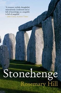
£14.99
Stonehaven, Inverbervie, Laurencekirk & Howe of the Mearns area on a detailed topographic & GPS compatible map No. 396, paper version, from the Ordnance Survey’s 1:25, 000 Explorer series. MOBILE DOWNLOADS: this title & all the other OS Explorer maps include a code for downloading after purchase the digital version onto your smartphone or tablet for viewing on the OS smartphone app.OS EXPLORER SERIES: to see the list of all the titles in the OS Explorer series, both paper & waterproof versions, please click on the series link. The Explorer series, Ordnance Survey’s most detailed maps recommended for anyone enjoying outdoor activities, provides topographic coverage of Great Britain at 1:25, 000 on GPS compatible maps with hiking trails, cycling routes & extensive tourist information. Each printed map is available either on paper or as a waterproof & tear-resistant OS Active Map, as indicated in its title. Britain’s National Parks & other areas of particular tourist interest are presented on often double-sided OL (Outdoor Leisure) maps, whilst most standard format Explorers cover an area of 30 x 20km (approx. 19 x 12 miles). All three versions (paper, waterproof & digital) are the same & provide plenty of recreational & tourist information, indicating the traditional public right of way paths (except in Scotland where different laws apply), including bridleways & byways. National Trails & other long-distance paths are marked, as well as permissive footpaths or bridleways & on-road or traffic-free cycle routes with, where appropriate, their National/ Regional Cycle Network numbers. Boundaries of access land are clearly marked. A wide range of symbols provides additional tourist information, highlighting camping & caravanning sites, information offices & visitors’ centres, parking & picnicking places, country pubs, sport & recreational facilities including cycle hire locations & mountain biking trails, historic buildings & museums, etc. Exceptionally clear presentation of the landscape is provided by contours at 5m or in the uplands at 10m intervals, with additional spot heights plus colouring and/or graphics for different types of woodlands, orchards, heath, marshl&, scree or boulders, & other topographic features. For GPS users the maps have British National Grid lines at 1km intervals, with latitude & longitude given by margin ticks at 1`. Clearly laid out map legend

Includes::
French & German translations for the tourist information symbols.

...
Archived Product
£8.99
Stonehaven, Inverbervie, Laurencekirk & Howe of the Mearns area on a detailed topographic & GPS compatible map No. 396, paper version, from the Ordnance Survey’s 1:25, 000 Explorer series. MOBILE DOWNLOADS: this title & all the other OS Explorer maps include a code for downloading after purchase the digital version onto your smartphone or tablet for viewing on the OS smartphone app.OS EXPLORER SERIES: to see the list of all the titles in the OS Explorer series, both paper & waterproof versions, please click on the series link. The Explorer series, Ordnance Survey’s most detailed maps recommended for anyone enjoying outdoor activities, provides topographic coverage of Great Britain at 1:25, 000 on GPS compatible maps with hiking trails, cycling routes & extensive tourist information. Each printed map is available either on paper or as a waterproof & tear-resistant OS Active Map, as indicated in its title. Britain’s National Parks & other areas of particular tourist interest are presented on often double-sided OL (Outdoor Leisure) maps, whilst most standard format Explorers cover an area of 30 x 20km (approx. 19 x 12 miles). All three versions (paper, waterproof & digital) are the same & provide plenty of recreational & tourist information, indicating the traditional public right of way paths (except in Scotland where different laws apply), including bridleways & byways. National Trails & other long-distance paths are marked, as well as permissive footpaths or bridleways & on-road or traffic-free cycle routes with, where appropriate, their National/ Regional Cycle Network numbers. Boundaries of access land are clearly marked. A wide range of symbols provides additional tourist information, highlighting camping & caravanning sites, information offices & visitors’ centres, parking & picnicking places, country pubs, sport & recreational facilities including cycle hire locations & mountain biking trails, historic buildings & museums, etc. Exceptionally clear presentation of the landscape is provided by contours at 5m or in the uplands at 10m intervals, with additional spot heights plus colouring and/or graphics for different types of woodlands, orchards, heath, marshl&, scree or boulders, & other topographic features. For GPS users the maps have British National Grid lines at 1km intervals, with latitude & longitude given by margin ticks at 1`. Clearly laid out map legend

Includes::
French & German translations for the tourist information symbols.

...
Archived Product
£11.19
Laminated waterproof edition of a detailed topographic map of Stonehaven, Inverbervie & Laurencekirk from the Ordnance Survey Explorer series, covering Howe of the Mearns. Edition A1; Publication date July 2007 About this series: These highly detailed maps show all the administrative boundaries, settlements as small as isolated farms, the road network down to unfenced roads & country tracks, & field boundaries (hedges & drystone walls) which make navigation across the countryside much easier. Steep gradients on roads are indicated. Various landmarks, e.g. powerlines, archaeological sites, windmills, churches & lighthouses are shown & additional graphics indicate natural terrain features such as cliffs, scree, mud & vegetation variations. The contour interval is 5 metres in the lower parts of the country & 10 metres in the uplands, & spot heights are marked. Each map covers an area of 30 x 20km (i.e. approx. 19 x 12 miles), with some double-sided maps covering more, as indicated in the individual descriptions. The maps are fully GPS compatible, with the National Grid shown at 1km intervals & latitude & longitude indicated by margin ticks at 1'. The Explorer series has replaced the earlier, green-cover Pathfinder maps. The Explorer series is now complete & covers all of Engl&, Wales & Scotl&. Some sheets for popular areas like the National Parks are still branded as Outdoor Leisure (OL) maps, but are now included in this series as the cartography is the same as that in the Explorer Maps. The Explorer maps offer a substantial improvement on the Pathfinder series, with greater use of colour, larger area per map, & stronger emphasis on information for ramblers & tourists. This series is ideal for walking & other outdoor pursuits & each map shows a large amount of information for ramblers & tourists. Public rights of way are shown (except in Scotland), together with other routes with public access: National Trails & Recreational Paths, permitted paths & bridleways, & selected cycle routes. Open access land created under the Countryside & Rights of Way Act 2000 is marked. Tourist information

Includes::
caravan & camp sites, Park & Ride locations, recreation/leisure/sport centres, museums, historic buildings, English Heritage & National Trust sites, rural pubs, etc. The map legend is in English only, except for the tourist information content which is also in French & German.

...
Archived Product
£5.95
Stonehenge is the world's most famous prehistoric monument &, since the middle of the 19th century, probably the most photographed. Using images from English Heritage's unique photographic archive, the National Monument Record (NMR), this evocative book of 24 postcards charts the last 150 years in the life of this extraordinary & iconic site. Postcards include Druids at dawn, crop circles, the first known aerial photograph of Stonehenge, rock festivals & even Morris dancers. (English Heritage 2006) ...
Archived Product
£25.00
Our knowledge about Stonehenge has changed dramatically as a result of the Stonehenge Riverside Project (2003-2009), led by Mike Parker Pearson, & included not only Stonehenge itself but also the nearby great henge enclosure of Durrington Walls. This book is about the people who built Stonehenge & its relationship to the surrounding landscape. The book explores the theory that the people of Durrington Walls built both Stonehenge & Durrington Walls, & that the choice of stone for constructing Stonehenge has a significance so far undiscovered, namely, that stone was used for monuments to the dead. Through years of thorough & extensive work at the site, Parker Pearson & his team unearthed evidence of the Neolithic inhabitants & builders which connected the settlement at Durrington Walls with the henge, & contextualised Stonehenge within the larger site complex, linked by the River Avon, as well as in terms of its relationship with the rest of the British Isles. Parker Pearson`s book changes the way that we think about Stonehenge; correcting previously erroneous chronology & dating; filling in gaps in our knowledge about its people & how they lived; identifying a previously unknown type of Neolithic building; discovering Bluestonehenge, a circle of 25 blue stones from western Wales; & confirming what started as a hypothesis
- that Stonehenge was a place of the dead
- through more than 64 cremation burials unearthed there, which span the monument`s use during the third millennium BC. In lively & engaging prose, Parker Pearson brings to life the imposing ancient monument that continues to hold a fascination for everyone.

...
Archived Product
£16.99
Perched on the chalk uplands of Salisbury Plain, the megaliths of Stonehenge offer one of the most recognizable outlines of any ancient structure. Its purpose
- place of worship, sacrificial arena, giant calendar
- is unknown, but its story is one of the most extraordinary of any of the world`s prehistoric monuments. Constructed in several phases over a period of some 1500 years, beginning c. 3000 BC, Stonehenge`s key elements are its `bluestones`, transported from West Wales by unexplained means, & sarsen stones quarried from the nearby Marlborough Downs. Francis Pryor delivers a rigorous account of the nature & history of Stonehenge, but also places the enigmatic stones in a wider cultural context, exploring how antiquarians, scholars, writers, artists, `the heritage industry`
- & even neopagans
- have interpreted the site over the centuries.


...
Archived Product
£4.99
Today, visitors experience Stonehenge as a wonder of ancient achievement & an enduring symbol of mystery. But Stonehenge was built as a temple
- a place of ceremony, of burial & of celebration. The first Stonehenge was simple
- just a circular ditch & bank, perhaps with a few small upright timber posts or stones
- & was constructed about 5, 000 years ago, in the period of prehistory known as the Neolithic or New Stone Age. By about 2500 BC more & much larger stones had been brought to the site, huge sarsen stones from north Wiltshire & smaller bluestones from west Wales. This marked the beginning of over 800 years of construction & alteration stretching into the period known as the Bronze Age, when the first metal tools & weapons were made. By this time Stonehenge was the greatest temple in Britain, its banks, ditches & standing stones arranged in sophisticated alignments to mark the passage of the sun & the changing seasons. But Stonehenge was just one part of a remarkable ancient landscape. Hundreds of burial mounds clustered on the surrounding hilltops, while smaller temples & other ceremonial sites were built nearby. Stonehenge & these other ancient structures form an archaeological landscape so rich that it is classified as a World Heritage Site. Stonehenge has inspired people to study & interpret it for centuries. Medieval writers suggested magic as an explanation of how it was created; early antiquarians, like William Stukeley in the early 18th century, guessed
- wrongly- that the Druids had built it. Archaeology still provides the best hope of answering some of these fundamental questions about Stonehenge: how & when it was built, who built it &, perhaps most difficult of all, why it was built, But even with the evidence that archaeology & modern science provide, not all these questions can be answered. Stonehenge will always keep some of its secrets.


...
Archived Product
£9.99
Stonehenge & Avebury World Heritage Sites on a large double-sided map from the English Heritage presenting each site on one side of the map at 1:10, 000 annotated with extensive archaeological & tourist information & accompanied by historical notes, colour photos & a time line. The archaeological remains, various tourist facilities & local footpaths, etc are marked on a base derived from Ordnance Survey mapping. Archaeological sites are coloured according to their age (Mesolithic, Neolithic, Bronze, etc), distinguishing between those visible & below surface. The map shows access to the sites & across the surrounding land indicating footpaths, bridleways, restricted byways, National Trails, permissive paths & the Sustrans cycle network with their route numbers. Other information

Includes::
bus stops, car parks, visitors’ centres, public toilets, museums, etc. Each map is accompanied by extensive historical notes, colour photos, plus a tile line comparing the development of the site with events elsewhere in the world.

...
Archived Product
£12.95
Since its first & prize-winning edition of 1983, Stonehenge Complete has established itself as the classic account of this most famous of ancient places. For this new edition, Christopher Chippindale has revised & updated the story to include the latest theories & discoveries. People have puzzled over Stonehenge for centuries, speculating & dreaming about it, drawing & painting it, trying to make sense of it. Here is the story of the one real Stonehenge, as well as the many unreal Stonehenges that archaeologists, tourists, mystics, astronomers, artists, poets, & visionaries have made out of it. New studies in the last decade have revolutionized our knowledge of the complex sequence of structures that make its celebrated profile; remarkably, these new discoveries have been made without new excavations. Stonehenge today is as lively as it ever was. After a period of dissent & confrontation, visitors are once again welcome to see the sun rise over the Heel stone on midsummer solstice day, & some 20, 000 people are expected to gather at midsummer dawn this year. As the new edition explains, they are in error: although Stonehenge is indeed astronomically oriented, it is not aligned on the midsummer sunrise at all. ...
Archived Product
£12.95
This newly revised & enlarged fourth edition of Christopher Chippindales prize-winning classic account brings the story of Stonehenge right up to date. It describes in two new chapters the startling ideas & insights of the latest field research. In a radical reinterpretation, Stonehenge with its cold rocks is seen as the place of the dead, & another site over the horizon as the place of the living, built in wood, & complete with houses & paved ways. In another theory, Stonehenge is a place of healing. Alongside the quest to understand Stonehenge are the taxing practicalities of caring for a 4, 000 years old site that was never designed to cope with a million visitors a year, & how to preserve the monument for millennia to come. ” It would not be easy to name a better guide”. (” The Guardian”). ” Splendidly illustrated Will for years to come be a standard reference work”). (” The Times Literary Supplement”). ” All you ever wanted to know about Stonehenge is catalogued in this humorously written, beautifully illustrated book”. (” The Economist”). ...
Archived Product

Stonehenge

Stonehenge is woven into the earliest Arthurian legends and has been analysed by everyone from archaeologists, to town planners, to the Druids who have made it their spiritual home. By refusing to adopt one theoretical position, Rosemary Hill provides the most wide-ranging and expansive history of the megalithic structure to date, from its creation in 3000 BC to the threat of the thunderous main roads that flank it today.
RIP - This product is no longer available on our network. It was last seen on 25.09.2019

This page now acts as a permanent archive for this product. Add more information using the comments box below to ensure it can still be found by future generations.

Use our search facility to see if it is available from an alternative contributor.
  • Availability: Out Of Stock
  • Supplier: Stanfords
  • SKU: 9781861978806
Availability: In Stock
£8.99

Product Description

Stonehenge is woven into the earliest Arthurian legends & has been analysed by everyone from archaeologists, to town planners, to the Druids who have made it their spiritual home. By refusing to adopt one theoretical position, Rosemary Hill provides the most wide-ranging & expansive history of the megalithic structure to date, from its creation in 3000 BC to the threat of the thunderous main roads that flank it today.

Reviews/Comments

Add New

Intelligent Comparison

Oooops!
We couldn't find anything!
Perhaps this product's unique.... Or perhaps we are still looking for comparisons!
Click to bump this page and we'll hurry up.

Price History

Vouchers

No voucher codes found.
Do you know a voucher code for this product or supplier? Add it to Insights for others to use.

Facebook

Jargon Buster

Rosemary - A woody fragrant herb
Date - A day on a calendar
Date - A social activity whith a current or potential partner
History - Anything that happens in the past. An acedemic subject.
Wide - Something with a large width.
Home - A place of permanent residence for families.

Supplier Information

Stanfords
Stanfords was established in 1853 and opened their iconic Covent Garden flagship store in 1901. They have become the top retailer of maps, travel books and accessories in the UK and arguably offer the largest selection of maps and travel books worldwide. Famous names such as Captain Robert Falcon Scott, Ranulph Fiennes and Michael Palin have purchased from Stanfords. They now have a shop in Bristol and both stores together with other venues operate a calendar of events including talks, book signings and exhibitions. As a specialist map retailer, the map selection is comprehensive and includes road maps, street maps and walking maps from worldwide destinations, as well as a selection of world atlases and wall maps. Books include travel guides and travel literature. Stanfords also stock globes, from miniatures made of blue marble to magnificent floor-standing globes. The website features a selection of interesting articles on travel topics.
Page Updated: 2023-11-12 20:15:36

Community Generated Product Tags

Oh No! The productWIKI community hasn't generated any tags for this product yet!
Menu