
 United Kingdom
 France
 Germany
 Netherlands
 Sweden
 USA
USA
 Italy
Italy
 Spain
Spain
More From Contributor


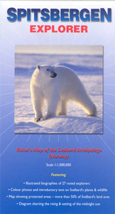
Spitsbergen Explorer
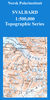
Svalbard archipelago, including Kvitøya, Kong Karls Land, and Bjørnøya (Bear Island) at 1:1, 000, 000 approx. on a tourist map with extensive additional information, photos of fauna and flora, biographies of explorers, etc.On one side is a map of the whole Svalbard group with Bjørnøya shown as an inset, showing settlements and naming numerous topographic features such as peaks, glaciers, bays and fjords, etc. The map had latitude lines at 1º and longitude at 3º. Two insets provide a locator map showing the position of the group within the North Polar Region and its protected areas including bird colonies. Also provided is a Norwegian/English glossary plus a chart of the sun’s yearly cycle at Longyearbyen.The whole of the reverse side is covered by biographies of 27
explorers connected with Svalbard from Willem Barents to Umberto Nobile, plus colour photos and descriptions of several species of fauna and flora.
explorers connected with Svalbard from Willem Barents to Umberto Nobile, plus colour photos and descriptions of several species of fauna and flora.

Product Description
Reviews/Comments
Add New
Vouchers
No voucher codes found.
Do you know a voucher code for this product or supplier? Add it to Insights for others to use.
Do you know a voucher code for this product or supplier? Add it to Insights for others to use.
 Denmark