More From Contributor
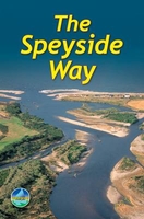
£8.25
Spessart Regional Park: Southern Part, map no. 22, in a series of special GPS compatible recreational editions of the German topographic survey at 1:50, 000, with waymarked hiking trails & cycling routes, campsites & youth hostels, etc. All the maps have cartography identical to the standard topographic survey of Germany, with extensive overprint highlighting local & long-distance footpaths & cycle routes, including King Ludwig Way, different variants of the Way of St James, etc, indicating their waymarking. Symbols highlight various types of accommodation (campsites, youth hostels, refuges, etc), sport & recreational facilities, places of interest, ski & cable car lift, etc. The maps have an overprint showing 1-km UTM grid. Many of the titles have on the reverse photos of fauna & flora & descriptions of the area covered by them. Map legend & all the text are in German only. ...
Archived Product
£11.50
Spessart Regional Park: Southern Part, map no. 22, in a series of special GPS compatible recreational editions of the German topographic survey at 1:50, 000, with waymarked hiking trails & cycling routes, campsites & youth hostels, etc. All the maps have cartography identical to the standard topographic survey of Germany, with extensive overprint highlighting local & long-distance footpaths & cycle routes, including King Ludwig Way, different variants of the Way of St James, etc, indicating their waymarking. Symbols highlight various types of accommodation (campsites, youth hostels, refuges, etc), sport & recreational facilities, places of interest, ski & cable car lift, etc. The maps have an overprint showing 1-km UTM grid. Many of the titles have on the reverse photos of fauna & flora & descriptions of the area covered by them. Map legend & all the text are in German only. ...
Archived Product
£7.50
Road Edition maps are produced in co-operation with the Hellenic Army Geographical Service, the national survey organisation. The maps have contours with colour altitude tints. All the place names are shown in both Greek & Roman script. Road classification distinguishes between unsurfaced roads of good & poor quality. Tourist information

Includes::
scenic routes, petrol stations, archaeological sites, campsites, beaches, etc. Brief descriptions, in Greek & English, illustrate some of the interesting aspects of each isl&. Map legend

Includes::
English. On the reverse, there are lists of various types of accommodation from hotels to private rooms. Please note: deliveries from Road Editions are not very reliable. For titles currently not in stock it may be advisable to choose a map from another publisher.


...
Archived Product
£4.50
Spetses at 1: 12, 500 on a contoured, GPS compatible map from a wide coverage of the Greek islands by Anavasi, printed on light, waterproof & tear-resistant plastic paper, with a street plan of Spetses Town. The map has contours at 4m intervals with additional altitude colouring. The network of roads & paths indicates earth roads, dirt roads in poor condition, difficult roads, narrow earth paths & wide/narrow/faint paths, with suggested routes highlighted. Symbols mark various places of interest, including beaches. The map has a UTM grid for GPS use & latitude/longitude margin ticks. All place names are in both Greek & Latin alphabet. Map legends include English. On the reverse is a street plan of Spetses Town showing locations of various facilities. Also included is a list of various facilities on the isl&, in Greek only. To see which other Greek islands are covered by maps from Anavasi, please click on the series link. ...
Archived Product
£9.99
Spetses at 1: 12, 500 on a contoured, GPS compatible map from a wide coverage of the Greek islands by Anavasi, printed on light, waterproof & tear-resistant plastic paper, with a street plan of Spetses Town. The map has contours at 4m intervals with additional altitude colouring. The network of roads & paths indicates earth roads, dirt roads in poor condition, difficult roads, narrow earth paths & wide/narrow/faint paths, with suggested routes highlighted. Symbols mark various places of interest, including beaches. The map has a UTM grid for GPS use & latitude/longitude margin ticks. All place names are in both Greek & Latin alphabet. Map legends include English. On the reverse is a street plan of Spetses Town showing locations of various facilities. Also included is a list of various facilities on the isl&, in Greek only. To see which other Greek islands are covered by maps from Anavasi, please click on the series link. ...
Archived Product
£12.95
“ Speyside Way” is part of Cicerone’s of Great Britain & Ireland Cicerone walking guides series on topics & grades covering short walks & day walks, coastal & ridge walks, lowlands & highlands, long distance trails & popular regional routes. The Speyside Way runs for 66 miles along good paths beside the river Spey from Aviemore to Buckie on the Moray coast. Together with a 20-mile extension back to Newtonmore it makes an easy week’s backpacking. This guide describes all options fully, with linking routes to other official trails – the Dava Way & the Moray Coast Trail. Guides are a smaller format & illustrated with OS mapping & colour photography. Very thorough route descriptions are given, with walk profile boxes summarizing essential data such as distance, height gain, grade, walking time, Ordnance Survey mapping references, & accommodation & parking options. Cicerone Press are one of the UK’s most well known & respected publishers of guidebooks for the outdoor enthusiast. Easily distinguished by their convenient pocket size, these books have been a favourite amongst walkers, climbers & cyclists for many years. Their guides for European & international destinations are highly popular amongst English-speaking tourists. The books are of the same high standard as the UK guides, with clear maps, detailed route descriptions & plentiful background information. The range is extensive & often they produce the only available English language guide available for a particular area or long distance route. ...
Archived Product
£13.95
Speyside Way, a 123km / 77 miles trail between Buckie on the Moray coast & Aviemore in the Cairngorms National Park or alternatively to Tomintoul, presented at 1:40, 000 on a light, waterproof & tear-resistant map from Harvey Map Services. The whole route is covered on five overlapping panels, with small street plans of Buckie, Charlestown of Aberlour, Grantown-on-Spey & Aviemore. In addition to the usual information, map also highlights locations of the region’s famous whisky distilleries open to the general public. Maps in the Harvey’s series covering Great Britain’s national trails & other long-distance footpaths are printed on light, waterproof & tear-resistant synthetic paper & cover the routes at 1:40, 000 or 1:60, 000. Topography is shown by contours at 15m intervals, with additional spot heights plus colouring and/or graphics to provide a very detailed picture of the terrain (boulder fields, scree, crags, etc) & vegetation / land use (pastures, moorl&, woodlands, etc). In Scotland peaks & hills classified as Munros, Corbetts & Donalds are marked. The overprint for the long-distance trail shows sections on local or main roads (highlighting danger points), on tracks, & on footpaths, indicating intermittent or not visible paths. The maps also show other right of way paths, including permissive paths & bridleways. Symbols indicate various facilities & accommodation options (including campsites & youth hostels), pubs & refreshments, food shops, banks, information points, etc, both along the route itself & in the nearby locations. All maps are GPS compatible, with the British National Grid overprinted on each panel. The maps also include useful contact details & general advice. To see other titles in this series please click on the series link. ...
Archived Product
£7.95
All the mapping you need to complete Scotland`s 66-mile (106km) Speyside Way, an official Scottish Long Distance Route which follows the River Spey through northern Scotland from Aviemore to the old port of Buckie on the Moray coast. As well as beautiful scenery, the Spey is famed for its salmon & its distilleries. The route features easy walking on good paths & along disused railway lines & can be comfortably completed in a week. This booklet of Ordnance Survey 1:25, 000 Explorer maps has been designed for convenient use on the trail & can be used when walking the route in either direction. It shows the line of the Speyside Way along with the relevant extract from the OS Explorer map legend. It is conveniently sized for slipping into a jacket pocket or top of a rucksack & comes in a clear PVC sleeve. NOTE An accompanying Cicerone guidebook
- The Speyside Way / ISBN 9781852848682
- describes the full route from Aviemore to Buckie with lots of other practical & background information, for those preferring a written guide. The accompanying guidebook

Includes::
a copy of this map booklet.


...
Archived Product
£6.99
Alexandria, Egypt, 1977. During a dive to an old shipwreck, archaeologist Isabella Warnock uncovers an artefact unlike anything she has ever seen: an astrarium, a mysterious ancient device rumoured to have shaped the destinies of pharaohs & kings since the beginning of time. But her discovery comes at a terrible price, & it falls to her husband Oliver to keep the priceless object safe. Up against a shadowy enemy & a powerful cult prepared to do anything for the treasure, Oliver is catapulted into a breakneck race to protect an ancient secret in a dangerous world of conspiracy & Egyptology, where age-old sorcery & legends clash violently with modern-day ambitions. ...
Archived Product
£18.99
Levi dubs up all of our favourite classic recipes, adding a tamarind & orange glaze to lamb chops, making a lime jerk marinade for chicken, cooking salmon with chilli & dishing up a spiced tropical fruit pilaf. As you would expect from Levi, everything in this book is easy to prepare, & there are lots of ideas for quick suppers. With chapters packed with ideas for spicing up everything from chicken to chocolate, tropical fruit to tea, root vegetables to rum, this book is full of delicious & surprising recipes to add some spice to your life. ...
Archived Product

Speyside Way

The Speyside Way, a 106km/66 mile trail from Aviemore to Buckie, presented in six stages at 1:45, 000 on a light, waterproof and tear-resistant map from Footprint Walks in their series covering long-distance hiking routes. Contours are at 50 feet intervals, with spot heights also shown in feet.Maps in this series present each route in separate stages with mapping designed to provide user-friendly yet comprehensive information about the challenges of the route, services along the way, places of interest, etc.Each route is divided into overlapping panels designed to cover one daily stage. The maps are contoured with additional colouring and/or graphics to provide more information about the terrain. The route is highlighted by bright colouring, marked in miles from the starting point,
and annotated with brief comments at points which require special attention. Symbol indicate various facilities such as different types of accommodation including campsites and youth hostels, cafes and pubs, grocery stores, banks and ATMs, tourist information centre, etc. Each panel also includes a brief description of the stage. Unless indicated in the individual description, the maps have no geographical coordinates for GPS.Also provided are useful contact details for various organizations.
RIP - This product is no longer available on our network. It was last seen on 25.09.2019

This page now acts as a permanent archive for this product. Add more information using the comments box below to ensure it can still be found by future generations.

Use our search facility to see if it is available from an alternative contributor.
  • External links may include paid for promotion
  • Availability: Out Of Stock
  • Supplier: Stanfords
  • SKU: 9781871149722
Availability: In Stock
£6.95

Product Description

The Speyside Way, a 106km/66 mile trail from Aviemore to Buckie, presented in six stages at 1:45, 000 on a light, waterproof & tear-resistant map from Footprint Walks in their series covering long-distance hiking routes. Contours are at 50 feet intervals, with spot heights also shown in feet. Maps in this series present each route in separate stages with mapping designed to provide user-friendly yet comprehensive information about the challenges of the route, services along the way, places of interest, etc. Each route is divided into overlapping panels designed to cover one daily stage. The maps are contoured with additional colouring and/or graphics to provide more information about the terrain. The route is highlighted by bright colouring, marked in miles from the starting point, & annotated with brief comments at points which require special attention. Symbol indicate various facilities such as different types of accommodation including campsites & youth hostels, cafes & pubs, grocery stores, banks & ATMs, tourist information centre, etc. Each panel also

Includes::
a brief description of the stage. Unless indicated in the individual description, the maps have no geographical coordinates for GPS. Also provided are useful contact details for various organizations.

Reviews/Comments

Add New

Price History

Vouchers

No voucher codes found.
Do you know a voucher code for this product or supplier? Add it to Insights for others to use.

Facebook

Jargon Buster

GPS - Global Positioning System - Global position using satellites
Hiking - An outdoor activity envolving walking in nature
Graphics - A general term for visual aspects of an item/display
Waterproof - Resistant to water, usualy specified by depth in metres
Resistant - Something that can repel against something.
Accommodation - A room in which someone can live in, for example in a hotel
Individual - A single separate item or person.

Supplier Information

Stanfords
Stanfords was established in 1853 and opened their iconic Covent Garden flagship store in 1901. They have become the top retailer of maps, travel books and accessories in the UK and arguably offer the largest selection of maps and travel books worldwide. Famous names such as Captain Robert Falcon Scott, Ranulph Fiennes and Michael Palin have purchased from Stanfords. They now have a shop in Bristol and both stores together with other venues operate a calendar of events including talks, book signings and exhibitions. As a specialist map retailer, the map selection is comprehensive and includes road maps, street maps and walking maps from worldwide destinations, as well as a selection of world atlases and wall maps. Books include travel guides and travel literature. Stanfords also stock globes, from miniatures made of blue marble to magnificent floor-standing globes. The website features a selection of interesting articles on travel topics.
Page Updated: 2023-11-12 20:15:36

Community Generated Product Tags

Oh No! The productWIKI community hasn't generated any tags for this product yet!
Menu