More From Contributor

£9.50
Southern Pindos Mountains at 1:50, 000 in a series of contoured maps from Road Editions covering popular hiking areas of Greece. All the maps have altitude coloring & spot heights
- contour interval varies, as indicated in the descriptions of individual titles. Local footpaths are marked &, for road users the maps show picturesque routes, intermediate driving distances on minor roads, & locations of petrol stations & tyre repairs workshops. Boundaries of national parks & administrative regions are marked, & symbols show campsites, hotels & mountain refuges, & various landmarks & places of interest, e.g. archaeological sites, churches, etc. All place names are in both Greek & Latin alphabet. All the titles have latitude & longitude margin ticks, many also show GPS waypoints. Some maps come with a booklet or notes on the reverse side giving further information about the area and/or descriptions of hiking routes. Map legends include English. In this title: south Pindos with Mts. Tzoumerka & Lakmos. A booklet, in Greek & English,

Includes::
an index, general information about the area, & detailed descriptions of a recommended hiking routes. Please note: Items from this publisher can have long delivery times. If your selected item is displayed as not in stock & you need the item within 4 weeks, to avoid disappointment we suggest you order a similar item from an alternative publisher.


...
Archived Product
£15.99
Southern Pomerania & North Eastern Wielkopolska at 1:200, 000 from Höfer Verlag in a series of road maps of areas which used to be part of Germany or the Austro-Hungarian Empire, showing both current & the old German place names. In many places former settlements which now no longer exist are also named. Present road & rail networks are supplemented by historical information, e.g. former railway lines. There is no relief detail apart from spot heights. Forests, nature reserves, national park boundaries & locations of interest are marked, & symbols indicate campsites, historical sites, etc. The maps have no geographical coordinates. * Map legend

Includes::
English.* As the maps have dual place names, the print is rather small, but each title comes with a special magnifying lens attached to the map cover. Also included is a booklet with separate, cross-referenced indexes for each set of names & a street plan of the central part of the area’s main city, showing both old & current street layout.* In this title:* a street plan of Pila/ Schneidemühl.

...
Archived Product
£25.95
This new title in the Crossbill Guides series covers Southern Portugal from Lisbon to the Algarve. Like all other Crossbill Guides, this title poses & answers two key questions: what makes this area so special & how you can experience this uniqueness for yourself. This book describes the flora & fauna, landscape & traditional land use of this region plus 21 detailed routes & around 50 sites with specific suggestions on where & how to find the birds, wildlife & flora. Southern Portugal is a superb & rich wildlife destination. The Algarve province & its northern neighbour the Alentejo has a highly diverse landscape from the cliffs, dunes & tidal marshes on the coast to the extensive oak pastures, steppes & rocky hills in the interior. Whether you enjoy birdwatching, searching for orchids or simply a pleasant ramble through a flower-dotted landscape, southern Portugal is a great destination at any season. ...
Archived Product
£13.99
The Marseille
- Aix-en-Provence
- Toulon area of Provence at 1:60, 000, with an enlargement for the Calanques National Park

...
Archived Product
£15.99
The southern part of the Quebec Province presented at 1:200, 000 in an A4 paperback, GPS compatible road atlas with a list of local events, & extensive distance table, a route planning map, etc. Mapping at 1:200, 000 covers the areas indicated on our coverage image. The region’s road network is presented on a single-colour base but with provincial parks & other protected areas prominently highlighted. Road classification indicates unpaved or unimproved & seasonal routes; driving distances are not marked. Symbols indicate various facilities & places of interest, including campgrounds, recreational areas, tourist information centres, etc. The maps have a 10km UTM grid. The index lists communities & road names. Additional features include a 4-page listing of local events, a comprehensive distance table, plus an overview map of the province for route planning. To see the list of the currently available provincial or regional road atlases from the Map Art / Canadian Cartographics Corporation / JDM Géo publishing group, please click on the series link. ...
Archived Product
£9.99
The Southern Railway Map 1924: Waterloo to Padstow & Ilfracombe from The Old Book House presents the whole route divided into six separate panels: from Waterloo past Exeter’s St David’s station to Colebrooke Junction & then either northwards to Ilfracombe via Barnstaple, or westwards to Padstow. Unlike its companion maps presenting other famous railway routes, this title is printed on a 62 x 90cm sheet. All stations along the route are marked & annotated with distances from Waterloo. The map also shows tunnels & other railway lines connecting to or crossing the route, indicating sections closed since 1924. All along its course the route is annotated with comments on various features of the line & local sights, etc, including text describing changes since 1924. Further background notes are provided in a panel at the bottom of the map & in its elegant card cover. Please note: this title is also available as part of a four-map set with similar maps of the main routes from the GWR, LM&SR & L&NER companies. ...
Archived Product
£5.99
1948: with post-war Britain`s sense `dulled by traffic & by bombs`, this pocket-sized book was a clarion call for readers to rediscover the beauties of the idyllic English countryside. Published by Southern Railways, it recounts the joys of listening to birdsong, picking whortleberries, gazing at the clouds & `being genial` in the bars of tiny village inns
- experiences that had been obscured by war, deprivation & the bus & train journeys that suburbanisation had brought. Offering twenty real country walks around Surrey & Kent, this guide reveals where the 1940s rambler would be `most likely to find quietude & loveliness`
- as well as the best cakes!

...
Archived Product
£5.99
Southern Rockies: Arizona
- Colorado
- New Mexico
- Utah Zoom Map from Michelin at 1:1, 267, 200 (1” to 20 miles), with


...
Archived Product
£19.99
The southern part of Sweden in a series of 30 double-sided cycling maps from Norstedts printed on light, waterproof & tear-resistant synthetic paper. Mainland is covered at 1:90, 000 with Gotland at 1:100, 000. The maps, prepared in association with Cykelfrämjandet
- Sweden’s largest national cycling organization, highlight all the national & other major cycle routes, plus a selection of local routes. The overprint indicates sections which are on gravel roads and/or not singposted. Also marked are selected hiking trails. A range of symbols indicate various facilities & places of interest, including campsites & youth hostels, wind shelters, cultural & historical sites, interesting nature & geological spots, etc. The maps provide a very detailed picture of the road network, including privately maintained roads open to the general public. Railway lines are shown with stations & ferry connections are marked. Topography is indicated by light relief shading with spot heights, plus colouring and/or graphics for forests & marshl&. The maps have a UTM grid, plus latitude & longitude lines at intervals of 10’. Map legend

Includes::
English. Each map also provides phone numbers & web addresses of local tourist offices.


...
Archived Product
£22.50
Southern Sandstonecovers the big three outcrops in the area, Bowles, Harrison`s & Stone Farm plus many other less popular & therefore less worn craggs.

Includes::
informative colour photographs, diagrams showing the climbing routes & also the layout of the rocks. Also

Includes::
location maps, to help drivers of cyclists get to the crags. There is also some information on chalk & sea cliff climbing.


...
Archived Product

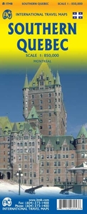
Southern Quebec ITMB

Southern part of the Quebec Province from North Bay in Ontario to the eastern tip of the De Gaspé Peninsula, on a double-sided, indexed map at 1:850, 000 from ITMB, with an enlargement for the Montreal – Laval area, plus a street plan of Montreal’s downtown district. Coverage, with a small overlap between the sides, extends north to James Bay in the north-west and Ile-Rene-Levasseur on the eastern half of the map. The map shows the region’s road and rail networks, indicating toll highways and showing driving distances on selected main routes. Symbols mark various facilities and places of interest, with provincial parks prominently highlighted. The map has latitude and longitude lines at 1º intervals and is indexed.Inset panels show main traffic arteries across Montreal –
Laval area, plus a detailed and informative street plan of Montral’s central districts highlighting selected hotels, important buildings, etc.
RIP - This product is no longer available on our network. It was last seen on 25.09.2019

This page now acts as a permanent archive for this product. Add more information using the comments box below to ensure it can still be found by future generations.

Use our search facility to see if it is available from an alternative contributor.
  • External links may include paid for promotion
  • Availability: Out Of Stock
  • Supplier: Stanfords
  • SKU: 9781771296953
Availability: In Stock
£9.99

Product Description

Southern part of the Quebec Province from North Bay in Ontario to the eastern tip of the De Gaspé Peninsula, on a double-sided, indexed map at 1:850, 000 from ITMB, with an enlargement for the Montreal – Laval area, plus a street plan of Montreal’s downtown district. Coverage, with a small overlap between the sides, extends north to James Bay in the north-west & Ile-Rene-Levasseur on the eastern half of the map. The map shows the region’s road & rail networks, indicating toll highways & showing driving distances on selected main routes. Symbols mark various facilities & places of interest, with provincial parks prominently highlighted. The map has latitude & longitude lines at 1º intervals & is indexed. Inset panels show main traffic arteries across Montreal – Laval area, plus a detailed & informative street plan of Montral’s central districts highlighting selected hotels, important buildings, etc.

Reviews/Comments

Add New

Intelligent Comparison

Oooops!
We couldn't find anything!
Perhaps this product's unique.... Or perhaps we are still looking for comparisons!
Click to bump this page and we'll hurry up.

Price History

Vouchers

No voucher codes found.
Do you know a voucher code for this product or supplier? Add it to Insights for others to use.

Facebook

Jargon Buster

Small - something that takes up less space than normal.
Road - a manmade lane or a path that is used to speed up travel.

Supplier Information

Stanfords
Stanfords was established in 1853 and opened their iconic Covent Garden flagship store in 1901. They have become the top retailer of maps, travel books and accessories in the UK and arguably offer the largest selection of maps and travel books worldwide. Famous names such as Captain Robert Falcon Scott, Ranulph Fiennes and Michael Palin have purchased from Stanfords. They now have a shop in Bristol and both stores together with other venues operate a calendar of events including talks, book signings and exhibitions. As a specialist map retailer, the map selection is comprehensive and includes road maps, street maps and walking maps from worldwide destinations, as well as a selection of world atlases and wall maps. Books include travel guides and travel literature. Stanfords also stock globes, from miniatures made of blue marble to magnificent floor-standing globes. The website features a selection of interesting articles on travel topics.
Page Updated: 2023-11-12 20:15:36

Community Generated Product Tags

Oh No! The productWIKI community hasn't generated any tags for this product yet!
Menu