More From Contributor

£3.50
South Shields in 1895 in a fascinating series of reproductions of old Ordnance Survey plans in the Alan Godfrey Editions, ideal for anyone interested in the history of their neighbourhood or family. SThe map covers the heart of South Shields, stretching from Ocean Road southward to Dean Lane, & from West Holborn eastward to Sea Road. Features include railway with High Shields & South Shields stations, Holy Trinity church, Laygate, St Jude`s church, St Hilda Colliery, St Hilda Colliery Wagonway, Mill Dam Valley, Holborn Graving Dock, St Hilda`s church, landing stage, South Shields Marsden & Whitburn Colliery Railway, other mineral railways, St Michael & All Angels church, part of Westoe along Dean Lane, King Street, Market Place, tramways, Westoe Brewery, Mariners Cottages, Bent House, Westoe Lane station, Glass Works, etc. A list of inns & beerhouses is on the reverse. About the Alan Godfrey Editions of the 25” OS Series: Selected towns in Great Britain & Ireland are covered by maps showing the extent of urban development in the last decades of the 19th & early 20th century. The plans have been taken from the Ordnance Survey mapping & reprinted at about 15 inches to one mile (1:4, 340). On the reverse most maps have historical notes & many also include extracts from contemporary directories. Most maps cover about one mile (1.6kms) north/south, one & a half miles (2.4kms) across; adjoining sheets can be combined to provide wider coverage.FOR MORE INFORMATION & A COMPLETE LIST OF ALL AVAILABLE TITLES PLEASE CLICK ON THE SERIES LINK. ...
Archived Product
£3.50
South Shoreditch & Bunhill Fields area of London in 1872 in a series of exceptionally detailed reproductions of old Ordnance Survey street plans for areas of larger cities which have undergone substantial redevelopment in the late 19th or the early 20th century, published in the Alan Godfrey Editions. The plans, printed in back & white, have been taken from the original Ordnance Survey mapping at 1:1, 056 & reproduced at 1:1, 760 – the equivalent of 36 inches (or one yard) to a mile. The maps provide an unrivalled, house-by-house picture of streets & individual buildings with inner courtyards, outbuildings, pavements, covered passages, etc. Many important institutions are named; within the National Galley on Trafalgar Square even the individual rooms (the map is from 1871, so no French Impressionists as yet!). On the reverse are historical notes about the area covered by the map, plus extracts from contemporary street directories. These maps provide a fascinating addition to Alan Godfrey’s huge series of some 2, 000 titles presenting reproductions of street plans at taken from the Ordnance Survey mapping at 1:2, 500 (25” to 1 mile) & reprinted at about 15 inches to one mile (1:4, 340). ...
Archived Product
£14.99
Waterproof & tear-resistant OS Active version of map No. 32 from the Ordnance Survey’s Landranger series at 1:50, 000, with contoured & GPS compatible topographic mapping plus tourist information.MOBILE DOWNLOADS: As well as the physical edition of the map, each Landranger title now

Includes::
a code for downloading after purchase its digital version onto your smartphone or tablet for viewing on the OS smartphone app.OS LANDRANGER SERIES: to see the list of all the titles in the OS Landranger series, both paper & waterproof versions, please click on the series link. Maps in the Landranger series provide plenty of recreational & tourist information, indicating the traditional public right of way paths (except in Scotland where different laws apply), including bridleways & byways restricted or open to motorized traffic. National Trails & selected other long-distance paths are marked, as well as on-road & traffic-free cycle routes with their National/ Regional Cycle Network numbers. National Trust/ National Trust for Scotland & Forestry Commission land is clearly marked, indicating open or restricted access. A range of symbols highlights camping & caravanning sites, youth hostels, tourist information offices & visitors’ centres, parking & picnicking places, World Heritage sites, sport & recreational facilities, etc. The maps provide detailed presentation of topography with contours at 10m intervals, numerous spot heights & additional colouring and/or graphics for different types of woodlands, orchards or parkl&, rock features including scree & cliffs, water features inland & along the sea shore with marshl&, dunes, s&, mud, shingle & the high water mark. All the standard information expected of survey mapping at this scale is included: finely graded road network, railway lines with stations, cuttings, embankments, etc; individual isolated buildings; archaeological & historical sites, etc. For GPS users the British National Grid is shown at 1km intervals, with latitude & longitude given by margin ticks at 1` & cross hairs on the map at 5`. Each map covers an area of 40 x 40km, (approx. 25 x 25 miles).

...
Archived Product
£8.99
Paper version of map No. 32 from the Ordnance Survey’s Landranger series at 1:50, 000, with contoured & GPS compatible topographic mapping plus tourist information.MOBILE DOWNLOADS: As well as the physical edition of the map, each Landranger title now

Includes::
a code for downloading after purchase its digital version onto your smartphone or tablet for viewing on the OS smartphone app.OS LANDRANGER SERIES: to see the list of all the titles in the OS Landranger series, both paper & waterproof versions, please click on the series link. Maps in the Landranger series provide plenty of recreational & tourist information, indicating the traditional public right of way paths (except in Scotland where different laws apply), including bridleways & byways restricted or open to motorized traffic. National Trails & selected other long-distance paths are marked, as well as on-road & traffic-free cycle routes with their National/ Regional Cycle Network numbers. National Trust/ National Trust for Scotland & Forestry Commission land is clearly marked, indicating open or restricted access. A range of symbols highlights camping & caravanning sites, youth hostels, tourist information offices & visitors’ centres, parking & picnicking places, World Heritage sites, sport & recreational facilities, etc. The maps provide detailed presentation of topography with contours at 10m intervals, numerous spot heights & additional colouring and/or graphics for different types of woodlands, orchards or parkl&, rock features including scree & cliffs, water features inland & along the sea shore with marshl&, dunes, s&, mud, shingle & the high water mark. All the standard information expected of survey mapping at this scale is included: finely graded road network, railway lines with stations, cuttings, embankments, etc; individual isolated buildings; archaeological & historical sites, etc. For GPS users the British National Grid is shown at 1km intervals, with latitude & longitude given by margin ticks at 1` & cross hairs on the map at 5`. Each map covers an area of 40 x 40km, (approx. 25 x 25 miles).

...
Archived Product
£5.59
Map No. 32, South Skye & Cuillin Hills, in the Ordnance Survey Landranger series at 1:50, 000, including Strathaird, Glen Brittle, Glen Varragill, Sgurr Mhairi, Camastianavaig, Bracadale, Portnalong, Carbost, Eynort, Drynich, Peinchorran, Dunan, Torrin, Elgol, Broadford, Heaste, Ord, Teangue, Tarskavaig, Kilbeg, Ardvasar & Aird of Sleat. Also included are the islands of Raasay with Clachan, Scalpay, Pabay, Soay & the northern tip of R ...
Archived Product
£39.95
South Southeast is a portfolio of Steve Mc Curry's best photography, showing classical, magical & powerful images from South & Southeast Asia. Mc Curry takes photographs all over the world, for National Geographic magazine & his own projects, but it is the people, places, colours & forms of South & Southeast Asia that Steve has found most inspiring. It is in Afghanistan, India, Sri Lanka, Cambodia & Mynamar (Burma) that Mc Curry has captured his most sublime photographs to create images that transcend their original editorial purpose to become timeless classics of our era. South Southeast features 69 photographs, each one with a full double-page spread to itself. Introducing the book is a succinct text about Mc Curry, & accompanying the photographs are brief captions. Eight of the photographs are accompanied by short texts written by Mc Curry himself, telling the fascinating stories behind the striking images. The National Press Photographers Association & the Missouri School of Journalism ' Pictures of the Year Competition' awarded this book First Place in the Best Use of Photography category. Steve Mc Curry is an internationally-acclaimed photojournalist whose daring & groundbreaking work in Afghanistan before the Soviet invasion secured his status as a living legend of photography. Since then his work has become famous for its vibrancy, depth & masterful rendition of vivid colour. ...
Archived Product
£15.50
Twenty-five blank greetings cards (with envelopes) illustrated with magical & powerful images from Steve Mc Curry's South Southeast. In his book South Southeast Steve Mc Curry presented a portfolio the cream of his work
- magical & powerful images from South & Southeast Asia. South Southeast Greetings Cards translates 25 of these images into greetings card format. Mirroring the classic design of the book, the cards have a small white border. They are contained in a beautiful & distinctive box which uses a magnetic strip to secure the lid. On the inside of the lid there is a short"ation from Steve Mc Curry, describing his love of colour & light. The greetings cards are blank inside so that you can choose your own message. Envelopes are included. This item will be published simultaneously with South Southeast Postcards.
...
Archived Product
£15.99
Fifty postcards illustrated with magical & powerful images from Steve Mc Curry's South Southeast. In his book South Southeast Steve Mc Curry presented a portfolio the cream of his work
- magical & powerful images from South & Southeast Asia. South Southeast Postcards translates 50 of these images into postcard format. Mirroring the classic design of the book, the cards have a small white border. They are contained in a beautiful & distinctive box which uses a magnetic strip to secure the lid. On the inside of the lid there is a short"ation from Steve Mc Curry, describing his love of colour & light. This item will be published simultaneously with South Southeast Greetings Cards.
...
Archived Product
£16.99
Topographic survey of Sweden at 1:50, 000, the Terrängkartan, from the Lantmäteriet, covering most of the country in 244 double-sided maps. Please note: the mountainous regions of central & northern Sweden are not covered by this series but presented in a separate “ Fjällkartan
- Mountain Map” series also listed on our website. Each 1:50, 000 topographic survey map covers an area of 37.5 x 40km. The maps have contours at 5 metre intervals, plus relief shading & graphics for rocky outcrops & boulders. Further graphics and/or colouring show different types of land use or vegetation (forests, arable l&, orchards, marshes, peat bogs, etc). An unusual feature of this survey is the colouring indicating buildings below or above two storeys high & “leisure/holiday homes”. The maps indicate privately maintained roads & include all other information expected of topographic survey at this scale. The maps have a 1-km UTM grid, plus latitude & longitude lines 5’ intervals. Map legend

Includes::
English. For coverage of the country’s most visited hiking areas in central & northern Sweden please see Lantmäteriet’s Mountain Map series, listed separately on our website.


...
Archived Product
£8.99
South Stuttgart on a topographic map at 1:200, 000 from the Bundesamt für Kartographie und Geodäsie, Germany’s federal mapping agency. The map covers an area of Approx. 100 x 90km. This map is belongs to a series of 58 topographic maps from Bundesamt für Kartographie und Geodäsie, the federal cartographic agency of Germany responsible for topographic mapping at 1:200, 000 & maps at smaller scales (the more detailed topographic & leisure maps are prepared & published by the survey organizations of the individual states). Cartography is from the 200K topographic survey & the maps have very elegant, modern look whilst retaining the traditional German presentation of names of smaller towns & villages in italics. Contours are at 12, 5m intervals, enhanced by relief shading, with colouring for woodlands, moors, marches, vineyards & hop plantations. Waterways & rivers are also described in detail, with currents, waterfalls, dams, & jetties clearly marked. Road network, graded into five types, highlights in colour national & regional roads; no driving distances are marked Railway network is also shown in detail, with stations, goods only lines, etc. The maps show administrative boundaries of states & counties, & have a UTM grid plus margin ticks for latitude & longitude at 2’ intervals. Map legend is in German only. PLEASE NOTE: maps in this series provide an excellent presentation of the areas covered by them, with plenty of place names & detailed representation of the road network, & will appeal to anyone who likes quality cartography, but they are not necessarily the best option for holiday & business travel. To see other titles in this series please click on the series link. ...
Archived Product

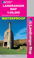
South Skye And Cuillin Hills OS ACTIVE MAP

Map No. 32, South Skye and Cuillin Hills, in waterproof and tear-resistant OS Active version of the Ordnance Survey Landranger series at 1:50, 000, including Strathaird, Glen Brittle, Glen Varragill, Sgurr Mhairi, Camastianavaig, Bracadale, Portnalong, Carbost, Eynort, Drynich, Peinchorran, Dunan, Torrin, Elgol, Broadford, Heaste, Ord, Teangue, Tarskavaig, Kilbeg, Ardvasar and Aird of Sleat. Also included are the islands of Raasay with Clachan, Scalpay, Pabay, Soay and the northern tip of R
RIP - This product is no longer available on our network. It was last seen on 25.09.2019

This page now acts as a permanent archive for this product. Add more information using the comments box below to ensure it can still be found by future generations.

Use our search facility to see if it is available from an alternative contributor.
  • Availability: Out Of Stock
  • Supplier: Stanfords
  • SKU: 9780319480083
Availability: In Stock
£10.39

Product Description

Map No. 32, South Skye & Cuillin Hills, in waterproof & tear-resistant OS Active version of the Ordnance Survey Landranger series at 1:50, 000, including Strathaird, Glen Brittle, Glen Varragill, Sgurr Mhairi, Camastianavaig, Bracadale, Portnalong, Carbost, Eynort, Drynich, Peinchorran, Dunan, Torrin, Elgol, Broadford, Heaste, Ord, Teangue, Tarskavaig, Kilbeg, Ardvasar & Aird of Sleat. Also included are the islands of Raasay with Clachan, Scalpay, Pabay, Soay & the northern tip of R

Reviews/Comments

Add New

Price History

Vouchers

No voucher codes found.
Do you know a voucher code for this product or supplier? Add it to Insights for others to use.

Facebook

Jargon Buster

Waterproof - Resistant to water, usualy specified by depth in metres
Resistant - Something that can repel against something.

Supplier Information

Stanfords
Stanfords was established in 1853 and opened their iconic Covent Garden flagship store in 1901. They have become the top retailer of maps, travel books and accessories in the UK and arguably offer the largest selection of maps and travel books worldwide. Famous names such as Captain Robert Falcon Scott, Ranulph Fiennes and Michael Palin have purchased from Stanfords. They now have a shop in Bristol and both stores together with other venues operate a calendar of events including talks, book signings and exhibitions. As a specialist map retailer, the map selection is comprehensive and includes road maps, street maps and walking maps from worldwide destinations, as well as a selection of world atlases and wall maps. Books include travel guides and travel literature. Stanfords also stock globes, from miniatures made of blue marble to magnificent floor-standing globes. The website features a selection of interesting articles on travel topics.
Page Updated: 2023-11-12 20:15:36

Community Generated Product Tags

Oh No! The productWIKI community hasn't generated any tags for this product yet!
Menu