
 United Kingdom
 France
 Germany
 Netherlands
 Sweden
 USA
USA
 Italy
Italy
 Spain
Spain
More From Contributor


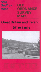
South Shields 1895
South Shields in 1895 in a fascinating series of reproductions of old Ordnance Survey plans in the Alan Godfrey Editions, ideal for anyone interested in the history of their neighbourhood or family. SThe map covers the heart of South Shields, stretching from Ocean Road southward to Dean Lane, and from West Holborn eastward to Sea Road. Features include railway with High Shields and South Shields stations, Holy Trinity church, Laygate, St Jude`s church, St Hilda Colliery, St Hilda Colliery Wagonway, Mill Dam Valley, Holborn Graving Dock, St Hilda`s church, landing stage, South Shields Marsden & Whitburn Colliery Railway, other mineral railways, St Michael & All Angels church, part of Westoe along Dean Lane, King Street, Market Place, tramways, Westoe Brewery, Mariners
Cottages, Bent House, Westoe Lane station, Glass Works, etc. A list of inns and beerhouses is on the reverse. About the Alan Godfrey Editions of the 25” OS Series:Selected towns in Great Britain and Ireland are covered by maps showing the extent of urban development in the last decades of the 19th and early 20th century. The plans have been taken from the Ordnance Survey mapping and reprinted at about 15 inches to one mile (1:4, 340). On the reverse most maps have historical notes and many also include extracts from contemporary directories. Most maps cover about one mile (1.6kms) north/south, one and a half miles (2.4kms) across; adjoining sheets can be combined to provide wider coverage.FOR MORE INFORMATION AND A COMPLETE LIST OF ALL AVAILABLE TITLES PLEASE CLICK ON THE SERIES
LINK.

Product Description
Reviews/Comments
Add New
Intelligent Comparison
Archived Product
Southfields 1913 Stanfords
£3.50
Archived Product
North Shields Stanfords
£2.50
Vouchers
No voucher codes found.
Do you know a voucher code for this product or supplier? Add it to Insights for others to use.
Do you know a voucher code for this product or supplier? Add it to Insights for others to use.
 Denmark