More From Contributor
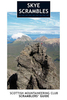
£2.99
Handy little full colour Collins map of Skye with a high level of detail. Clear mapping of the Isle of Skye showing the road network, ferries & places of interest. Map at a scale of 1:175 000 (3 miles to 1 inch). Clear, detailed, full colour Collins road mapping is presented in a handy format ideal for the pocket or handbag. It is excellent value & covers the whole of the Isle of Skye.
Includes:* Scotland route map* Caravan & camping sites* Tourist locations* Ferry links* Listing of major places to visit, with additional details for Dunvegan Castle, Old Man of Storr & Loch Coruisk* Detailed place names index
...
Archived Product
£25.00
This is the 2011 fully updated & enlarged, colour edition of the very popular SMC guide ” Skye Scrambles”, first published in 2000. The guide describes not only scrambles, but also walks & some easier rock climbs. It is the definitive guidebook to scrambling on Skye & as such it is also an essential guide for any hillwalkers wishing to venture into the mountains of The Cuillin. There are informative introductory sections on geology, wildlife & mountaineering history. The guide is profusely illustrated with new colour maps, crag diagrams & photographs. A significant number of new outings are described & many route descriptions have been updated. The guide uses a slightly larger format than the previous guide & is also colour throughout. The traverse of the main ridge of the Cuillin is fully described & new diagrams have been created to show the crucial sections. Skye has far & away the best scrambling in the UK. & this new edition of the guide gives the most comprehensive description so far available of the magnificent scrambles & easy climbs in the Cuillin & many other parts of the isl&. ...
Archived Product
£25.00
This Scottish Mountaineering Club climbers` guidebook details all the climbing to be found on the sea-cliffs & outcrops on the magical Isle of Skye. It is an up to date & fully comprehensive guide to what is an increasingly popular area, on an already popular isl&. It is a companion volume to the 2011 guide to the Cuillin mountains of Skye, from the SMC. It is written by one of the recognised experts in this area. It is full colour throughout with action pictures & detailed photo-diagrams. User friendly in a successful & well presented format, this title

Includes::
page marker ribbon to ease the location of climbs.

...
Archived Product
£13.95
The Skye Trail
- an unofficial 134 kms / 83 miles long-distance route along the island’s eastern coast, suitable only for experienced
...
Archived Product
£11.99
Skye in the Pathfinder Guides series, produced in association with Ordnance Survey & published by Crimson; comprising a range of walking guides to popular British destinations. Each Pathfinder guide

Includes::
28 varied walks ranging from easy strolls to exhilarating hikes & is accompanied by 1:25, 000 Ordnance Survey mapping with marked, colour-coded routes. Introductory sections profile the county or region covered, with recommendations on the best time to visit & a brief explanation of GPS. An

...
Archived Product
£6.39
A detailed topographic map of Skye
- Portree & Bracadale from the Ordnance Survey Explorer series. Edition A1: Publication date
...
Archived Product
£11.19
Laminated waterproof edition of a detailed topographic map of Skye
- Portree & Bracadale from the Ordnance Survey Explorer series.
...
Archived Product
£14.99
Skye: Cuillin Hills & Soay area on a detailed topographic & GPS compatible map No. 411, waterproof version, from the Ordnance Survey’s 1:25, 000 Explorer series.MOBILE DOWNLOADS: this title & all the other OS Explorer maps include a code for downloading after purchase the digital version onto your smartphone or tablet for viewing on the OS smartphone app.OS EXPLORER SERIES: to see the list of all the titles in the OS Explorer series, both paper & waterproof versions, please click on the series link. The Explorer series, Ordnance Survey’s most detailed maps recommended for anyone enjoying outdoor activities, provides topographic coverage of Great Britain at 1:25, 000 on GPS compatible maps with hiking trails, cycling routes & extensive tourist information. Each printed map is available either on paper or as a waterproof & tear-resistant OS Active Map, as indicated in its title. Britain’s National Parks & other areas of particular tourist interest are presented on often double-sided OL (Outdoor Leisure) maps, whilst most standard format Explorers cover an area of 30 x 20km (approx. 19 x 12 miles). All three versions (paper, waterproof & digital) are the same & provide plenty of recreational & tourist information, indicating the traditional public right of way paths (except in Scotland where different laws apply), including bridleways & byways. National Trails & other long-distance paths are marked, as well as permissive footpaths or bridleways & on-road or traffic-free cycle routes with, where appropriate, their National/ Regional Cycle Network numbers. Boundaries of access land are clearly marked. A wide range of symbols provides additional tourist information, highlighting camping & caravanning sites, information offices & visitors’ centres, parking & picnicking places, country pubs, sport & recreational facilities including cycle hire locations & mountain biking trails, historic buildings & museums, etc. Exceptionally clear presentation of the landscape is provided by contours at 5m or in the uplands at 10m intervals, with additional spot heights plus colouring and/or graphics for different types of woodlands, orchards, heath, marshl&, scree or boulders, & other topographic features. For GPS users the maps have British National Grid lines at 1km intervals, with latitude & longitude given by margin ticks at 1`. Clearly laid out map legend

Includes::
French & German translations for the tourist information symbols.

...
Archived Product
£8.99
Skye: Cuillin Hills & Soay area on a detailed topographic & GPS compatible map No. 411, paper version, from the Ordnance Survey’s 1:25, 000 Explorer series.MOBILE DOWNLOADS: this title & all the other OS Explorer maps include a code for downloading after purchase the digital version onto your smartphone or tablet for viewing on the OS smartphone app.OS EXPLORER SERIES: to see the list of all the titles in the OS Explorer series, both paper & waterproof versions, please click on the series link. The Explorer series, Ordnance Survey’s most detailed maps recommended for anyone enjoying outdoor activities, provides topographic coverage of Great Britain at 1:25, 000 on GPS compatible maps with hiking trails, cycling routes & extensive tourist information. Each printed map is available either on paper or as a waterproof & tear-resistant OS Active Map, as indicated in its title. Britain’s National Parks & other areas of particular tourist interest are presented on often double-sided OL (Outdoor Leisure) maps, whilst most standard format Explorers cover an area of 30 x 20km (approx. 19 x 12 miles). All three versions (paper, waterproof & digital) are the same & provide plenty of recreational & tourist information, indicating the traditional public right of way paths (except in Scotland where different laws apply), including bridleways & byways. National Trails & other long-distance paths are marked, as well as permissive footpaths or bridleways & on-road or traffic-free cycle routes with, where appropriate, their National/ Regional Cycle Network numbers. Boundaries of access land are clearly marked. A wide range of symbols provides additional tourist information, highlighting camping & caravanning sites, information offices & visitors’ centres, parking & picnicking places, country pubs, sport & recreational facilities including cycle hire locations & mountain biking trails, historic buildings & museums, etc. Exceptionally clear presentation of the landscape is provided by contours at 5m or in the uplands at 10m intervals, with additional spot heights plus colouring and/or graphics for different types of woodlands, orchards, heath, marshl&, scree or boulders, & other topographic features. For GPS users the maps have British National Grid lines at 1km intervals, with latitude & longitude given by margin ticks at 1`. Clearly laid out map legend

Includes::
French & German translations for the tourist information symbols.

...
Archived Product
£14.99
Skye: Dunvegan, Waternish & Macleod`s Tables area on a detailed topographic & GPS compatible map No. 407, waterproof version, from the Ordnance Survey’s 1:25, 000 Explorer series.MOBILE DOWNLOADS: this title & all the other OS Explorer maps include a code for downloading after purchase the digital version onto your smartphone or tablet for viewing on the OS smartphone app.OS EXPLORER SERIES: to see the list of all the titles in the OS Explorer series, both paper & waterproof versions, please click on the series link. The Explorer series, Ordnance Survey’s most detailed maps recommended for anyone enjoying outdoor activities, provides topographic coverage of Great Britain at 1:25, 000 on GPS compatible maps with hiking trails, cycling routes & extensive tourist information. Each printed map is available either on paper or as a waterproof & tear-resistant OS Active Map, as indicated in its title. Britain’s National Parks & other areas of particular tourist interest are presented on often double-sided OL (Outdoor Leisure) maps, whilst most standard format Explorers cover an area of 30 x 20km (approx. 19 x 12 miles). All three versions (paper, waterproof & digital) are the same & provide plenty of recreational & tourist information, indicating the traditional public right of way paths (except in Scotland where different laws apply), including bridleways & byways. National Trails & other long-distance paths are marked, as well as permissive footpaths or bridleways & on-road or traffic-free cycle routes with, where appropriate, their National/ Regional Cycle Network numbers. Boundaries of access land are clearly marked. A wide range of symbols provides additional tourist information, highlighting camping & caravanning sites, information offices & visitors’ centres, parking & picnicking places, country pubs, sport & recreational facilities including cycle hire locations & mountain biking trails, historic buildings & museums, etc. Exceptionally clear presentation of the landscape is provided by contours at 5m or in the uplands at 10m intervals, with additional spot heights plus colouring and/or graphics for different types of woodlands, orchards, heath, marshl&, scree or boulders, & other topographic features. For GPS users the maps have British National Grid lines at 1km intervals, with latitude & longitude given by margin ticks at 1`. Clearly laid out map legend

Includes::
French & German translations for the tourist information symbols.

...
Archived Product

Skye Walks

Are you planning a visit to the Isle of Skye? Do you enjoy a walk in the country or a leisurely afternoon stroll? Britain`s best loved walking guides brings you a brand new Pathfinder(R) Guide to the Isle of Skye containing 28 fabulous walks exploring the rugged and romantic beauty of this celebrated and most famous Scottish island. The walks range in length from 2.5 to 11 miles and in typical Pathfinder(R) Guide style offers something for all tastes and abilities. With Pathfinder(R) Guide to the Isle of Skye, you can follow in the footsteps of Bonnie Prince Charlie in Portree, the island`s main town and harbour, enjoy the history and parkland of Armadale Castle - one of the gentler walks for when the weather closes in - or wonder at spectacular Cuillin corries and waterfalls. One walk
in Pathfinder(R) Guide to the Isle of Skye also explores the beautiful island of Raasay between Skye and the Applecross Peninsula. All the walks have been fully researched and written by outdoor writer and Skye-expert Terry Marsh and are accompanied in the book by large-scale Ordnance Survey route maps, GPS waypoints and captivating photographs.From inspiring coastal scenery to highland peaks, and from romantic castles to crofters` cottages, Pathfinder(R) Guide to the Isle of Skye allows walkers to easily visit the northernmost and southernmost tips of the isle using the clear, large-scale Ordnance Survey route maps and GPS waypoints within.If you`re a walker who really wants to make the most of this most popular of the Western Isles - recently described by National Geographic magazine
as the 4th best island in the world - make sure you don`t set off on your walk without a copy Pathfinder(R) Guide to the Isle of Skye in your rucksack. Pathfinder(R) Guides are Britain`s best loved walking guides. Made with durable covers, they are the perfect companion for countryside walks throughout Britain. Each title features circular walks with easy-to-follow route descriptions, tried and tested by seasoned walkers and accompanied by beautiful photography and clear, large-scale Ordnance Survey mapping. Contents 1. Scorrybreac and The Bile 2. Brothers` Point 3. The Coral Beach 4. Oronsay 5. Ardmore Point 6. The Old Man of Storr 7. Bioda Buidhe 8. Waterstein 9. Rubha Hunish 10. An Aird and Dunan an Aislidh 11.Beinn an Sguirr and the Waternish 12. Ben Aslak 13. Coire Chat-achan 14.
Quiraing and Meall n Suiramach 15. Point of Sleat 16. Ben Tianavaig 17. Ramasaig, Lorgill and the Hoe 18. Bla Bheinn 19. The Storr 20. Rubh` and Dunain 21. Marsco 22. Glen Brittle Forest 23. Idrigill Point and MacLeod`s Maidens 24.Suisnish and Boreraig 25. Bruach na Frithe 26. Glen Sligachan 27. Srath Mor and Srath Beag 28. Camasunary - Elgol - Glasnakille
RIP - This product is no longer available on our network. It was last seen on 25.09.2019

This page now acts as a permanent archive for this product. Add more information using the comments box below to ensure it can still be found by future generations.

Use our search facility to see if it is available from an alternative contributor.
  • Availability: Out Of Stock
  • Supplier: Stanfords
  • SKU: 9780319090022
Availability: In Stock
£12.99

Product Description

Are you planning a visit to the Isle of Skye? Do you enjoy a walk in the country or a leisurely afternoon stroll? Britain`s best loved walking guides brings you a brand new Pathfinder (R) Guide to the Isle of Skye containing 28 fabulous walks exploring the rugged & romantic beauty of this celebrated & most famous Scottish isl&. The walks range in length from 2.5 to 11 miles & in typical Pathfinder (R) Guide style offers something for all tastes & abilities. With Pathfinder (R) Guide to the Isle of Skye, you can follow in the footsteps of Bonnie Prince Charlie in Portree, the island`s main town & harbour, enjoy the history & parkland of Armadale Castle
- one of the gentler walks for when the weather closes in
- or wonder at spectacular Cuillin corries & waterfalls. One walk in Pathfinder (R) Guide to the Isle of Skye also explores the beautiful island of Raasay between Skye & the Applecross Peninsula. All the walks have been fully researched & written by outdoor writer & Skye-expert Terry Marsh & are accompanied in the book by large-scale Ordnance Survey route maps, GPS waypoints & captivating photographs. From inspiring coastal scenery to highland peaks, & from romantic castles to crofters` cottages, Pathfinder (R) Guide to the Isle of Skye allows walkers to easily visit the northernmost & southernmost tips of the isle using the clear, large-scale Ordnance Survey route maps & GPS waypoints within. If you`re a walker who really wants to make the most of this most popular of the Western Isles
- recently described by National Geographic magazine as the 4th best island in the world
- make sure you don`t set off on your walk without a copy Pathfinder (R) Guide to the Isle of Skye in your rucksack. Pathfinder (R) Guides are Britain`s best loved walking guides. Made with durable covers, they are the perfect companion for countryside walks throughout Britain. Each title features circular walks with easy-to-follow route descriptions, tried & tested by seasoned walkers & accompanied by beautiful photography & clear, large-scale Ordnance Survey mapping. Contents 1. Scorrybreac & The Bile 2. Brothers` Point 3. The Coral Beach 4. Oronsay 5. Ardmore Point 6. The Old Man of Storr 7. Bioda Buidhe 8. Waterstein 9. Rubha Hunish 10. An Aird & Dunan an Aislidh 11. Beinn an Sguirr & the Waternish 12. Ben Aslak 13. Coire Chat-achan 14. Quiraing & Meall n Suiramach 15. Point of Sleat 16. Ben Tianavaig 17. Ramasaig, Lorgill & the Hoe 18. Bla Bheinn 19. The Storr 20. Rubh` & Dunain 21. Marsco 22. Glen Brittle Forest 23. Idrigill Point & Mac Leod`s Maidens 24. Suisnish & Boreraig 25. Bruach na Frithe 26. Glen Sligachan 27. Srath Mor & Srath Beag 28. Camasunary
- Elgol
- Glasnakille

Reviews/Comments

Add New

Intelligent Comparison

Oooops!
We couldn't find anything!
Perhaps this product's unique.... Or perhaps we are still looking for comparisons!
Click to bump this page and we'll hurry up.

Price History

Vouchers

No voucher codes found.
Do you know a voucher code for this product or supplier? Add it to Insights for others to use.

Facebook

Jargon Buster

GPS - Global Positioning System - Global position using satellites
Forest - A area with a high density of trees
Beach - An area on the coast consisting of a sandy or pebbled area
History - Anything that happens in the past. An acedemic subject.
World - A physical grouping, commonly used to describe earth and everything associated with ti
Set - a group of items usually related to one another. Some objects cannot function without the complete set of items.
Weather - is the change of an atmospheres conditions.
Large - something that takes up more space than normal.
Rucksack - A bag which is carried on the back.
Spectacular - Something that catches that eye due to its eye catchingness.
Popular - Something that is admired and liked by many people.

Supplier Information

Stanfords
Stanfords was established in 1853 and opened their iconic Covent Garden flagship store in 1901. They have become the top retailer of maps, travel books and accessories in the UK and arguably offer the largest selection of maps and travel books worldwide. Famous names such as Captain Robert Falcon Scott, Ranulph Fiennes and Michael Palin have purchased from Stanfords. They now have a shop in Bristol and both stores together with other venues operate a calendar of events including talks, book signings and exhibitions. As a specialist map retailer, the map selection is comprehensive and includes road maps, street maps and walking maps from worldwide destinations, as well as a selection of world atlases and wall maps. Books include travel guides and travel literature. Stanfords also stock globes, from miniatures made of blue marble to magnificent floor-standing globes. The website features a selection of interesting articles on travel topics.
Page Updated: 2023-11-12 20:15:36

Community Generated Product Tags

Oh No! The productWIKI community hasn't generated any tags for this product yet!
Menu