More From Contributor

£6.39
A detailed topographic map of Skye
- Trotternish & The Storr from the Ordnance Survey Explorer series, covering Uig. Edition A1;
...
Archived Product
£11.19
Laminated waterproof edition of a detailed topographic map of Skye
- Trotternish & The Storr from the Ordnance Survey Explorer
...
Archived Product
£8.99
One long walk divided into lots of short walks taking you all the way round Skye`s rugged coastline. Skye`s plethora of peninsulas & sea-lochs contain awesome cliffs, remote beaches, storm tossed sea-stacks, natural arches, ancient duns, romantic castles, poignant Clearance settlements, tidal islands & idyllic secluded corners. If you want to experience Skye in all its fascinating wealth of popular tourist haunts & hidden treasures, then let this book take you on a continuous 360-mile coastal walk around this mythical black isl&. You will soon find that there is a lot more to discover than the celebrated Cuillin ridge, mecca for walkers & climbers from all over the world. Andrew Dempster took one month to walk the whole coastline, he describes not just a geographical journey along the intricacies of Skye`s coastline but also a historical journey from prehistoric fortified duns to legendary castles, from the distressing remains of black-houses to the stark geometry of the Skye bridge. ...
Archived Product
£19.99
” The north west of Scotland is quite simply the best place to paddle a sea kayak in the world.”
- Gordon Brown. On the north west
...
Archived Product
£6.99
These remote islands, stretching out into the Atlantic Ocean like stepping stones in a vast lake, lie at the extremity of the British Isles & the very edge of our imagination. Hike through the Isle of Skye & feel your heart soar at the sight of surreal rock formations, wild emerald pastures, & implacable mountains rising from the sea. Footprint Focus will guide you from these wondrous sights to the Outer Hebrides where you`ll experience true remoteness
- fierce Atlantic winds, bleak peat bogs, & endless tiny lochs. These are the islands of emptiness, & there`s nowhere like them on earth.

Includes::
Essentials section with practical information on getting from island to isl&. Get off the beaten track & discover Skye`s charming but little-known ` Small Isles`. Accommodation listings aplenty, plus where to eat & drink. Detailed street maps will help you find your way around. Slim enough to fit in your pocket. Packed with practical & detailed advice on how to navigate these breathtaking landscapes, this concise Footprint Focus guide will help you get the most out of your trip without weighing you down. The content of Footprint Focus Skye & the Outer Hebrides guide has been extracted from Footprint`s Scotland Highlands & Islands Handbook.


...
Archived Product
£25.00
This is the 2011 fully updated & enlarged, colour edition of the very popular SMC guide ” Skye Scrambles”, first published in 2000. The guide describes not only scrambles, but also walks & some easier rock climbs. It is the definitive guidebook to scrambling on Skye & as such it is also an essential guide for any hillwalkers wishing to venture into the mountains of The Cuillin. There are informative introductory sections on geology, wildlife & mountaineering history. The guide is profusely illustrated with new colour maps, crag diagrams & photographs. A significant number of new outings are described & many route descriptions have been updated. The guide uses a slightly larger format than the previous guide & is also colour throughout. The traverse of the main ridge of the Cuillin is fully described & new diagrams have been created to show the crucial sections. Skye has far & away the best scrambling in the UK. & this new edition of the guide gives the most comprehensive description so far available of the magnificent scrambles & easy climbs in the Cuillin & many other parts of the isl&. ...
Archived Product
£25.00
This Scottish Mountaineering Club climbers` guidebook details all the climbing to be found on the sea-cliffs & outcrops on the magical Isle of Skye. It is an up to date & fully comprehensive guide to what is an increasingly popular area, on an already popular isl&. It is a companion volume to the 2011 guide to the Cuillin mountains of Skye, from the SMC. It is written by one of the recognised experts in this area. It is full colour throughout with action pictures & detailed photo-diagrams. User friendly in a successful & well presented format, this title

Includes::
page marker ribbon to ease the location of climbs.

...
Archived Product
£13.95
The Skye Trail
- an unofficial 134 kms / 83 miles long-distance route along the island’s eastern coast, suitable only for experienced
...
Archived Product
£11.99
Skye in the Pathfinder Guides series, produced in association with Ordnance Survey & published by Crimson; comprising a range of walking guides to popular British destinations. Each Pathfinder guide

Includes::
28 varied walks ranging from easy strolls to exhilarating hikes & is accompanied by 1:25, 000 Ordnance Survey mapping with marked, colour-coded routes. Introductory sections profile the county or region covered, with recommendations on the best time to visit & a brief explanation of GPS. An

...
Archived Product
£12.99
Are you planning a visit to the Isle of Skye? Do you enjoy a walk in the country or a leisurely afternoon stroll? Britain`s best loved walking guides brings you a brand new Pathfinder (R) Guide to the Isle of Skye containing 28 fabulous walks exploring the rugged & romantic beauty of this celebrated & most famous Scottish isl&. The walks range in length from 2.5 to 11 miles & in typical Pathfinder (R) Guide style offers something for all tastes & abilities. With Pathfinder (R) Guide to the Isle of Skye, you can follow in the footsteps of Bonnie Prince Charlie in Portree, the island`s main town & harbour, enjoy the history & parkland of Armadale Castle
- one of the gentler walks for when the weather closes in
- or wonder at spectacular Cuillin corries & waterfalls. One walk in Pathfinder (R) Guide to the Isle of Skye also explores the beautiful island of Raasay between Skye & the Applecross Peninsula. All the walks have been fully researched & written by outdoor writer & Skye-expert Terry Marsh & are accompanied in the book by large-scale Ordnance Survey route maps, GPS waypoints & captivating photographs. From inspiring coastal scenery to highland peaks, & from romantic castles to crofters` cottages, Pathfinder (R) Guide to the Isle of Skye allows walkers to easily visit the northernmost & southernmost tips of the isle using the clear, large-scale Ordnance Survey route maps & GPS waypoints within. If you`re a walker who really wants to make the most of this most popular of the Western Isles
- recently described by National Geographic magazine as the 4th best island in the world
- make sure you don`t set off on your walk without a copy Pathfinder (R) Guide to the Isle of Skye in your rucksack. Pathfinder (R) Guides are Britain`s best loved walking guides. Made with durable covers, they are the perfect companion for countryside walks throughout Britain. Each title features circular walks with easy-to-follow route descriptions, tried & tested by seasoned walkers & accompanied by beautiful photography & clear, large-scale Ordnance Survey mapping. Contents 1. Scorrybreac & The Bile 2. Brothers` Point 3. The Coral Beach 4. Oronsay 5. Ardmore Point 6. The Old Man of Storr 7. Bioda Buidhe 8. Waterstein 9. Rubha Hunish 10. An Aird & Dunan an Aislidh 11. Beinn an Sguirr & the Waternish 12. Ben Aslak 13. Coire Chat-achan 14. Quiraing & Meall n Suiramach 15. Point of Sleat 16. Ben Tianavaig 17. Ramasaig, Lorgill & the Hoe 18. Bla Bheinn 19. The Storr 20. Rubh` & Dunain 21. Marsco 22. Glen Brittle Forest 23. Idrigill Point & Mac Leod`s Maidens 24. Suisnish & Boreraig 25. Bruach na Frithe 26. Glen Sligachan 27. Srath Mor & Srath Beag 28. Camasunary
- Elgol
- Glasnakille


...
Archived Product

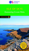
Skye Collins Pocket Map

Handy little full colour Collins map of Skye with a high level of detail. Clear mapping of the Isle of Skye showing the road network, ferries and places of interest. Map at a scale of 1:175 000 (3 miles to 1 inch). Clear, detailed, full colour Collins road mapping is presented in a handy format ideal for the pocket or handbag. It is excellent value and covers the whole of the Isle of Skye. INCLUDES* Scotland route map* Caravan and camping sites* Tourist locations* Ferry links* Listing of major places to visit, with additional details for Dunvegan Castle, Old Man of Storr and Loch Coruisk* Detailed place names index
RIP - This product is no longer available on our network. It was last seen on 25.09.2019

This page now acts as a permanent archive for this product. Add more information using the comments box below to ensure it can still be found by future generations.

Use our search facility to see if it is available from an alternative contributor.
  • Availability: Out Of Stock
  • Supplier: Stanfords
  • SKU: 9780008285647
Availability: In Stock
£2.99

Product Description

Handy little full colour Collins map of Skye with a high level of detail. Clear mapping of the Isle of Skye showing the road network, ferries & places of interest. Map at a scale of 1:175 000 (3 miles to 1 inch). Clear, detailed, full colour Collins road mapping is presented in a handy format ideal for the pocket or handbag. It is excellent value & covers the whole of the Isle of Skye.
Includes:* Scotland route map* Caravan & camping sites* Tourist locations* Ferry links* Listing of major places to visit, with additional details for Dunvegan Castle, Old Man of Storr & Loch Coruisk* Detailed place names index

Reviews/Comments

Add New

Intelligent Comparison

Oooops!
We couldn't find anything!
Perhaps this product's unique.... Or perhaps we are still looking for comparisons!
Click to bump this page and we'll hurry up.

Price History

Vouchers

No voucher codes found.
Do you know a voucher code for this product or supplier? Add it to Insights for others to use.

Facebook

Jargon Buster

Inch - Equivalent to approximately 2.5cm
Colour - The categorised spectrum of light visable to humans
Network - A link and communication between things. Often computers or people.
Road - a manmade lane or a path that is used to speed up travel.
Pocket - A bag shaped insert in clothing used to carry items
Ideal - Something that satisfies a perfect criteria.

Supplier Information

Stanfords
Stanfords was established in 1853 and opened their iconic Covent Garden flagship store in 1901. They have become the top retailer of maps, travel books and accessories in the UK and arguably offer the largest selection of maps and travel books worldwide. Famous names such as Captain Robert Falcon Scott, Ranulph Fiennes and Michael Palin have purchased from Stanfords. They now have a shop in Bristol and both stores together with other venues operate a calendar of events including talks, book signings and exhibitions. As a specialist map retailer, the map selection is comprehensive and includes road maps, street maps and walking maps from worldwide destinations, as well as a selection of world atlases and wall maps. Books include travel guides and travel literature. Stanfords also stock globes, from miniatures made of blue marble to magnificent floor-standing globes. The website features a selection of interesting articles on travel topics.
Page Updated: 2023-11-12 20:15:36

Community Generated Product Tags

Oh No! The productWIKI community hasn't generated any tags for this product yet!
Menu