
 United Kingdom
 France
 Germany
 Netherlands
 Sweden
 USA
USA
 Italy
Italy
 Spain
Spain
More From Contributor


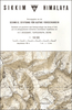


Sikkim
Sikkim at 1:150, 000 on an indexed map from Nepa, with more place names than shown on alternative publications, main trekking routes and places of interest, plus street plans of Gangtok, Darjeeling and Kalimpong. The map presents the country’s administrative districts in different colours. There is no relief shading or contours to present the topography, but the network of rivers and lakes is shown in some detail, main glaciers, numerous peaks and passes are marked, and protected areas are highlighted.Road network is shown with connecting trails and main trekking routes are highlighted. Symbols mark places of interest, including temples and other religious sites, caves and hot springs, camping sites, tourist accommodation, etc.More place names are shown than on alternative
maps of Sikkim, particularly in the southern, more populated part of the country. The map has latitude and longitude margin ticks at intervals of 15’. The index included lists of gompas and monasteries, lakes, passes, and peaks. The map includes basic street plans of Gangtok, Darjeeling and Kalimpong highlighting numerous places of interest and various tourist facilities, including accommodation. For Darjeeling there is also a map of a wider area from North Point to Ghoom. Also provided are brief descriptions of main places of interest in and around Gangkok.
maps of Sikkim, particularly in the southern, more populated part of the country. The map has latitude and longitude margin ticks at intervals of 15’. The index included lists of gompas and monasteries, lakes, passes, and peaks. The map includes basic street plans of Gangtok, Darjeeling and Kalimpong highlighting numerous places of interest and various tourist facilities, including accommodation. For Darjeeling there is also a map of a wider area from North Point to Ghoom. Also provided are brief descriptions of main places of interest in and around Gangkok.
Product Description
Reviews/Comments
Add New
Vouchers
No voucher codes found.
Do you know a voucher code for this product or supplier? Add it to Insights for others to use.
Do you know a voucher code for this product or supplier? Add it to Insights for others to use.
 Denmark