
 United Kingdom
 France
 Germany
 Netherlands
 Sweden
 USA
USA
 Italy
Italy
 Spain
Spain
More From Contributor


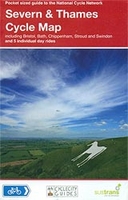
Severn & Upper Thames 110K Sustrnas Cycle Map No. 11
Severn and Thames Cycle Map at 1:110, 000 from Sustrans, including five day rides: Burford and Northleach, Marlborough, Lambourn and Shrivenham, Sherston and Castle Combe, and Bath and Priston. Street plans show Bristol, Bath, Chippenham and Swindon.Maps is this Sustrans series show all the National and Regional Cycle Network routes clearly numbered and have the colouring distinguishing between the on-road and traffic-free sections. The publishers’ own recommendations are shown in contrasting colour and, in most titles, are additionally presented on the reverse side on separate panels where each circuit is annotated with useful notes. The maps have contours and altitude colouring to show the topography, with additional gradient markings. Towns along the routes are annotated
with symbols indicating what facilities can be found there. Also marked are various places of interest, on or near the routes, and railway lines are shown with stations for access to the routes by rail. On the reverse each title also provides large, clear city centre street plans of main towns, highlighting the Cycle Network and/or the recommended routes. Also included are contact details of tourist information centres.To see the list of titles in this series please click on the series link.
with symbols indicating what facilities can be found there. Also marked are various places of interest, on or near the routes, and railway lines are shown with stations for access to the routes by rail. On the reverse each title also provides large, clear city centre street plans of main towns, highlighting the Cycle Network and/or the recommended routes. Also included are contact details of tourist information centres.To see the list of titles in this series please click on the series link.

Product Description
Reviews/Comments
Add New
Intelligent Comparison
Archived Product
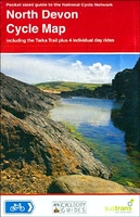
Devon North 110K Sustrans Cycle Map No. 3 Stanfords
£5.99
Archived Product
Essex & Thames Estuary 110K Sustrans Cycle Map No. 9 Stanfords
£5.99
Archived Product
Thames Valley 110K Sustrans Cycle Map No. 10 Stanfords
£5.99
Archived Product
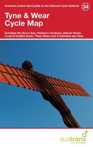
Tyne & Wear 110K Sustrans Cycle Map No. 34 Stanfords
£5.99
Archived Product
South East Wales 110K Sustrans Cycle Map No. 12 Stanfords
£5.99
Archived Product
South West Wales 110K Sustrans Cycle Map No. 13 Stanfords
£5.99
Archived Product
North Wales 110K Sustrans Cycle Map No. 24 Stanfords
£5.99
Vouchers
No voucher codes found.
Do you know a voucher code for this product or supplier? Add it to Insights for others to use.
Do you know a voucher code for this product or supplier? Add it to Insights for others to use.
 Denmark