More From Contributor

£8.99
Sevenoaks, Tonbridge, Royal Tunbridge Wells & Westerham area on a detailed topographic & GPS compatible map No. 147, paper version, from the Ordnance Survey’s 1:25, 000 Explorer series.MOBILE DOWNLOADS: this title & all the other OS Explorer maps include a code for downloading after purchase the digital version onto your smartphone or tablet for viewing on the OS smartphone app.OS EXPLORER SERIES: to see the list of all the titles in the OS Explorer series, both paper & waterproof versions, please click on the series link. The Explorer series, Ordnance Survey’s most detailed maps recommended for anyone enjoying outdoor activities, provides topographic coverage of Great Britain at 1:25, 000 on GPS compatible maps with hiking trails, cycling routes & extensive tourist information. Each printed map is available either on paper or as a waterproof & tear-resistant OS Active Map, as indicated in its title. Britain’s National Parks & other areas of particular tourist interest are presented on often double-sided OL (Outdoor Leisure) maps, whilst most standard format Explorers cover an area of 30 x 20km (approx. 19 x 12 miles). All three versions (paper, waterproof & digital) are the same & provide plenty of recreational & tourist information, indicating the traditional public right of way paths (except in Scotland where different laws apply), including bridleways & byways. National Trails & other long-distance paths are marked, as well as permissive footpaths or bridleways & on-road or traffic-free cycle routes with, where appropriate, their National/ Regional Cycle Network numbers. Boundaries of access land are clearly marked. A wide range of symbols provides additional tourist information, highlighting camping & caravanning sites, information offices & visitors’ centres, parking & picnicking places, country pubs, sport & recreational facilities including cycle hire locations & mountain biking trails, historic buildings & museums, etc. Exceptionally clear presentation of the landscape is provided by contours at 5m or in the uplands at 10m intervals, with additional spot heights plus colouring and/or graphics for different types of woodlands, orchards, heath, marshl&, scree or boulders, & other topographic features. For GPS users the maps have British National Grid lines at 1km intervals, with latitude & longitude given by margin ticks at 1`. Clearly laid out map legend

Includes::
French & German translations for the tourist information symbols.

...
Archived Product
£11.19
Laminated waterproof edition of a detailed topographic map of Sevenoaks & Tonbridge from the Ordnance Survey Explorer series, covering Royal Tunbridge Wells & Westerham (showing part of the North Downs Way). Edition B2 with minor changes; Publication date October 2007 About this series: These highly detailed maps show all the administrative boundaries, settlements as small as isolated farms, the road network down to unfenced roads & country tracks, & field boundaries (hedges & drystone walls) which make navigation across the countryside much easier. Steep gradients on roads are indicated. Various landmarks, e.g. powerlines, archaeological sites, windmills, churches & lighthouses are shown & additional graphics indicate natural terrain features such as cliffs, scree, mud & vegetation variations. The contour interval is 5 metres in the lower parts of the country & 10 metres in the uplands, & spot heights are marked. Each map covers an area of 30 x 20km (i.e. approx. 19 x 12 miles), with some double-sided maps covering more, as indicated in the individual descriptions. The maps are fully GPS compatible, with the National Grid shown at 1km intervals & latitude & longitude indicated by margin ticks at 1'. The Explorer series has replaced the earlier, green-cover Pathfinder maps. The Explorer series is now complete & covers all of Engl&, Wales & Scotl&. Some sheets for popular areas like the National Parks are still branded as Outdoor Leisure (OL) maps, but are now included in this series as the cartography is the same as that in the Explorer Maps. The Explorer maps offer a substantial improvement on the Pathfinder series, with greater use of colour, larger area per map, & stronger emphasis on information for ramblers & tourists. This series is ideal for walking & other outdoor pursuits & each map shows a large amount of information for ramblers & tourists. Public rights of way are shown (except in Scotland), together with other routes with public access: National Trails & Recreational Paths, permitted paths & bridleways, & selected cycle routes. Open access land created under the Countryside & Rights of Way Act 2000 is marked. Tourist information

Includes::
caravan & camp sites, Park & Ride locations, recreation/leisure/sport centres, museums, historic buildings, English Heritage & National Trust sites, rural pubs, etc. The map legend is in English only, except for the tourist information content which is also in French & German.

...
Archived Product
£3.50
Sevenoaks & Tonbridge in 1893 in a series of reproductions of Ordnance Survey’s famous ” Inch to the Mile” maps published in the Alan Godfrey Editions to provide a historical record of England & Wales in the second half of 19th & early 20th century. The map covers map covers the area from Limpsfield eastward to West Malling & from Wrotham southward to Speldhurst. Other locations include Addington, Bidborough, Birling, Brasted, Brenchley, Capel, Chevening, Chiddingstone, Chipstead, Cudham, East Peckham, Edenbridge, Hadlow, Hever, Hildenborough, Ightham, Kemsing, Knockholt, Leigh, Limpsfield, Mereworth, Offham, Otford, Paddock Wood, Ryarsh, Seal, Shipborne, Southborough, Sundridge, Tatsfield, The Weald, Titsey, Trotterscliffe, Tudeley, West Peckham & Westerham. On the reverse is a detailed map of the village of Wrotham About the Alan Godfrey Editions of the OS Inch to the Mile Maps: the maps provide an invaluable overview of a wider area, typically 18 x 12 miles (29 x 19 kms approx.), & offer historical mapping for small towns & villages not covered by the more detailed series for which the Godfrey Editions are better known. On the reverse all the maps have historical notes & most titles also include a more detailed, large scale map of a small town or a village in the area. To see other titles in this series please click on the series link. ...
Archived Product
£3.50
Sevenoaks North & Riverhead in 1907 in a fascinating series of reproductions of old Ordnance Survey plans in the Alan Godfrey Editions, ideal for anyone interested in the history of their neighbourhood or family. Sevenoaks is covered on two maps: the North sheet covers the area from Eardley Road northward to Bradbourne Vale. Features include railways with Sevenoaks station, Bradbourne Hall, Montreal, Montreal Park, Bessel`s Green, Chipstead Common, Riverhead, St Mary`s church, The Vine, Lyle Court, etc. The South map covers London Road & the High Street. Features here include St Nicholas church, grammar school, St Mary`s church, Bulimba, Bishop`s Court, Kippington Grange, The New Beacon, Great Britain`s Wood, Mildridge Wood, Middling`s Wood etc. Each map

Includes::
extracts from a 1905 Directory of Sevenoaks. About the Alan Godfrey Editions of the 25” OS Series Selected towns in Great Britain & Ireland are covered by maps showing the extent of urban development in the last decades of the 19th & early 20th century. The plans have been taken from the Ordnance Survey mapping & reprinted at about 15 inches to one mile (1:4, 340). On the reverse most maps have historical notes & many also include extracts from contemporary directories. Most maps cover about one mile (1.6kms) north/south, one & a half miles (2.4kms) across; adjoining sheets can be combined to provide wider coverage.FOR MORE INFORMATION & A COMPLETE LIST OF ALL AVAILABLE TITLES PLEASE CLICK ON THE SERIES LINK.

...
Archived Product
£3.50
Sevenoaks South in 1907 in a fascinating series of reproductions of old Ordnance Survey plans in the Alan Godfrey Editions, ideal for anyone interested in the history of their neighbourhood or family. Sevenoaks is covered on two maps: the North sheet covers the area from Eardley Road northward to Bradbourne Vale. Features include railways with Sevenoaks station, Bradbourne Hall, Montreal, Montreal Park, Bessel`s Green, Chipstead Common, Riverhead, St Mary`s church, The Vine, Lyle Court, etc. The South map covers London Road & the High Street. Features here include St Nicholas church, grammar school, St Mary`s church, Bulimba, Bishop`s Court, Kippington Grange, The New Beacon, Great Britain`s Wood, Mildridge Wood, Middling`s Wood etc. Each map

Includes::
extracts from a 1905 Directory of Sevenoaks. About the Alan Godfrey Editions of the 25” OS Series Selected towns in Great Britain & Ireland are covered by maps showing the extent of urban development in the last decades of the 19th & early 20th century. The plans have been taken from the Ordnance Survey mapping & reprinted at about 15 inches to one mile (1:4, 340). On the reverse most maps have historical notes & many also include extracts from contemporary directories. Most maps cover about one mile (1.6kms) north/south, one & a half miles (2.4kms) across; adjoining sheets can be combined to provide wider coverage.FOR MORE INFORMATION & A COMPLETE LIST OF ALL AVAILABLE TITLES PLEASE CLICK ON THE SERIES LINK.

...
Archived Product
£9.99
Our history is littered with heads. Over the centuries, they have decorated our churches, festooned our city walls & filled our museums; they have been props for artists & specimens for laboratory scientists, trophies for soldiers & items of barter. Today, as videos of decapitations circulate online & cryonicists promise that our heads may one day live on without our bodies, the severed head is as contentious & compelling as ever. From shrunken heads to trophies of war; from memento mori to Damien Hirst`s With Dead Head; from grave-robbing phrenologists to enterprising scientists, Larson explores the bizarre, often gruesome & confounding history of the severed head. Its story is our story. ...
Archived Product
£9.99
Severn & Avon in the Landmark Visitor Guides series, exploring a range of places in Britain, Europe & the Caribbean, with a particular expertise in UK destinations. Each guide presents the reader with detailed, wide-ranging & accessible overview of the region or area, with a particular focus on history & culture, notable local attractions, the landscape, local events & family activities. A series of recommended walks & guided car tours exploring the region are also included in each title. The guides are arranged geographically by region & are ideal both for short & longer breaks, with practical guidance on recommended routes & tourist attractions, in addition to insightful inset boxes into local history, culture & traditions. Information on accommodation, restaurants & day-to-day information are more limited, though a compact Directory at the end of each guide provides basic listings of recommended accommodation & restaurants, as well as tourist information contacts & regional event calendars. International destinations also carry climate & country facts, basic phrases & other general travel practical guidance for travelling to the region. The British titles in the Landmark Visitor Guides series are highly recommended, covering titles that are rarely available from other publishers. ...
Archived Product
£6.99
Severn & Thames Cycle Map at 1:110, 000 from Sustrans, including five day rides: Burford & Northleach, Marlborough, Lambourn & Shrivenham, Sherston & Castle Combe, & Bath & Priston. Street plans show Bristol, Bath, Chippenham & Swindon. Maps is this Sustrans series show all the National & Regional Cycle Network routes clearly numbered & have the colouring distinguishing between the on-road & traffic-free sections. The publishers’ own recommendations are shown in contrasting colour &, in most titles, are in addition presented on the reverse side on separate panels where each circuit is annotated with useful notes. The maps have contours & altitude colouring to show the topography, with additional gradient markings. Towns along the routes are annotated with symbols indicating what facilities can be found there. Also marked are various places of interest, on or near the routes, & railway lines are shown with stations for access to the routes by rail. On the reverse each title also provides large, clear city centre street plans of main towns, highlighting the Cycle Network and/or the recommended routes. Also included are contact details of tourist information centres. To see the list of titles in this series please click on the series link. ...
Archived Product
£9.95
Severn & Avon Pearson`s Canal Companion from Wayzgoose, showing parts of the Avon, the Severn, the Stratford Canal, the Gloucester & Sharpness Canal, the Worcester & Birmingham Canal, the Droitwich Canals, & the Cotswold Canals. Pearson’s Canal Companions have for over 30 year now been presenting Britain’s network of inland waterways on handy size, informative guides which combine practical information with interesting descriptions & facts about the surrounding countryside. The routes are shown in sections on maps at approx. 2” to 1 mile, & are annotated with locks, towpaths & nearby facilities. Rather than providing a more technical picture of each waterway (depth, clearance, etc), these guides are indeed true “companions” with the accompanying descriptions full of interesting historical or literary references, little know facts, etc. Where appropriate the maps are also accompanied by recommendations for eating & drinking, shopping, things to do, & public transport connections. Each guide also

Includes::
a boating directory with hire bases, boatyards, ferries, etc. Please note: Pearson’s Canal Companions sometimes indicate facilities and/or places of interest without showing detailed road access to them; it’s perhaps advisable to use these charming companions with proper road maps of the surrounding countryside.

...
Archived Product
£8.95
This is a travel & walking & boating guide to the Upper Thames & Cotswold Canals. Pearson's Canal Companions have achieved cult status with canal users of all kinds. These lively, colourful & committed books are generally regarded as the most detailed, informative & down-right entertaining guides to the inland waterways. Each of the nine titles in the series covers a popular route or area with large scale & highly detailed maps accompanied by a wide ranging commentary, descriptions of waterside towns & villages, & itemised listings on eating & drinking, shopping, visitor centres, public transport & boating facilities. Of particular use to walkers & cyclists is the classification of towpath conditions into three grades. Considerable coverage is given to items of industrial archaeological interest. The Severn & Avon Canal Companion covers Gloucester & Sharpness, Cotswold Canals & Upper Thames. ...
Archived Product

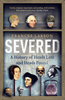
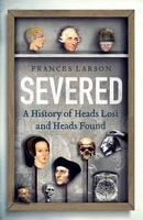
Severed: A History Of Heads Lost And Heads Found

The human head is exceptional. It accommodates four of our five senses, encases the brain and boasts the most expressive set of muscles in the body. It is our most distinctive attribute and it connects our inner selves to the outer world more evocatively than any other part of the body. Yet there is a dark side to the head`s pre-eminence. Over the centuries, human heads have decorated our churches, festooned our city walls and filled our museums. Long regarded as objects of fascination and repulsion, they have been props for artists and specimens for laboratory scientists, trophies for soldiers and items of barter. Today, as videos of decapitations circulate online and scientists promise the wealthy among us that our heads may one day live on without our bodies, the severed head is
as contentious and compelling as ever.From the western colonialists whose demand for shrunken heads spurred brutal massacres to the troops in the Second World War who sent the remains of Japanese soldiers home to their girlfriends; from the memento mori in Romantic portraits to Damien Hirst`s With Dead Head; from grave-robbing phrenologists to enterprising cryonicists, Larson explores the bizarre, often gruesome and confounding history of the severed head. Its story is our story.
RIP - This product is no longer available on our network. It was last seen on 25.09.2019

This page now acts as a permanent archive for this product. Add more information using the comments box below to ensure it can still be found by future generations.

Use our search facility to see if it is available from an alternative contributor.
  • Availability: Out Of Stock
  • Supplier: Stanfords
  • SKU: 9781783780556
Availability: In Stock
£20.00

Product Description

The human head is exceptional. It accommodates four of our five senses, encases the brain & boasts the most expressive set of muscles in the body. It is our most distinctive attribute & it connects our inner selves to the outer world more evocatively than any other part of the body. Yet there is a dark side to the head`s pre-eminence. Over the centuries, human heads have decorated our churches, festooned our city walls & filled our museums. Long regarded as objects of fascination & repulsion, they have been props for artists & specimens for laboratory scientists, trophies for soldiers & items of barter. Today, as videos of decapitations circulate online & scientists promise the wealthy among us that our heads may one day live on without our bodies, the severed head is as contentious & compelling as ever. From the western colonialists whose demand for shrunken heads spurred brutal massacres to the troops in the Second World War who sent the remains of Japanese soldiers home to their girlfriends; from the memento mori in Romantic portraits to Damien Hirst`s With Dead Head; from grave-robbing phrenologists to enterprising cryonicists, Larson explores the bizarre, often gruesome & confounding history of the severed head. Its story is our story.

Reviews/Comments

Add New

Intelligent Comparison

Oooops!
We couldn't find anything!
Perhaps this product's unique.... Or perhaps we are still looking for comparisons!
Click to bump this page and we'll hurry up.

Price History

Vouchers

No voucher codes found.
Do you know a voucher code for this product or supplier? Add it to Insights for others to use.

Facebook

Jargon Buster

Dark - A colour which absorbs visable ligt so apears less light than objects that reflect light
Human - A highly developed and adapted mamal and deminant species on earth
History - Anything that happens in the past. An acedemic subject.
World - A physical grouping, commonly used to describe earth and everything associated with ti
Day - The time it takes a planet or other space objects to complete one rotation.
Set - a group of items usually related to one another. Some objects cannot function without the complete set of items.
Exceptional - Something that is very good.
Home - A place of permanent residence for families.
Head - The upper part of a body typically separated by the neck.

Supplier Information

Stanfords
Stanfords was established in 1853 and opened their iconic Covent Garden flagship store in 1901. They have become the top retailer of maps, travel books and accessories in the UK and arguably offer the largest selection of maps and travel books worldwide. Famous names such as Captain Robert Falcon Scott, Ranulph Fiennes and Michael Palin have purchased from Stanfords. They now have a shop in Bristol and both stores together with other venues operate a calendar of events including talks, book signings and exhibitions. As a specialist map retailer, the map selection is comprehensive and includes road maps, street maps and walking maps from worldwide destinations, as well as a selection of world atlases and wall maps. Books include travel guides and travel literature. Stanfords also stock globes, from miniatures made of blue marble to magnificent floor-standing globes. The website features a selection of interesting articles on travel topics.
Page Updated: 2023-11-12 20:15:36

Community Generated Product Tags

Oh No! The productWIKI community hasn't generated any tags for this product yet!
Menu