More From Contributor

£8.99
Navigator Road Atlas of Scotland from Philip’s, in an A4 spiral-bound format, using mapping from the publishers’ Navigator series recommended by the Institute of Advanced Motorists. Most of the southern part of the country, up to Stirling & Dunfermline is covered at 1:100, 000 / 1” to 1.6 miles, with the rest, including all the islands & the southern part of Dumfries & Galloway, at 1:200, 000 / 1” to 3.2 mile. The atlas

Includes::
a special tourist section with descriptions of best places to visit: towns & villages, historic buildings, outdoor leisure areas & sport facilities, family attractions, museums & galleries, etc, not to forget whisky distilleries! Indexed city centre street plans show Aberdeen, Ayr, Dumfries, Dundee, Fort William, Edinburgh, Glasgow, Inverness, Oban, Perth, St Andrews, Stirling & Wick, indicating principal traffic arteries, one way streets, car parks, main sights, etc. Also provided is a map of ferry routes to the islands with contact details for ferry companies, plus a route planning map for Britain & Irel&. The main body of the atlas has a clear base map with colouring to indicate national parks or areas of outstanding natural beauty plus woodland & beaches. Spot heights & plenty of names of various geographical features such as peaks, glens, etc provide more landscape information. Road network

Includes::
minor roads & tracks & marks separately narrow A & B road. Locations of speed cameras are marked on primary routes & selected A roads, The maps show names of many isolated building, farms or local landmarks often not marked on maps at scales less detailed than the Ordnance Survey’s Landranger series at 1:50, 000. Railway lines are shown with stations. Symbols highlight various places of interest, sport & recreational facilities, etc. The maps have no geographical coordinates.


...
Archived Product
£5.99
Reproduction from Soho Publishing of a colourful Scotland Pictorial Plan, size 30 x 40cm (12” x 16” approx), “a Curious yet authentic ...
Archived Product
£4.99
Scotland in the Pocket Guide series from Berlitz; a collection of handy, pocket-sized guides dedicated to an extensive range of cities, regions & countries worldwide. Written in narrative form, individual guides explore the history, main sights & attractions, food & drink, accommodation & local culture of the destination in detail. Each Berlitz pocket guide has a similar format, with colour-coded sections helping readers locate information quickly in addition to distinctive chapters exploring the city or region. An introduction outlines the destination for visitors & a section dedicated to 'A Brief History' actually explores the area in relative depth. A where to go chapter is organized by region & city & is written in prose form with references to individual sites highlighted in bold for clarity. There are also further suggestions on where & when to eat. Recommendations for leisure activities in the region, including sport, nightlife & shopping, are also provided & tailored accordingly for each destination. Handy travel tips are listed alphabetically in a dedicated section, providing practical guidance & helping visitors make the most of their stay. The main hotels, particularly for cities, are also listed in an accommodation section, offering a brief overview with approximate price bandings & relevant contact details. ...
Archived Product
£5.99
Scotland in the Pocket Guide series from Berlitz; a collection of handy, pocket-sized guides dedicated to an extensive range of cities, regions & countries worldwide. Written in narrative form, individual guides explore the history, main sights & attractions, food & drink, accommodation & local culture of the destination in detail. Each Berlitz pocket guide has a similar format, with colour-coded sections helping readers locate information quickly in addition to distinctive chapters exploring the city or region. An introduction outlines the destination for visitors & a section dedicated to `A Brief History` actually explores the area in relative depth. A where to go chapter is organized by region & city & is written in prose form with references to individual sites highlighted in bold for clarity. There are also further suggestions on where & when to eat. Recommendations for leisure activities in the region, including sport, nightlife & shopping, are also provided & tailored accordingly for each destination. Handy travel tips are listed alphabetically in a dedicated section, providing practical guidance & helping visitors make the most of their stay. The main hotels, particularly for cities, are also listed in an accommodation section, offering a brief overview with approximate price bandings & relevant contact details. ...
Archived Product
£1.99
Handy little full colour map of Scotland at a scale of 8.7 miles to 1 inch. Excellent value at GBP1.99 & very detailed for ...
Archived Product
£7.99
You can count on Rick Steves to tell you what you really need to know when travelling in Scotl&. In this compact guide, Rick Steves covers the best of Scotl&, including Edinburgh, Glasgow, Inverness, & the Northern Highlands. Tour the Edinburgh Castle, walk the Royal Mile, visit the Glasgow Cathedral, or look for Nessie in Loch Ness--you`ll get tips on the best tours, museums, festivals, & more. Rick offers firsthand advice on the best sights, eating, sleeping, & nightlife, & the maps & self-guided tours will ensure you make the most of your experience. More than just reviews & directions, a Rick Steves Snapshot guide is a tour guide in your pocket. Rick Steves` Snapshot guides consist of excerpted chapters from Rick Steves` European country guidebooks. Snapshot guides are a great choice for travellers visiting a specific city or region, rather than multiple European destinations. These slim guides offer all of Rick`s up-to-date advice on what sights are worth your time & money. They include good-value hotel & restaurant recommendations, with no introductory information (such as overall trip planning, when to go, & travel practicalities). ...
Archived Product
£7.99
Scotland in Rick Steves' Snapshot Guides, which consist of the best chapters of Rick Steves' European country guidebooks. Published in the UK by Avalon, comprise a range of titles focussing on destinations in Great Britain & Europe. As one of the leading American guide book publishers to European destinations, Rick Steves ...
Archived Product
£9.99
Scotland in the AA Spiral Guides series; comprising a selection of titles exploring a wide range of cities, regions & countries in a handy, spiral loose-leaf format. Fold-out flaps at the front & back of each title give an overview of the main regions covered, with page numbers so visitors can locate their destination easily. Each guide explores the destination geographically by region or area & provides the essential information for the main sites & attractions in addition to a recommended tour of each area by car. An introductory section - ...
Archived Product
£25.00
We are able to source a wide range of courtesy flags. Flags are available in many sizes & can be sewn or printed on 100% Ministry Of Defence Standard Woven & Knitted Polyester. Flags are supplied with rope & toggle. If you would like more information, have a custom size request or cannot find a desired product, please email us at maritime@stanfords.co.uk. We will be glad to help! ...
Archived Product
£11.99
Lonely Planet Scotland
Scare yourself silly ghost-hunting in Edinburgh's spooky underworld
Laugh at the antics of the puffins

...
Archived Product

Scotland Reise Know-How

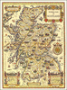
Scotland at 1:400, 000 on an indexed, waterproof and tear-resistant road map published by Reise Know-How as part of their highly acclaimed World Mapping Project. The map is double-sided to provide the best balance between a good scale and a convenient size sheet.Scotland is divided north/south with a good overlap between the sides. Coverage extends south beyond Newcastle and Carlisle. On the northern side of the map the Orkney group is presented with the mainland but without its northernmost islands. A separate inset shows the Shetland Islands. Light altitude colouring provides a good presentation of the country topography, with names of mountain ranges, glens, peaks, etc. National parks are highlighted. Road network indicates narrow main and secondary roads with passing places. No
driving distances or primary route destinations are marked and road colouring differs from what has now become the standard way of presenting Britain’s road network. Railway lines and ferry routes to the islands are included. Symbols highlight various places of interest, including campsites and golf courses. The map is indexed and has latitude and longitude lines at intervals of 30’. Map legend includes English.
RIP - This product is no longer available on our network. It was last seen on 25.09.2019

This page now acts as a permanent archive for this product. Add more information using the comments box below to ensure it can still be found by future generations.

Use our search facility to see if it is available from an alternative contributor.
  • Availability: Out Of Stock
  • Supplier: Stanfords
  • SKU: 9783831773220
Availability: In Stock
£11.50

Product Description

Scotland at 1:400, 000 on an indexed, waterproof & tear-resistant road map published by Reise Know-How as part of their highly acclaimed World Mapping Project. The map is double-sided to provide the best balance between a good scale & a convenient size sheet. Scotland is divided north/south with a good overlap between the sides. Coverage extends south beyond Newcastle & Carlisle. On the northern side of the map the Orkney group is presented with the mainland but without its northernmost islands. A separate inset shows the Shetland Islands. Light altitude colouring provides a good presentation of the country topography, with names of mountain ranges, glens, peaks, etc. National parks are highlighted. Road network indicates narrow main & secondary roads with passing places. No driving distances or primary route destinations are marked & road colouring differs from what has now become the standard way of presenting Britain’s road network. Railway lines & ferry routes to the islands are included. Symbols highlight various places of interest, including campsites & golf courses. The map is indexed & has latitude & longitude lines at intervals of 30’. Map legend

Includes::
English.

Reviews/Comments

Add New

Intelligent Comparison

Oooops!
We couldn't find anything!
Perhaps this product's unique.... Or perhaps we are still looking for comparisons!
Click to bump this page and we'll hurry up.

Price History

Vouchers

No voucher codes found.
Do you know a voucher code for this product or supplier? Add it to Insights for others to use.

Facebook

Jargon Buster

Waterproof - Resistant to water, usualy specified by depth in metres
World - A physical grouping, commonly used to describe earth and everything associated with ti
Size - is the measurement of how big an object is in space.
Network - A link and communication between things. Often computers or people.
Road - a manmade lane or a path that is used to speed up travel.
Resistant - Something that can repel against something.
Altitude - Something that can be quite high in relation to sea or ground level.
Golf - A sport played on a large outside grass course, the aim to hit a small ball with a club into small holes.
Balance - Something that is evenly weighted to keep something upright.
Primary - the beginning of something, of chief importance.
Convenient - Something that suits and fits well to other activities.

Supplier Information

Stanfords
Stanfords was established in 1853 and opened their iconic Covent Garden flagship store in 1901. They have become the top retailer of maps, travel books and accessories in the UK and arguably offer the largest selection of maps and travel books worldwide. Famous names such as Captain Robert Falcon Scott, Ranulph Fiennes and Michael Palin have purchased from Stanfords. They now have a shop in Bristol and both stores together with other venues operate a calendar of events including talks, book signings and exhibitions. As a specialist map retailer, the map selection is comprehensive and includes road maps, street maps and walking maps from worldwide destinations, as well as a selection of world atlases and wall maps. Books include travel guides and travel literature. Stanfords also stock globes, from miniatures made of blue marble to magnificent floor-standing globes. The website features a selection of interesting articles on travel topics.
Page Updated: 2023-11-12 20:15:36

Community Generated Product Tags

Oh No! The productWIKI community hasn't generated any tags for this product yet!
Menu