
 United Kingdom
 France
 Germany
 Netherlands
 Sweden
 USA
USA
 Italy
Italy
 Spain
Spain
More From Contributor


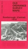
Scarborough
Map No. 101, Scarborough, in the Ordnance Survey Landranger series at 1:50, 000, including Bridlington, Carnaby, Burton Agnes, Lowthorpe, Kilham, Langtoft, Fumber, Sledmere, Wharran le Street, West Lutton, Thwing, Flamborough, Burton Flaming, Weaverthorpe, Wintringham, Wold Newton, Reighton, Hunmanby, Filey, Staxton, Sherburn, West Knapton, Brompton-by Sawdon, Allerston, Eastfield, East Ayton, Sawdon, Scalby, Hackness, Cloughton and Harwood Dale, with Flamborough Head, The Wolds and part of the North Yorkshire Moors National Park including the Fylingdales Moor. The map also shows Wolds Way and Cleveland Way, part of the E2 European Long Distance Path. Edition D2; Revised for selected changes 2005; Copyright date 2006 This title is also available on our
website in a waterproof and tear-resistant version.Maps in this series are only published folded. Stanfords can also print flat versions of Ordnance Survey maps through the OS Select system, centring the map on a location of your choice and with a picture provided by you on the cover. For more information please click on the link at the bottom of this description.About Ordnance Survey
website in a waterproof and tear-resistant version.Maps in this series are only published folded. Stanfords can also print flat versions of Ordnance Survey maps through the OS Select system, centring the map on a location of your choice and with a picture provided by you on the cover. For more information please click on the link at the bottom of this description.About Ordnance Survey
Product Description
Reviews/Comments
Add New
Vouchers
No voucher codes found.
Do you know a voucher code for this product or supplier? Add it to Insights for others to use.
Do you know a voucher code for this product or supplier? Add it to Insights for others to use.
 Denmark