
 United Kingdom
 France
 Germany
 Netherlands
 Sweden
 USA
USA
 Italy
Italy
 Spain
Spain
More From Contributor


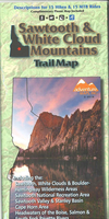
Sawtooth & White Cloud Mountains Trail Map
The Sawtooth & White Cloud Mountains Adventure Map is a waterproof, topographic trail map that includes route descriptions covering trails throughout the Sawtooth & White Cloud Mountains including the Sawtooth Wilderness, Sawtooth National Recreation Area, Sawtooth Valley, Stanley Basin, Cape Horn Area, Headwaters of the Boise, Salmon, and the South Fork Payette Rivers.It includes details for 15 mountain bike rides, 15 hikes, and 5 X/C ski trails. Fishermen, Hunter, Equestrians, and OHV riders will also find this map very useful as it accurately shows all streams, lakes, roads, and land ownership boundaries.

Product Description
Reviews/Comments
Add New
Vouchers
No voucher codes found.
Do you know a voucher code for this product or supplier? Add it to Insights for others to use.
Do you know a voucher code for this product or supplier? Add it to Insights for others to use.
 Denmark