
 United Kingdom
 France
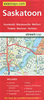
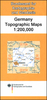
 Germany
 Netherlands
 Sweden
 USA
USA
 Italy
Italy
 Spain
Spain
More From Contributor


Sasso Simone And Simoncello Natural Park
Sasso Simone and Simoncello Natural Park on a contoured, GPS compatible map at 1:25, 000 from Selca highlighting local hiking, cycling or horse riding routes, various tourist facilities, etc. Also provided are route profiles for recommended trails.The map has contours at 25m intervals, enhanced by relief shading. An overprint highlights waymarked hiking trails, as well as recommended cycling, mountain biking and horse riding routes. Icons indicate locations of various facilities, including hotels, agriturismo accommodation, campsites, sport and recreational facilities, places of interest, etc. The map has a 1-km UTM grid.On the reverse are route profiles for 19 recommended itineraries, plus extensive notes about the area illustrated with photos and drawing of fauna and
flora.Map legend and all the text are in Italian only.
flora.Map legend and all the text are in Italian only.
Product Description
Reviews/Comments
Add New
Vouchers
No voucher codes found.
Do you know a voucher code for this product or supplier? Add it to Insights for others to use.
Do you know a voucher code for this product or supplier? Add it to Insights for others to use.
 Denmark