
 United Kingdom
 France
 Germany
 Netherlands
 Sweden
 USA
USA
 Italy
Italy
 Spain
Spain
More From Contributor


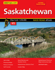


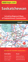
Saskatchewan MapArt
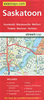
Saskatchewan on an indexed road map at 1:1, 250, 000 with on the reverse street maps of the province’s 10 main towns, including detailed plans of downtown Regina, Saskatoon and Prince Albert, plus a distance table.On one side is a road map of Saskatchewan at 1:1, 250, 000. Road network indicates paved, gravel and seasonal roads, with distance marked on main and selected local routes. Railway lines are included and locations with scheduled air services are marked. Symbols indicate campsites, tourist information offices, etc. National and provincial parks are highlighted; numerous small rives and lakes are named. The map has no geographical coordinates. The index is next to the map.On the reverse are street maps covering at 1:50, 000 Saskatoon, Regina, Prince Albert, Estevan,
Lloydminster, Moose Jaw, North Battleford - Battleford, Swift Current, and Yorkton. Saskatoon, Regina and Prince Albert also have detailed street plans of their downtown areas at 1:25, 000.To see the list of currently available Canadian province and regional maps form the MapArt / Canadian Cartographics Corporation / JDM Géo publishing group, including waterproof and tear-resistant FastTrack titles, please click on the series link.
Lloydminster, Moose Jaw, North Battleford - Battleford, Swift Current, and Yorkton. Saskatoon, Regina and Prince Albert also have detailed street plans of their downtown areas at 1:25, 000.To see the list of currently available Canadian province and regional maps form the MapArt / Canadian Cartographics Corporation / JDM Géo publishing group, including waterproof and tear-resistant FastTrack titles, please click on the series link.

Product Description
Reviews/Comments
Add New
Vouchers
No voucher codes found.
Do you know a voucher code for this product or supplier? Add it to Insights for others to use.
Do you know a voucher code for this product or supplier? Add it to Insights for others to use.
 Denmark