
 United Kingdom
 France
 Germany
 Netherlands
 Sweden
 USA
USA
 Italy
Italy
 Spain
Spain
More From Contributor


Santiago De Chile
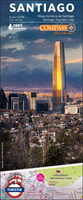
Santiago’s central districts at 1:8, 000 on a large street plan from the Chilean publishers Compass Editorial, highlighting a wide range of facilities and places of interest, with extensive tourist information on the reverse, and printed on light, waterproof and tear-resistant synthetic paper.The plan prominently highlights the route of the city’s hop-on / hop-off sightsee bus and clearly shows locations of metro stations, with an additional diagram presenting the whole network. For drivers, main traffic arteries are indicated. The map also shows cycle routes. Various interesting barrios are highlighted and a wide range of symbols mark various places of interest including cultural institutions, restaurants, cafes, beer cellars, night clubs, shopping venues, etc. The reverse
side has extensive tourist information including descriptions of the various barrios, recommendations for sightseeing and eating out, notes on transport, addresses of main embassies, etc. Map legend is in Spanish but the pictures are self-explanatory. The text on the reverse is in Spanish and English.
side has extensive tourist information including descriptions of the various barrios, recommendations for sightseeing and eating out, notes on transport, addresses of main embassies, etc. Map legend is in Spanish but the pictures are self-explanatory. The text on the reverse is in Spanish and English.

Product Description
Reviews/Comments
Add New
Vouchers
No voucher codes found.
Do you know a voucher code for this product or supplier? Add it to Insights for others to use.
Do you know a voucher code for this product or supplier? Add it to Insights for others to use.
 Denmark