
 United Kingdom
 France
 Germany
 Netherlands
 Sweden
 USA
USA
 Italy
Italy
 Spain
Spain
More From Contributor


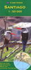


Santiago & Central Chile ITMB
Double-sided map from ITMB conveniently combining on one side a clear, indexed street plan of Santiago at 1:12, 500 with on the reverse a road map of central Chile at 1:720, 000, centred on Santiago and showing the region’s topography by altitude colouring.On one side the central districts of Santiago are presented at 1:12, 500 on an indexed, very clear street plan. Coverage extends beyond Rio Mapocho to include the cable-car link to Estación Pedro de Valdivia, and southwards to the motorway exit onto the Autopista del Sol. Stations of the metro lines are prominently marked, and the map also shows stops of the city’s bus network. For drivers, principal traffic arteries are highlighted and one way streets are marked. Symbols indicate various facilities and places of interest,
including selected hotels, shopping centres, embassies, cultural institutions, etc. The plan is accompanied by a diagram of the capital’s metro network and a small road map of the environs including access to the international airport and Valparaiso.On the reverse is an indexed road map of central Chile at 1:720, 000 with coverage extending north of Santiago to Combarbalá and south of the capital beyond Chillán to Los Angeles. Topography is presented by altitude colouring. The map shows the region’s network of main and secondary roads, annotated with driving distances, plus selected local roads. Railway lines are included and local airports are marked. Symbols indicate locations with various tourist facilities, as well as a selection of the country’s numerous protected
areas. Latitude and longitude lines are drawn at 1º intervals. Also provided here is a map showing the south-western part of the Easter Islands around Hanga Roa at 1:38, 000.

Product Description
Reviews/Comments
Add New
Vouchers
No voucher codes found.
Do you know a voucher code for this product or supplier? Add it to Insights for others to use.
Do you know a voucher code for this product or supplier? Add it to Insights for others to use.
 Denmark