
 United Kingdom
 France
 Germany
 Netherlands
 Sweden
 USA
USA
 Italy
Italy
 Spain
Spain
More From Contributor

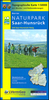


Saar-Hunsruck NP West
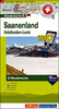
One of the titles in a series of topographic tourist maps covering selected areas in the Rhineland-Palatinate. All the maps have cartography identical to the standard topographic survey of Germany, with extensive overprint highlighting local footpaths, long-distance paths, and cycle routes, indicating their waymarking. A wide range of symbols show various types of accommodation (campsites, youth hostels, etc), sport and recreational facilities, and places of interest. All maps, unless indicated to the contrary in the individual description, have a UTM grid. Map legend is in German only. Several titles also include descriptions, in German only, of the area covered by the map and its main places of interest, contact details, and coloured photos.This title is also available as
part of a set covering the whole of the Regional Park.
part of a set covering the whole of the Regional Park.
Product Description
Reviews/Comments
Add New
Vouchers
No voucher codes found.
Do you know a voucher code for this product or supplier? Add it to Insights for others to use.
Do you know a voucher code for this product or supplier? Add it to Insights for others to use.
 Denmark