
 United Kingdom
 France
 Germany
 Netherlands
 Sweden
 USA
USA
 Italy
Italy
 Spain
Spain
More From Contributor


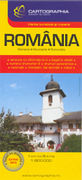
Romania
Romania on a single-sided, indexed road map at 1:800, 000 from Insight. This large map includes many places of interest, a street plan of Bucharest, and a small overview of the country with neighbouring countries.The network of main roads is displayed, with distinctions between motorways (with junctions), toll motorways, dual carriageways, main and secondary roads. Markers indicate distances between selected points and symbols highlight filling stations, restaurants and motels en route. Airports, the rail network, and major ports and ferry terminals on the Black Sea are marked. Ferry routes and shipping lanes are marked for major destinations. Major towns and cities are displayed, as are many smaller towns.Mountain ranges are named and highlighted with relief shading, and spot
heights are shown for the main peaks. Main lakes and rivers are shown.Many places of interest are annotated on the map, such as: museums and castles; churches and cathedrals; trekking areas, national parks and nature reserves.The map also includes Hungary to Budapest, most of Serbia, northern Bulgaria and Moldova. See the adjoining image for full coverage.Also includes: A street plan of Bucharest at 1:17, 500 (approximate), with detail of main streets, public transport, districts and many places of interest. A small inset road map, showing the whole country in the context of its neighbouring countries and the wider region.An index on the map lists placenames, streets (for the city plan) and main places of interest.
heights are shown for the main peaks. Main lakes and rivers are shown.Many places of interest are annotated on the map, such as: museums and castles; churches and cathedrals; trekking areas, national parks and nature reserves.The map also includes Hungary to Budapest, most of Serbia, northern Bulgaria and Moldova. See the adjoining image for full coverage.Also includes: A street plan of Bucharest at 1:17, 500 (approximate), with detail of main streets, public transport, districts and many places of interest. A small inset road map, showing the whole country in the context of its neighbouring countries and the wider region.An index on the map lists placenames, streets (for the city plan) and main places of interest.
Product Description
Reviews/Comments
Add New
Intelligent Comparison
Archived Product

Romania Stanfords
£5.99
Archived Product
Romania Stanfords
£11.19
Archived Product
Romania Stanfords
£11.19
Archived Product
Romania Stanfords
£9.99
Archived Product

Romania Stanfords
£19.99
Archived Product
Romania Stanfords
£7.50
Archived Product
Romanian. Stanfords
£22.99
Archived Product

Rosmaninhal Stanfords
£17.99
Vouchers
No voucher codes found.
Do you know a voucher code for this product or supplier? Add it to Insights for others to use.
Do you know a voucher code for this product or supplier? Add it to Insights for others to use.
 Denmark