
 United Kingdom
 France
 Germany
 Netherlands
 Sweden
 USA
USA
 Italy
Italy
 Spain
Spain
More From Contributor


Rhodes F&B
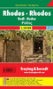
Rhodes on a large indexed map from Freytag & Berndt, including a booklet with multilingual descriptions of the island’s main sights. Although the scale is 1:50, 000 and the map is contoured, it is better suited for exploring the island by car rather than for hiking.Coverage includes Symi and Halki with Alimia, shown on separate insets. Contours enhanced by bold relief shading and colouring indicating woodlands show the topography. Road network includes local tracks and gives distances on most routes. Scenic routes are prominently highlighted. Large icons indicate various places of interest, highlighting locations with are given multilingual descriptions in the booklet attached to the map cover. The map has a 5-km UTM grid, plus margin tick and crosshairs for latitude and longitude
at intervals of 2’. The booklet also includes an index plus a street plan of central Rhodes Town with its historic Old City. Multilingual map legend includes English.
at intervals of 2’. The booklet also includes an index plus a street plan of central Rhodes Town with its historic Old City. Multilingual map legend includes English.

Product Description
Reviews/Comments
Add New
Vouchers
No voucher codes found.
Do you know a voucher code for this product or supplier? Add it to Insights for others to use.
Do you know a voucher code for this product or supplier? Add it to Insights for others to use.
 Denmark