
 United Kingdom
 France
 Germany
 Netherlands
 Sweden
 USA
USA
 Italy
Italy
 Spain
Spain
More From Contributor


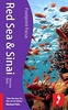


Red Sea Gizi Map
Red Sea at 1:2, 000, 000 from Gizi Map with lists of diving sites and wrecks along its shores, an enlargement of southern Sinai and its coastal waters, plus street plans of Sharm el Sheikh and Hurghada with tourist information.Coverage extends from Port Said and the Suez Canal beyond the Bab-el-Mandeb Straights to Djibouti City and Aden (Adan). On land in its northern section the map extends west to include the whole of the Nile Valley from Cairo to Aswan and Abu Simbel, and east to Tel Aviv and Amman. All place names are in Latin alphabet, with names of main towns also shown in Arabic.*Information on sea:* The map has bathymetric colouring with additional sea depths. Numerous small islands are shown and named, as well as coral reefs and marine parks or other protected areas.
Overprint highlights and names locations of numerous diving sites and famous wrecks.*Information on land:*Excellent presentation of the topography, with altitude colouring, spot heights and names of mountain ranges, etc. The map shows road and rail networks, airports and internal administrative boundaries with names of the provinces. Places of interest, including numerous sights along the Nile Valley and on Sinai, are highlighted. Also marked are oil and gas extraction sites.The map has latitude and longitude lines at intervals of 1º. Map legend includes English and Arabic.*Additional features:*An enlargement at 1:800, 000 covers central and southern Sinai with the Gulfs of Suez and Aqaba plus Hurghada and its coastal waters. Also provided are street plan of the coastal strips
around Sharm El Sheikh and Hurghada, each with a more detailed plan of the central area. All highlight tourist accommodation and various places of interest.The map also includes an index of diving sites in each country, plus a list of famous wrecks, each with a brief description in English.

Product Description
Reviews/Comments
Add New
Intelligent Comparison
Archived Product

Red Sea Wall Map Stanfords
£13.50
Archived Product

Syria Gizi Map Stanfords
£9.99
Archived Product

New Zealand Gizi Map Stanfords
£9.99
Vouchers
No voucher codes found.
Do you know a voucher code for this product or supplier? Add it to Insights for others to use.
Do you know a voucher code for this product or supplier? Add it to Insights for others to use.
 Denmark