
 United Kingdom
 France
 Germany
 Netherlands
 Sweden
 USA
USA
 Italy
Italy
 Spain
Spain
More From Contributor


Red Sea And Sinai Footprint Focus Guide
Red Sea & Sinai in the Footprint Focus Guides, which are targeted at cities, regions and countries worldwide that have no, or very limited, coverage from other publishers. Widely recognised for their reliability and independent writing style, Footprint Focus guides all have the same layout. Smaller than their sister Handbooks, the Focus guides are intended to streamline the information contained so that you have more of what you need, without losing Footprint’s signature unrestrictive editorial style that gives authors the freedom to capture and explore local cultures, sights and areas that are often not covered in other guides.An introductory section introduces the reader to the destination, with chapters on planning on your trip and essentials, including practical information
and guidance on subjects such as when and where to go, itineraries, sport and activities, arts, getting there and around, eating and drinks, sleeping and a dedicated section on the anticipated carbon footprint involved in travelling to the destination.Essentially a condensed, straight-to-the-point version of their Handbook series. “Sets the pace for all the rest to follow” Michael Palin.
and guidance on subjects such as when and where to go, itineraries, sport and activities, arts, getting there and around, eating and drinks, sleeping and a dedicated section on the anticipated carbon footprint involved in travelling to the destination.Essentially a condensed, straight-to-the-point version of their Handbook series. “Sets the pace for all the rest to follow” Michael Palin.

Product Description
Reviews/Comments
Add New
Intelligent Comparison
Archived Product

Trinidad And Tobago Footprint Focus Guide Stanfords
£6.99
Archived Product
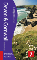
Devon And Cornwall Footprint Focus Guide Stanfords
£5.99
Archived Product

Chennai And Tamil Nadu Footprint Focus Guide Stanfords
£9.99
Archived Product
Rio De Janeiro Footprint Focus Guide Stanfords
£8.99
Archived Product

Indonesia Footprint Focus Guide Stanfords
£9.99
Archived Product
Paraguay Footprint Focus Guide Stanfords
£7.99
Archived Product

Sumatra Footprint Focus Guide Stanfords
£5.99
Archived Product

Jamaica Footprint Focus Guide Stanfords
£5.99
Vouchers
No voucher codes found.
Do you know a voucher code for this product or supplier? Add it to Insights for others to use.
Do you know a voucher code for this product or supplier? Add it to Insights for others to use.
 Denmark