
 United Kingdom
 France
 Germany
 Netherlands
 Sweden
 USA
USA
 Italy
Italy
 Spain
Spain
More From Contributor


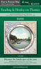
Reading 1898
Reading in 1898 in a fascinating series of reproductions of old Ordnance Survey plans in the Alan Godfrey Editions, ideal for anyone interested in the history of their neighbourhood or family. Coverage stretches from Brunswick Street and Argyle Street eastward to Craven Road, and from the railway southward to Waldeck Street and Berkeley Avenue. The important railway station is near the top of the map but is here shown in an interesting state of confusion as it was being enlarged at the time. Most of the GWR tracks are therefore without platforms, although the adjacent SER terminus is complete. The Oxford Road / Broad Street runs west-east through the map with tramway. Other features include most of the town centre, London Street, Castle Street, St Mary`s churc, River Kennet with
many riverside works and wharves, Kennet & Avon Canal, Seven Bridges Brewery, Royal Albert Brewery, Royal Berkshire Hospital, Municipal Buildings, Huntley & Palmer`s biscuit factory with rail connections, St Giles church, part of the GWR railway works, Royal Berkshire Seed Establishment, site of Abbey remains, prison (left blank as usual but famous as temporary home to Oscar Wilde), Ascham House. Near the western edge of the map is All Saints church.About the Alan Godfrey Editions of the 25” OS Series:Selected towns in Great Britain and Ireland are covered by maps showing the extent of urban development in the last decades of the 19th and early 20th century. The plans have been taken from the Ordnance Survey mapping and reprinted at about 15 inches to one mile (1:4, 340). On
the reverse most maps have historical notes and many also include extracts from contemporary directories. Most maps cover about one mile (1.6kms) north/south, one and a half miles (2.4kms) across; adjoining sheets can be combined to provide wider coverage.FOR MORE INFORMATION AND A COMPLETE LIST OF ALL AVAILABLE TITLES PLEASE CLICK ON THE SERIES LINK.

Product Description
Reviews/Comments
Add New
Intelligent Comparison
Archived Product

Yeading 1894 Stanfords
£3.50
Vouchers
No voucher codes found.
Do you know a voucher code for this product or supplier? Add it to Insights for others to use.
Do you know a voucher code for this product or supplier? Add it to Insights for others to use.
 Denmark