
 United Kingdom
 France
 Germany
 Netherlands
 Sweden
 USA
USA
 Italy
Italy
 Spain
Spain
More From Contributor


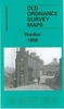


Yeading 1894
Yeading in 1894 in a fascinating series of reproductions of old Ordnance Survey plans in the Alan Godfrey Editions, ideal for anyone interested in the history of their neighbourhood or family. The map covers parts of three Middlesex parishes: Northolt to the top, Hayes to the south, and Southall in the south-east. It is an entirely rural map, showing the hamlet of Yeading, with its Manor Farm and Industry pub in the south-western quarter of the map, and a stretch of the Grand Junction Canal with various docks for the brickfields running north-south near the eastern side of the map. On the reverse are directories for Hayes and Northolt, plus a plan of the New Patent Brick Co and its canal access. Please note that the eastern half of this map, covering the canal area, is also
included on the Greenford map 15.07.About the Alan Godfrey Editions of the 25” OS Series:Selected towns in Great Britain and Ireland are covered by maps showing the extent of urban development in the last decades of the 19th and early 20th century. The plans have been taken from the Ordnance Survey mapping and reprinted at about 15 inches to one mile (1:4, 340). On the reverse most maps have historical notes and many also include extracts from contemporary directories. Most maps cover about one mile (1.6kms) north/south, one and a half miles (2.4kms) across; adjoining sheets can be combined to provide wider coverage.FOR MORE INFORMATION AND A COMPLETE LIST OF ALL AVAILABLE TITLES PLEASE CLICK ON THE SERIES LINK.
included on the Greenford map 15.07.About the Alan Godfrey Editions of the 25” OS Series:Selected towns in Great Britain and Ireland are covered by maps showing the extent of urban development in the last decades of the 19th and early 20th century. The plans have been taken from the Ordnance Survey mapping and reprinted at about 15 inches to one mile (1:4, 340). On the reverse most maps have historical notes and many also include extracts from contemporary directories. Most maps cover about one mile (1.6kms) north/south, one and a half miles (2.4kms) across; adjoining sheets can be combined to provide wider coverage.FOR MORE INFORMATION AND A COMPLETE LIST OF ALL AVAILABLE TITLES PLEASE CLICK ON THE SERIES LINK.

Product Description
Reviews/Comments
Add New
Intelligent Comparison
Archived Product
Reading 1898 Stanfords
£3.50
Archived Product

Ealing 1894 Stanfords
£3.50
Archived Product

Neasden 1894 Stanfords
£3.50
Archived Product
Felling 1894 Stanfords
£2.95
Archived Product

Felling 1894 Stanfords
£3.50
Archived Product
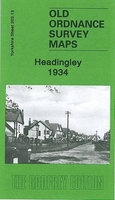
Headingley 1934 Stanfords
£3.50
Vouchers
No voucher codes found.
Do you know a voucher code for this product or supplier? Add it to Insights for others to use.
Do you know a voucher code for this product or supplier? Add it to Insights for others to use.
 Denmark