
 United Kingdom
 France
 Germany
 Netherlands
 Sweden
 USA
USA
 Italy
Italy
 Spain
Spain
More From Contributor

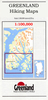


Qegertarsuaq Hiking Map
Qegertarsuaq Hiking Map No. 15 at 1: 100, 000 part of a series covering the Coastal areas of Greenland at 1:100, 000 or 1:75, 000 of GPS compatible contoured topographic maps from Greenland Tourism, indicating both recommended hiking trails and snowmobile routes, plus camping places, youth hostels, etc.Contours lines are at 25m intervals and additional altitude colouring. The maps provide a very detailed picture of the terrain, showing topographic features such as rivers and streams with fords, sand or gravel shoreline, marshes, boulder fields, etc. Recommended hiking trail are marked, as well as snowmobile routes. The maps show local settlements and connecting roads and tracks. Symbols indicate locations of heliports, general stores, medical facilities, youth hostels or huts,
camping terrain, viewpoints, etc.A grid gives UTM co-ordinates plus latitude in steps of 5' and longitude in 10'. The maps are printed on waterproof and tear-resistant paper. Map legend includes English.On the reverse selected titles have notes, in English, with advice on hiking in Greenland, as well as descriptions of the area, including plans of main settlements highlighting important buildings and institutions. Some maps are double-sided to provide a wider coverage.
camping terrain, viewpoints, etc.A grid gives UTM co-ordinates plus latitude in steps of 5' and longitude in 10'. The maps are printed on waterproof and tear-resistant paper. Map legend includes English.On the reverse selected titles have notes, in English, with advice on hiking in Greenland, as well as descriptions of the area, including plans of main settlements highlighting important buildings and institutions. Some maps are double-sided to provide a wider coverage.
Product Description
Reviews/Comments
Add New
Vouchers
No voucher codes found.
Do you know a voucher code for this product or supplier? Add it to Insights for others to use.
Do you know a voucher code for this product or supplier? Add it to Insights for others to use.
 Denmark