
 United Kingdom
 France
 Germany
 Netherlands
 Sweden
 USA
USA
 Italy
Italy
 Spain
Spain
More From Contributor


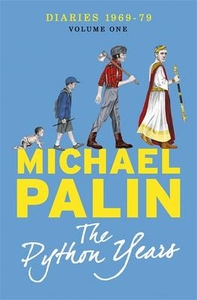
Python Years Diaries 1969-1979
The Python Years Diaries 1969-1979 by Michael Palin focuses on his years as part of Monty Python, revealing how it emerged and triumphed into a much-loved national television treasure that changed the face of British comedy.The years when Michael’s professional star was in its ascendancy were also years of development and growth in his personal life. The diaries tell of his growing family, his home in a north London terrace, which grows as he buys the house next door and then a second at the bottom of the garden!Not only are the diaries document to the extraordinary goings on behind the Python scene, with all of its powerful personalities, but they also reflect on his blossoming solo work as an actor, writer and producer. Highlights include his accounts of the making both The Holy
Grail and the Life of Brian and the fight with American TV who wanted to bleep out all the best jokes.
Grail and the Life of Brian and the fight with American TV who wanted to bleep out all the best jokes.
Product Description
Reviews/Comments
Add New
Intelligent Comparison
Archived Product
The Python Years: Diaries 1969-1979 Stanfords
£12.99
Vouchers
No voucher codes found.
Do you know a voucher code for this product or supplier? Add it to Insights for others to use.
Do you know a voucher code for this product or supplier? Add it to Insights for others to use.
 Denmark