
 United Kingdom
 France
 Germany
 Netherlands
 Sweden
 USA
USA
 Italy
Italy
 Spain
Spain
More From Contributor

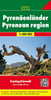

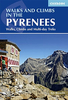
Pyrenees Walks & Climbs (170 Routes)
Kev Reynolds' Cicerone walking guide to the Pyrenees includes 170 described walks, multi-day routes and moderate climbs on one of Europe's finest mountain rangers. It takes in walks and climbs on some of the principle summits in the Central and High Pyrennes between the Cirque de Lescun and Carlit Massif east of Andorra.Over 150 walks, multi-day tours, including the Pyrenean High Level Route and moderate rock climbs. Chapter headings: Cirque de Lescun, Pic du Midi D'Ossau, Balaitous, The Gourette Massif, Vall
Product Description
Reviews/Comments
Add New
Intelligent Comparison
Archived Product
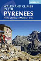
Pyrenees Walks And Climbs Stanfords
£17.95
Vouchers
No voucher codes found.
Do you know a voucher code for this product or supplier? Add it to Insights for others to use.
Do you know a voucher code for this product or supplier? Add it to Insights for others to use.
 Denmark