
 United Kingdom
 France
 Germany
 Netherlands
 Sweden
 USA
USA
 Italy
Italy
 Spain
Spain
More From Contributor

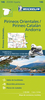
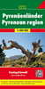


Pyrenees Rando Editions
Pyrenees coast to coast and across both sides of the border presented by Rando Editions on a map at 1:400, 000 with coverage extending from Auch, Toulouse and Béziers in France to Bilbao, Logroño, Zaragoza, Lleida and Barcelona in Spain; plus prominent highlighting of the region’s national / natural parks.Relief shading and altitude colouring presents the region’s topography, with names of valleys, peaks, passes, etc. National parks and other protected areas are prominently marked. Road network includes selected local roads, although fewer than on similar coverage from other publishers. Symbols highlight locations worth visiting and other places of interest or areas for recreational pursuits. The map has no geographical coordinates for GPS (contrary to the icon on its
cover!). Map legend includes English. Accompanying text about various aspects of the region, illustrated with photos and maps, is in French only.
cover!). Map legend includes English. Accompanying text about various aspects of the region, illustrated with photos and maps, is in French only.

Product Description
Reviews/Comments
Add New
Vouchers
No voucher codes found.
Do you know a voucher code for this product or supplier? Add it to Insights for others to use.
Do you know a voucher code for this product or supplier? Add it to Insights for others to use.
 Denmark