
 United Kingdom
 France
 Germany
 Netherlands
 Sweden
 USA
USA
 Italy
Italy
 Spain
Spain
More From Contributor

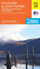
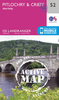
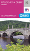


Pitlochry And Crieff OS ACTIVE Map
Map No. 52, Pitlochry and Crieff, in the waterproof and tear-resistant OS Active version of the Ordnance Survey Landranger series at 1:50, 000, including Perth, Aberfeldy, Balgowan, Comrie, Gilmerton, Methven, Luncarty, Harrietfield, Bankfoot, Amulree, Caputh, Trochry, Dunkeld, Kindallachan, Ballnluig, Strathtay, Tummel Bridge, Keltneyburn, Weem, Kenmore, Acharn, Fearnan and Ardtalnaig, with a small section of the Loch Lomond and the Trossachs National Park, Forest of Clunie, Keillour Forest, Tay Forest Park, Glen Almond, the peaks of Meall Reamhar, Deuchary Hill, Drum Tick, Meall nan Caorach, Meall Tairneachan, Schiehallion, Meall Dearg, Meall a
Product Description
Reviews/Comments
Add New
Vouchers
No voucher codes found.
Do you know a voucher code for this product or supplier? Add it to Insights for others to use.
Do you know a voucher code for this product or supplier? Add it to Insights for others to use.
 Denmark