More From Contributor

£12.99
Walk! Tenerife guide from Discovery Walking Guides, with colour extracts of contoured maps cross-referenced to detailed descriptions of 46 walks on the isl&. For GPS users the publishers offer a free downloadable zip file with all the waypoints. The walks are grouped in the five main hiking areas of the isl&, including the popular resorts on the south coasts & the central highlands with Mount Teide. For each walk the guide provides a very detailed description, cross-referenced to the accompanying map extract which is overprinted with the route & annotated with waypoints. The mapping is taken from the publishers ...
Archived Product
£12.99
43 fully detailed walking routes with 1:25, 000 scale maps & GPS Waypoints. A real ` Rolls Royce` of a walking guide to the authors` home isl&. Full GPS information for Waypoint navigation with `pin-point` accuracy. Large scale map sections for every walking route adapted from Tenerife Hiking Map. Walking routes cover the North (Orotava Valley), Central High Altitude (Las Canadas & Paisaje Lunar), West (Masca/ Santiago del Teide), South (Adeje, Arona & coastal routes) plus all new routes in the Anaga. Fully detailed walk descriptions for the 43 routes, with GPS Waypoints, plus notes & comments on Pico del Teide, Montana Blanca & Barranco del Infierno including booking conditions. Large scale maps for each walking route plus regional locator maps & island map. All walking routes rated for ` Effort`, ` Time`, ` Distance`, ` Ascents & Descents`, & ` Refreshment` opportunities. ...
Archived Product
£12.99
Walk! Alpujarras guide from Discovery Walking Guides providing descriptions of 34 hiking trails on the southern slopes of the Alpujarras range of the Sierra Nevada, with extracts from the publishers’ map of the region & general tourist advice. The 34 walks cover routes of varying degrees of difficulty, length & altitude. Each walk has a detailed description, accompanied by a colour extract from the publishers’ detailed, contoured & GPS compatible map of the whole area. The map extracts have no GPS waypoints, but they can be downloaded for free from the publishers’ website. The guide also provides general information about the area, advice for access to walks on public transport or by car, etc. ...
Archived Product
£12.99
Walk the Axarquia is Charles Davis’ Discovery Walking Guide exploring this popular walking region of the Costa del Sol. The guide covers a range of walks in the Sierras Tejeda & Almijara, which form the backdrop of the Axarquia region, including walks in great oak woods in El Robledal, the peak of Rambla de la Mota & the dramatic rock landscapes of Tajo Almendron & La Puerta. There are also easier short walk alternatives for those seeking more leisurely days out. The guide describes a total of 30 GPS waymarked walking routes in the Axarquia & each has been thoroughly researched. An extensive introduction provides information on when to go, climate, getting there & about, equipment, where to eat & drink & tourist attractions in the area. There is also useful guidance about map & walking information including details of walk location regional maps & using GPS in the Axarquia. Each walk gives an overview of the route & colour keys indicating difficulty, times, total distance, vertigo risks, ascents & descents & if refreshments are available on route. Appendices provide walkers with a summary of GPS Waypoints Lists, welsh place names, public transport & places to stay. Detailed walk descriptions are accompanied by 1:40, 000 scale CIGN Survey extracts mapping the route & GPS waypoints at every key point on the walk as well as colour photographs illustrating some of the highlights of each walk covered in the guide. ...
Archived Product
£12.99
Walk the Brecon Beacons is Bob Greaves’ Discovery Walking Guide exploring the best walking possibilities in the famous Welsh mountain range. The guide covers a range of walks within the Brecon Beacons National Park, from a gentle stroll around Usk Reservoir to a challenging four peaks in one day on the Grwynne Fawr route. The walks explore high peaks, glacial lakes, man-made reservoirs, canals & ancient castles, churches & monasteries. There are also short walk & stroll alternatives for those seeking more leisurely days out. The guide describes a total of 40 GPS waymarked walking routes in the Brecon Beacons & each has been thoroughly researched. A detailed introduction provides information on the Brecon Beacons national park, where to stay, history, geology, weather, weather & a note about Welsh spelling. There is also useful guidance about map & walking information including details of walk location regional maps & using GPS in the Brecon Beacons. Each walk gives an overview of the route & colour keys indicating difficulty, times, total distance, vertigo risks, ascents & descents & if refreshments are available on route. Appendices provide walkers with a summary of GPS Waypoints Lists, welsh place names, public transport & places to stay. Detailed walk descriptions are accompanied by 1:40, 000 scale Ordnance Survey extracts mapping the route & GPS waypoints at every key point on the walk as well as colour photographs illustrating some of the highlights of each walk covered in the guide. ...
Archived Product
£9.99
` Salvation comes in the form of a good old-fashioned walk.` Clare Balding A leisurely ramble through the woods, a meandering city stroll, a blustery seaside promenade or a vigorous mountain hike
- all have their delights & incomparable joys. Whatever your walking style, you`ll be captivated & enthralled by the stories & excerpts of classic writing, trivia & practical tips in this book
- perfect for anyone who loves the freedom of lacing up their hiking boots & heading for the hills.

...
Archived Product
£7.99
` Walking is man`s best medicine`
- Hippocrates. Walk invites you to explore the benefits to be gained from the simple act of walking
...
Archived Product
£3.50
Walkden North & Blackleach in 1907 in a fascinating series of reproductions of old Ordnance Survey plans in the Alan Godfrey Editions, ideal for anyone interested in the history of their neighbourhood or family. The map covers the northern part of Walkden, extending from Chatsworth Street northward to Blackleach Sewage Works, & from Sod Hall on Cleggs Lane eastward to Linnyshaw Moss. Features include Little Hulton station, Walkden Mills, Primrose Mill, Park Mill, Granville Mill, St John the Baptist church, Hill Top, Kearsley Chemical Works, Kearsley Moss Colliery, several stretches of the Bridgewater Collieries Railway, tramways, Ashton`s Field Colliery, Buckley Lane End, Blackleach Reservoir, etc. A Walkden directory is on the reverse. About the Alan Godfrey Editions of the 25” OS Series: Selected towns in Great Britain & Ireland are covered by maps showing the extent of urban development in the last decades of the 19th & early 20th century. The plans have been taken from the Ordnance Survey mapping & reprinted at about 15 inches to one mile (1:4, 340). On the reverse most maps have historical notes & many also include extracts from contemporary directories. Most maps cover about one mile (1.6kms) north/south, one & a half miles (2.4kms) across; adjoining sheets can be combined to provide wider coverage.FOR MORE INFORMATION & A COMPLETE LIST OF ALL AVAILABLE TITLES PLEASE CLICK ON THE SERIES LINK. ...
Archived Product
£3.50
Walkden South in 1908-1911 in a fascinating series of reproductions of old Ordnance Survey plans in the Alan Godfrey Editions, ideal for anyone interested in the history of their neighbourhood or family. The map covers the southern half of the Lancashire town of Walkden, west of Salford. Coverage stretches from Ellenbrook station eastward to Old Clough Lane & northward to the Manchester Road & Wardley Street. Features include a stretch of the LYR Pendleton & Hindley railway with Walkden station, a stretch of the LNWR Worsley & Bolton line with Walkden station, a stretch of the LNWR Eccles-Wigan line with Ellenbrook station, Walkden Yard, Ellesmere Colliery, Wardley Mill, Linnyshaw Reservoir, Linnyshaw Mill, St Paul`s church, Stocks Hotel, tramways, Lady Ellesmere Memorial, Parr Fold Park, Edge Fold, Bridgewater Collieries Railway with various spurs, Mather`s Fold, Engine Fold, Primrose Bank, etc. On the reverse are 1889 & 1929 timetables for the LNWR Manchester-Bolton line. About the Alan Godfrey Editions of the 25” OS Series: Selected towns in Great Britain & Ireland are covered by maps showing the extent of urban development in the last decades of the 19th & early 20th century. The plans have been taken from the Ordnance Survey mapping & reprinted at about 15 inches to one mile (1:4, 340). On the reverse most maps have historical notes & many also include extracts from contemporary directories. Most maps cover about one mile (1.6kms) north/south, one & a half miles (2.4kms) across; adjoining sheets can be combined to provide wider coverage.FOR MORE INFORMATION & A COMPLETE LIST OF ALL AVAILABLE TITLES PLEASE CLICK ON THE SERIES LINK. ...
Archived Product
£2.95
Walker & Hebburn in 1895 in a fascinating series of reproductions of old Ordnance Survey plans in the Alan Godfrey Editions, ideal for anyone interested in the history of their neighbourhood or family. Selected towns in Great Britain & Ireland are covered by maps showing the extent of urban development in the last decades of the 19th & early 20th century. In this title: two maps have have been published for this area to show how it has changed over the years. Coverage stretches from Carville Ward in the north to Walker Football Ground in the south. Features on the map include Tennant's Works & Tyne Works, Walker Colliery, Hebburn Shipbuilding Yard, Walkergate Methodist Chapel, Christ Church, Scrogg House & the NER railway line & station. Main streets include Wellbeck Road, Ellison Street, Victoria Street & Prince Consort Road. On the reverse is an extract from a directory of Hebburn Parish. About the Alan Godfrey Editions of the 25 ...
Archived Product

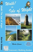
Walk! The Isle Of Wight

Walk The Isle of Wight is Martin Simons’ Discovery Walking Guide exploring the walking possibilities in one of the best destinations in the UK and home to the largest walking festival of its kind. The guide covers a range of walks including routes on Tennyson Down and the Needles, Newtown Nature Reserve, Shorewell and the Downs, Newport and Quarr Abbey. The walks selected by the author pass through the Island’s diverse landscapes – including formidable hills, towering cliffs, river valleys, marshes, farmland, ancient churches, villages and a wealth of inns and pubs. Many of the routes also have short walk and stroll alternatives for those seeking more leisurely days out.The guide describes a total of 40 GPS waymarked walking routes on the Isle of Wight and each has been
thoroughly researched. A detailed introduction provides information on getting to and around the island, the Isle’s creation, flora and fauna and a note about the walks included in the guide. There is also useful guidance about map and walking information including details of walk location regional maps and using GPS on the Island. Each walk gives an overview of the route and colour keys indicating difficulty, times, total distance, vertigo risks, ascents and descents and if refreshments are available on route. Appendices provide walkers with a summary of GPS Waypoints Lists, useful website details and a list of pubs, inns and cafes featured in the walks. Detailed walk descriptions are accompanied by 1:40, 000 scale Ordnance Survey extracts mapping the route and GPS waypoints at
every key point on the walk as well as colour photographs illustrating some of the highlights of each walk covered in the guide.
RIP - This product is no longer available on our network. It was last seen on 25.09.2019

This page now acts as a permanent archive for this product. Add more information using the comments box below to ensure it can still be found by future generations.

Use our search facility to see if it is available from an alternative contributor.
  • Availability: Out Of Stock
  • Supplier: Stanfords
  • SKU: 9781782750024
Availability: In Stock
£12.99

Product Description

Walk The Isle of Wight is Martin Simons’ Discovery Walking Guide exploring the walking possibilities in one of the best destinations in the UK & home to the largest walking festival of its kind. The guide covers a range of walks including routes on Tennyson Down & the Needles, Newtown Nature Reserve, Shorewell & the Downs, Newport & Quarr Abbey. The walks selected by the author pass through the Island’s diverse landscapes – including formidable hills, towering cliffs, river valleys, marshes, farml&, ancient churches, villages & a wealth of inns & pubs. Many of the routes also have short walk & stroll alternatives for those seeking more leisurely days out. The guide describes a total of 40 GPS waymarked walking routes on the Isle of Wight & each has been thoroughly researched. A detailed introduction provides information on getting to & around the isl&, the Isle’s creation, flora & fauna & a note about the walks included in the guide. There is also useful guidance about map & walking information including details of walk location regional maps & using GPS on the Isl&. Each walk gives an overview of the route & colour keys indicating difficulty, times, total distance, vertigo risks, ascents & descents & if refreshments are available on route. Appendices provide walkers with a summary of GPS Waypoints Lists, useful website details & a list of pubs, inns & cafes featured in the walks. Detailed walk descriptions are accompanied by 1:40, 000 scale Ordnance Survey extracts mapping the route & GPS waypoints at every key point on the walk as well as colour photographs illustrating some of the highlights of each walk covered in the guide.

Reviews/Comments

Add New

Intelligent Comparison

Oooops!
We couldn't find anything!
Perhaps this product's unique.... Or perhaps we are still looking for comparisons!
Click to bump this page and we'll hurry up.

Price History

Vouchers

No voucher codes found.
Do you know a voucher code for this product or supplier? Add it to Insights for others to use.

Facebook

Jargon Buster

GPS - Global Positioning System - Global position using satellites
UK - United Kingdom - An island nation in Europe
Key - A physical or virtual device or code used for opening something
Colour - The categorised spectrum of light visable to humans
Festival - A period usually occurring once a year for celebration, typically for religious reasons.
Home - A place of permanent residence for families.
Regional - An adjective to describe a set geographic area.

Supplier Information

Stanfords
Stanfords was established in 1853 and opened their iconic Covent Garden flagship store in 1901. They have become the top retailer of maps, travel books and accessories in the UK and arguably offer the largest selection of maps and travel books worldwide. Famous names such as Captain Robert Falcon Scott, Ranulph Fiennes and Michael Palin have purchased from Stanfords. They now have a shop in Bristol and both stores together with other venues operate a calendar of events including talks, book signings and exhibitions. As a specialist map retailer, the map selection is comprehensive and includes road maps, street maps and walking maps from worldwide destinations, as well as a selection of world atlases and wall maps. Books include travel guides and travel literature. Stanfords also stock globes, from miniatures made of blue marble to magnificent floor-standing globes. The website features a selection of interesting articles on travel topics.
Page Updated: 2023-11-12 20:15:36

Community Generated Product Tags

Oh No! The productWIKI community hasn't generated any tags for this product yet!
Menu