More From Contributor
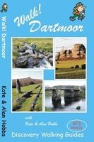
£4.99
Walk to Skiddaw from Keswick by Handi Hikes is perfect for the experienced hiker as well as those new to the Lake District. This handy guide is 1 of 18 in a series of guide maps covering selected walks in the Lake District. Printed on durable compact foldaway waterproof plastic, this map

Includes::
1 easy & 2 difficult routes & is ideal for walking & outdoor pursuits. Carry a local guide in your pocket
- carry a Handi Hike! Each Map Guide in this series

Includes::
OS 1:25, 000 Explorer mapping, accurate directions, tips on navigation & recommendations for refreshments at the end of the walks. One side the map guide shows an extract from OS explorer, accurate & easy to follow directions for the walks & a few tips on navigation. The mapping from Ordnance Survey offers a large amount of information for ramblers & tourists. All types of roads, tracks, permitted & public footpaths & bridleways are shown. Graphics & colour coding represent terrain features such as cliffs, scree, marsh, mud & vegetation. Contours are shown at 10-meter vertical intervals & spots heights are marked. A wide range of symbols locates various facilities for walkers, including youth & independent hostels, camping & caravan sites & information points. Easy to follow directions describe 3 or 4 walks in the area that are clearly marked in the map with colour coded dots. Further information

Includes::
suggested viewpoints & places for refreshments, how to link together other routes in this series as well as tips on navigation. The maps indicate whether the routes are easy, moderate or difficult. This means that you can choose a walk according to ability & mood. Walk duration & distance covered are stated. The reverse of the map guide shows the legend, reference tips on reading a grid, information on how to use a compass, as well as advice on how to stay safe in the hills. GPS compatible. All text & legends are in English only. Carry a local guide in your pocket
- carry a Handi Hike!


...
Archived Product
£7.99
Explorer, novelist, writer & film-maker, Sir Laurens van der Post was one of the most influential figures of our era. Here, in conversation with Jean-Marc Pottiez, he records his ideas & insights into a wide range of issues & personalities, forged by a lifetime of vast experiences & challenges. ...
Archived Product
£5.99
Come on an adventure around the world to see how different animals walk & talk. See them hop, clop, slide & glide from behind some flaps or snap, growl or squawk from behind other flaps. There are lots of other animals to find, too, & colourful scenes set in many countries with children from different cultures. Introducing lift-the-flap books: an exciting new format for Barefoot! This title was illustrated by best-selling artist, Caroline Mockford, who has brought the Cleo series of books to life so successfully. It represents children from Africa, America, China, Russia & India. It is accessible & interactive
-

Includes::
a simple hide-&-seek theme to engage young children.


...
Archived Product
£12.99
Walk! Costa Blanca Mountains guide from Discovery Walking Guides providing descriptions of 37 hiking trails in the mountains north-west of Altea & Benidorm, with extracts from the publishers’ map of the region & general tourist advice. The guide covers an area centred on Guadalest with mountain rages both north & south of the CV-70 road linking Benidorm with Alcoy/ Alcoi. The recommended routes of varying vary in the degree of difficulty, length & altitude. Each walk has a detailed description, accompanied by a colour extract from the publishers’ detailed, contoured & GPS compatible map of the whole area. The map extracts have no GPS waypoints, but they can be downloaded for free from the publishers’ website. The guide also provides general information about the area, advice for access to walks on public transport or by car, etc. ...
Archived Product
£12.99
We celebrate a Costa del Sol that does not correspond to the cliches, a Costa del Sol that is all right rather than all wrong, a playground of green valleys & gilded mountain tops, a hidden idyll unknown to most visitors, a haven for dedicated walkers & adventurous tourists alike, a place in which every nook is graced with some gratifying discovery & every outing is a great adventure. The majority of walks are aimed at the adventurous leisure walker, people who will on the whole have some experience of hiking in mountains, are happy to invest a certain amount of effort for a corresponding reward. Covering the best preserved stretch of coastline, the prettiest villages, & most spectacular mountains, Walk! Costa del Sol explores the Axarquia region east of Malaga, an area blessed with grand summits, dizzying pinnacles, dramatic crags, deep ravines, delightful streams, stunning views, & the finest coves on the Costa del Sol, & all of it knitted together by a network of paths, trails, tracks & lanes so beguiling that walking is by far the best way to explore this lovely landscape. THE COAST: TORRE DEL MAR, TORROX COSTA, NERJA, MARO are well-placed for accessing the itineraries between Canillas de Aceituno & Competa. THE MOUNTAINS: THE SIERRAS DE TEJEDA & ALMIJARA The Sierra is a discrete massif defined by cliffs, gullies & gorges, & culminating in the Iberian Peninsula`s westernmost 2000 metre summit (La Maroma, Walk 35), while the Sierra Almijara comprises numerous mini-ranges separated by canyons. The traditional dividing point between the two sierras is Puerto de Competa, which we visit in Walk 36. The joys of these mountains are manifold, including bulbous karstic domes & vertiginous pinnacles, dramatic cliffs draped with ragged crags & grand ridges dominating the glittering blue sea; there are uplands patched with ancient pastures & dotted with the ruins of remote cortijos (farmhouses), there are terraces stippled with olive & almond trees, hillsides swaddled in a buttery blanket of yellow-flowering shrubs, valleys flanked by shady forests of conifer & cork oak, & fabulous ravines twisting between towering chicanes (known as cahorros) & tipping over spectacular waterfalls into deep plunge pools, all accessible within 15 minutes of the coast. THE WHITE VILLAGES The Pueblos Blancos of Andalusia with their whitewashed walls & red-tiled roofs are justly famous & the Axarquia does not disappoint in this respect. The best known pueblos blancos & the main gateway destinations for walkers are Competa & Frigiliana. West of Competa are some of the region`s prettiest villages, the two Canillas (Aceituno & Albaida), Sedella, Salares & Archez. Walk! Costa del Sol (Axarquia) together with Costa del Sol Tour & Trail Map will give you a series of adventures you`ll never forget. Each walk is fully described & accompanied by a detailed map & colour photos, plus an information bar that helps you easily choose the right routes for you, based on difficulty, distance, time needed, ascents & descents & more. ...
Archived Product
£12.99
Buying Walk Devon qualifies you for a free Tour & Trail Super-Durable Map in Discovery Walking Guides Great Map Giveaway
- see
...
Archived Product
£12.99
Walk Dorset is Charles Davis’ Discovery Walking Guide surveying the many walks available in the rural landscape of Dorset. The guide covers a range of walks including routes on the Purbeck Way & Wessex Ridgeway, coastal walks near Piddle & Frome, island trips to Portland & ideas for rambles on weekend breaks in & around Chedington, Cranbourne, Evershot, Milton Abbas, Powerstock & Shaftesbury, often touching the very heart of Thomas Hardy country. There are also short walk & stroll alternatives for those seeking more leisurely days out. The guide describes a total of 20 GPS waymarked walking routes in & around Dorset & each has been thoroughly researched. A detailed introduction provides information on identifying Dorset & the county’s landscape & history. There is also useful guidance about map & walking information including details of walk location regional maps & using GPS on Dartmoor. Each walk gives an overview of the route & colour keys indicating difficulty, times, total distance, vertigo risks, ascents & descents & if refreshments are available on route. Appendices provide walkers with a summary of GPS Waypoints Lists, a list of recognised walking paths in Dorset & how to get to the county by road or rail. Detailed walk descriptions are accompanied by 1:40, 000 scale Ordnance Survey extracts mapping the route & GPS waypoints at every key point on the walk as well as colour photographs illustrating some of the highlights of each walk covered in the guide. ...
Archived Product
£12.99
La Gomera is the ultimate get-away-from-it-all island: easy-going, unspoilt, friendly, isolated from the hustle & bustle of modern living, & so laid back it`s virtually supine
- even the volcanoes have been dormant for millions of years. The walks, however, are a bit more energetic. For the new 4th edition of Walk! La Gomera Charles Davis has teamed up with Jan Kostura. Jan brings his wide experience & passion for the Canaries, checking, re-walking & revising existing routes, & adding a couple of his own adventures, including a new Top Three Gomeran walk. Two routes have been dropped as having become too dangerous, but the good news is that many of the more harum-scarum walks have been enhanced through path clearing & the addition of railings to the vertiginous stretches. Other good news is that the devastating forest fires of 2012 have proved not nearly as damaging as we feared, leaving most of our itineraries unscathed. In short, there is every reason to take off & explore La Gomera, or to return with this new edition to revive acquaintances & make some new discoveries at the same time. All the trails have been surveyed & mapped using GPS satellite navigation. The authors & their co-walkers have walked all these routes, ensuring accuracy & up to date information for hikers. Clear descriptions guide the walker both to the starting point & throughout the routes, with gradings, distances, timings & altitudes all symbolized, as are vertigo alerts & refreshment possibilities on or at ends of the routes. There are 34 detailed walking adventures with routes ranging from a couple of 90 minute 4 kilometre walks, up to challenging trails taking over 6 hours, covering 20 kilometres including ascents & descents of 1060 metres. Each route

Includes::
its own map sections with the route & waypoints clearly marked. Map sections are developed from the La Gomera Tour & Trail Super-Durable Map, the most up to date & toughest map of the isl&. GPS waypoint files for all the 34 routes are available in three formats as a free zip file download from the Discovery Walking Guides website.


...
Archived Product
£12.99
Walk La Palma is Charles Davis’ Discovery Walking Guide exploring the walking possibilities one of the steepest islands & unspoilt walking destinations in Europe. The guide covers a range of walks including routes in Barranco de la Madera, the southern Volcanoes, Santo Domingo, Cubo de la Galga & Roque Palmero. The routes pass through diverse landscapes including the craters of volcanoes, sub-tropical forests & coastal paths along the island’s 1080 kilometres of way-marked paths. There are also easier short walk & family alternatives for those seeking more leisurely days out. The guide describes a total of 34 GPS waymarked walking routes on La Palma & each has been thoroughly researched. An extensive introduction provides information on the island’s climate, when to go, getting there & around, equipment, risks, flora & fauna, rating & drinking, tourist attractions & a note on the historic town of Santa Cruz de la Palma. There is also useful guidance about map & walking information including details of walk location regional maps & using GPS on La Palma. Each walk gives an overview of the route & colour keys indicating difficulty, times, total distance, vertigo risks, ascents & descents & if refreshments are available on route. Detailed appendices provide walkers with a summary of GPS Waypoints Lists, recommended maps & books, useful websites, accommodation, camping advice, restaurants, mountain bike itineraries, taxis & bus timetables, with way-marked routes that cross them. Detailed walk descriptions are accompanied by 1:40, 000 scale extracts mapping the route & GPS waypoints at every key point on the walk as well as colour photographs illustrating some of the highlights of each walk covered in the guide. ...
Archived Product
£12.99
Walk! Lanzarote is a GPS ready walking guidebook detailing thirty five routes across the isl&. Ratings are given for the difficulty levels, time, distance, ascent/descent, refreshment & vertigo risks for each hike listed. Access details by car or public transport are provided for each route & maps are displayed cut into manageable & readable sections, relevant to the text description on adjacent pages. The book gives an introduction to staying & walking on this lesser known World Heritage Site, including explaining the guide ...
Archived Product

Walk! Dartmoor

Kate and Alan Hobbs have reviewed and refreshed their Walk! Dartmoor classic guide book for its new 2016 edition. 40 fully detailed walking routes with OS maps and gps waypoints for you to enjoy adventuring on Dartmoor. Walk! Dartmoor with Kate and Alan Hobbs covers walks of varying length across Dartmoor - from the dramatic high moors, gentle riversides, idyllic country lanes, unspoilt villages, to sites of ancient archaeology and former industries, and all with spectacular views. This user friendly illustrated guide has a summary of walking routes and is rated by time, effort, distance and hills, as well as the availability of refreshments en route and the vertigo risk.Each walk is described in full and there are timings listed in the book to help with navigation and progress.
Walk! Dartmoor contains a 1:40, 000 scale Ordnance Survey map for each route. Within the heart of Devon lies Dartmoor`s 365 square miles of natural beauty, one of the largest areas of exposed granite in southern England. Apart from its spectacular scenery, Dartmoor is rich in flora and fauna.Come with us to explore Dartmoor`s dramatic high moors, gentle riversides, idyllic country lanes and unspoilt villages, discovering spectacular views, ancient archaeology and traces of bygone industries.All 40 walking routes include: walking route summary, ratings for Effort Time Distance Ascents/Descents Refreshments and Vertigo risk, fully detailed walk description including frequent timings to aid navigation and check your progress, GPS waypoints at every key point on every route, full
colour 1:40, 000 scale Ordnance Survey licenced mapping for each route, short walk and stroll alternatives.
RIP - This product is no longer available on our network. It was last seen on 25.09.2019

This page now acts as a permanent archive for this product. Add more information using the comments box below to ensure it can still be found by future generations.

Use our search facility to see if it is available from an alternative contributor.
  • Availability: Out Of Stock
  • Supplier: Stanfords
  • SKU: 9781782750253
Availability: In Stock
£12.99

Product Description

Kate & Alan Hobbs have reviewed & refreshed their Walk! Dartmoor classic guide book for its new 2016 edition. 40 fully detailed walking routes with OS maps & gps waypoints for you to enjoy adventuring on Dartmoor. Walk! Dartmoor with Kate & Alan Hobbs covers walks of varying length across Dartmoor
- from the dramatic high moors, gentle riversides, idyllic country lanes, unspoilt villages, to sites of ancient archaeology & former industries, & all with spectacular views. This user friendly illustrated guide has a summary of walking routes & is rated by time, effort, distance & hills, as well as the availability of refreshments en route & the vertigo risk. Each walk is described in full & there are timings listed in the book to help with navigation & progress. Walk! Dartmoor contains a 1:40, 000 scale Ordnance Survey map for each route. Within the heart of Devon lies Dartmoor`s 365 square miles of natural beauty, one of the largest areas of exposed granite in southern Engl&. Apart from its spectacular scenery, Dartmoor is rich in flora & fauna. Come with us to explore Dartmoor`s dramatic high moors, gentle riversides, idyllic country lanes & unspoilt villages, discovering spectacular views, ancient archaeology & traces of bygone industries. All 40 walking routes include: walking route summary, ratings for Effort Time Distance Ascents/ Descents Refreshments & Vertigo risk, fully detailed walk description including frequent timings to aid navigation & check your progress, GPS waypoints at every key point on every route, full colour 1:40, 000 scale Ordnance Survey licenced mapping for each route, short walk & stroll alternatives.

Reviews/Comments

Add New

Intelligent Comparison

Oooops!
We couldn't find anything!
Perhaps this product's unique.... Or perhaps we are still looking for comparisons!
Click to bump this page and we'll hurry up.

Price History

Vouchers

No voucher codes found.
Do you know a voucher code for this product or supplier? Add it to Insights for others to use.

Facebook

Jargon Buster

GPS - Global Positioning System - Global position using satellites
England - A country within the United Kingdom.
Key - A physical or virtual device or code used for opening something
Colour - The categorised spectrum of light visable to humans
Heart - An organ that pumps blood around the body. Usually related to love.
Natural - not manmade
Spectacular - Something that catches that eye due to its eye catchingness.
Classic - Something that is still like it was originally a high quality standard.

Supplier Information

Stanfords
Stanfords was established in 1853 and opened their iconic Covent Garden flagship store in 1901. They have become the top retailer of maps, travel books and accessories in the UK and arguably offer the largest selection of maps and travel books worldwide. Famous names such as Captain Robert Falcon Scott, Ranulph Fiennes and Michael Palin have purchased from Stanfords. They now have a shop in Bristol and both stores together with other venues operate a calendar of events including talks, book signings and exhibitions. As a specialist map retailer, the map selection is comprehensive and includes road maps, street maps and walking maps from worldwide destinations, as well as a selection of world atlases and wall maps. Books include travel guides and travel literature. Stanfords also stock globes, from miniatures made of blue marble to magnificent floor-standing globes. The website features a selection of interesting articles on travel topics.
Page Updated: 2023-11-12 20:15:36

Community Generated Product Tags

Oh No! The productWIKI community hasn't generated any tags for this product yet!
Menu