
 United Kingdom
 France
 Germany
 Netherlands
 Sweden
 USA
USA
 Italy
Italy
 Spain
Spain
More From Contributor


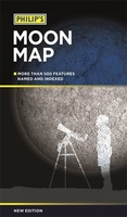
Philip`s Moon Map
In a convenient folded format, Philip`s Moon Map is a superbly detailed, large-format map of the near (visible) side of the Moon. Specially drawn for Philip`s by Dr John Murray, an expert on the lunar surface, the map is not only a highly accurate and clear representation of the Moon but is also a practical guide for lunar observers. More than 500 physical features - craters, seas, mountain ranges, peaks, valleys and rilles (elongated depressions) - are named and indexed, and the landing sites of unmanned and manned spacecraft are also marked. The observer can thus readily identify objects seen through binoculars or a telescope, or pick targets for a programme of observation. The accompanying text is a practical guide to Moonwatching, which explains how to use the map and
highlights the most interesting lunar features. Close-up images of some of these objects show what the observer can expect to see. Also included are photographs of the Moon at each daily stage and a smaller map of the far side, as revealed by satellites. Guidelines on drawing or photographing the Moon are also included.
highlights the most interesting lunar features. Close-up images of some of these objects show what the observer can expect to see. Also included are photographs of the Moon at each daily stage and a smaller map of the far side, as revealed by satellites. Guidelines on drawing or photographing the Moon are also included.

Product Description
Reviews/Comments
Add New
Vouchers
No voucher codes found.
Do you know a voucher code for this product or supplier? Add it to Insights for others to use.
Do you know a voucher code for this product or supplier? Add it to Insights for others to use.
 Denmark