More From Contributor

£10.99
Britain`s best-selling secondary school atlas, now in its 98th Edition, Philip`s Modern School Atlas is an essential reference work for secondary education (14-18 year olds), suitable for Key Stage 4, GCSE, A-Level & international schools. The contents are divided into sections for ease of use, with each page colour-coded for rapid reference. A 12-page Remote Sensing section covers such topics as satellite imagery & GIS (with an explanation of false-colour usage), incorporating a selection of images used in studies of exploration, land reclamation, erosion, geology, pollution & urban regeneration, with explanatory text. The next section covers the United Kingdom & Ireland in 31 pages. With physically coloured maps, this is the most accurate mapping of the UK & Ireland available at the chosen scales
- accompanying the physical maps are thematic maps on numerous key social & economic themes. The middle section is made up of 74 pages of World topographical maps, incorporating continental thematic maps on topics such as climate, population & economics, followed by 30 pages of World thematic maps. Completing the atlas is a section of World social & economic statistics, accompanied by the index to the topographical maps in the atlas, showing letter-figure grid references as well as latitude & longitude co-ordinates. Available in both hardback & paperback formats, Philip`s Modern School Atlas 98th Edition is an unbeatable combination of highly detailed physical mapping backed up by numerous tables & thematic maps.
...
Archived Product
£4.99
Philip`s Month-by-Month Star Finder is a concise calendar for star watchers in the northern hemisphere. Star charts show the position of stars, constellations & other celestial objects for each month of the year, in both northerly & southerly directions. The introduction explains the basic facts that observers need to know: the apparent motions of the stars, seasonal changes, star brightnesses, the nature of the Milky Way, & how the night sky is represented on maps. In addition, location tables are provided for the four planets bright enough to be seen easily from the Earth with the naked eye: Venus, Mars, Jupiter & Saturn. The principal lunar features are also indicated on a pair of photographs showing the Moon at first quarter & at last quarter. ...
Archived Product
£6.99
Here are the key features of the new-look guide: * 12 Month-by-month features, showing you what there is to see throughout the year. * A 2-page map of the night sky, showing the position of all the stars, planets & moon. * A daily calendar showing the phases of the moon & explaining all the most important events of the month. * Planet Watch: the best times to see planets each month (with sky maps of the most important monthly events). * Informative advice from Heather Couper & Nigel Henbest, Philip`s expert authors, & superb photographs illustrating the night skies. Brand new is the UK Dark Sky map, showing the best places in Britain to go stargazing, where the skies are least polluted with light. &...* The Solar System Almanac explains the movement of the planets, with particular attention paid to their positions in 2018. Solar & lunar eclipses, meteor showers & comets are also described. * Exploring the Deep Sky provides a list of recommended deep-sky objects. The observer can use the monthly charts to discover which constellations are on view, & then use this information to plan deep-sky observing.* Expert Robin Scagell`s Equipment Review looks at the pro`s & con`s of Stargazing with binoculars or telescope & offers advice for both. ...
Archived Product
£6.99
Philip`s Month-by-Month Stargazing 2017 is a concise guide to the northern-hemisphere night sky, helping starwatchers to see the year`s most fascinating events, whether observing with the naked eye, binoculars or a telescope. The authors have also included ideas for joining Citizen Science projects at the cutting edge of astronomical research. The guide is suitable for use between latitudes 40 N & 60 N, including Britain & Irel&, Europe as far south as Rome, & Canada & the northern USA as far south as Philadelphia. Each chapter (one for each month of the year) has a colour star map, created by Wil Tirion, showing the positions & phases of the Moon, the positions of the planets, & other useful information. Each month also

Includes::
a constellation described in detail; special events during the month, such as eclipses; a featured astronomical object, usually a deep-sky target; plus an astrophotograph, with details of how it was taken. The Solar System Almanac explains the movement of the planets, with particular attention paid to their positions in 2017. Solar & lunar eclipses, meteor showers & comets are also described. Exploring the Deep Sky provides a list of recommended deep-sky objects. The observer can use the monthly charts to discover which constellations are on view, & then use this information to plan deep-sky observing. The book concludes with an Equipment Review. Here Robin Scagell, author of Philip`s Stargazing with a Telescope, provides a round-up of what`s new in observing technology.

...
Archived Product
£6.99
In a convenient folded format, Philip`s Moon Map is a superbly detailed, large-format map of the near (visible) side of the Moon. Specially drawn for Philip`s by Dr John Murray, an expert on the lunar surface, the map is not only a highly accurate & clear representation of the Moon but is also a practical guide for lunar observers. More than 500 physical features
- craters, seas, mountain ranges, peaks, valleys & rilles (elongated depressions)
- are named & indexed, & the landing sites of unmanned & manned spacecraft are also marked. The observer can thus readily identify objects seen through binoculars or a telescope, or pick targets for a programme of observation. The accompanying text is a practical guide to Moonwatching, which explains how to use the map & highlights the most interesting lunar features. Close-up images of some of these objects show what the observer can expect to see. Also included are photographs of the Moon at each daily stage & a smaller map of the far side, as revealed by satellites. Guidelines on drawing or photographing the Moon are also included.

...
Archived Product
£9.99
Philip`s Moon Observer`s Guide is a practical guide for Moonwatchers, suitable for both beginners & more experienced observers. Peter Grego, a well-known Moon expert, shares his enthusiasm & expertise in this informative book. Features on the Moon are best seen when they are close to the day-night line, known as the terminator. At the heart of Philip`s Moon Observer`s Guide is a day-by-day lunar observing diary based on the progress of the terminator. Using detailed sections of Moon map for each day, the author explains when to look for which features, enabling you to plan your own lunar explorations. Colourful diagrams, stunning close-up images & straightforward text explain the origin & appearance of the different types of surface feature. Eclipses are always eagerly followed by astronomers, & the author explains the best way to observe & record these fascinating events. Philip`s Moon Observer`s Guide is divided into seven chapters: Lunar geology & the Moon`s features The Moon in space The lunar observer`s equipment Moonwatching Recording your observations Eclipses & occultations The space-age Moon Philip`s Moon Observer`s Guide also

Includes::
a glossary of terms as well as details of a number of astronomical societies & groups, together with useful Internet resources.

...
Archived Product
£24.99
Philip`s Navigator Camping & Caravanning Road Atlas in an approx A3 SPIRAL-BOUND format, with 6290 bridge heights, 1447 weight & 256 width limits, plus an overprint for over 3000 caravan or camping sites. Current edition of this atlas, published in March 2016,

Includes::
a list of Camping & Caravanning Club sites indicating what facilities can be found there, 100 indexed town-centre street plans plus approach maps of 12 major urban areas, a 6-page route-planner, & a distance/journey time table. The index lists 43, 000 locations. To see the list of currently available road atlases of Britain from Philip’s, including the annually updated versions, please click on the series link. The four Philip’s Navigator Atlases have the same cartography & the scale of 1:100, 000 (1” to 1.58 miles) up to the central lowlands of Scotl&, with Scotland north of Stirling plus most of Dumfries & Galloway & the islands at 1:200, 000 (1” to 3.15 miles). Road network shows minor roads & country tracks, &

Includes::
all the standard

Features:
motorway service areas, full or restricted access interchanges on motorways & primary routes, level crossings, etc. Also marked are steep gradients & locations of single or multiple speed cameras; the Camping & Caravanning & the Trucker’s versions include additional information showing height, width & weight restrictions. Railway lines are shown with stations & ferry connections are marked. Landscape is indicated by colouring for national parks, areas of outstanding natural beauty, etc, plus woodlands & beaches. Over 8000 tourist attractions & places of interest are shown & named on the maps, including nature reserves, RSPB reserves, TWT reserves, houses & gardens, beaches, marinas, canals, county showgrounds, CCC camping & caravan sites, shopping villages, World Heritage Sites, long-distance footpaths, sporting venues, park & rides, & ferries. Each page has National Grid lines at 5-km intervals.


...
Archived Product
£14.99
Philip`s Night Sky Atlas can be used anywhere in the world & at any time of the year. With a sturdy, damp-proof binding, it is the ideal choice for the backyard astronomer using binoculars or a small telescope. It contains all the maps you need to learn your way around the night sky, whether you want to find remote galaxies, sketch lunar craters or make estimates of variable stars. Author Robin Scagell explains what you can see, what equipment (if any) you will need & how to make the most of your time under the stars. The star maps are by Wil Tirion, the world-renowned celestial cartographer. The eight sky maps together show the whole of the night sky. Stars down to magnitude 5.5 are marked, together with the brighter deep sky objects. They are drawn on a white background so that you can add your own pencil notes or observations to the maps. Opposite each of the sky maps is a photo-realistic version of the same map. In addition, constellation maps show numerous deep sky targets, with interesting objects described in detail. A Moon map, split into quadrants, is accompanied by suggestions of what to look for, with images of the most interesting features. The author also describes how to observe & record the planets, the Sun, meteors, eclipses, comets & deep sky objects. ...
Archived Product
£14.99
Fully revised & now in its third edition, Philip`s Night Sky Atlas is a highly practical star atlas that can be used anywhere in the world & at any time of the year. With a sturdy, damp-proof binding, it is the ideal choice for the backyard astronomer using binoculars or a small telescope. It contains all the maps you need to learn your way around the night sky, whether you want to find remote galaxies, sketch lunar craters or make estimates of variable stars. Author Robin Scagell explains what you can see, what equipment (if any) you will need & how to make the most of your time under the stars. The star maps are by Wil Tirion, the world-renowned celestial cartographer. The eight sky maps together show the whole of the night sky. Stars down to magnitude 5.5 are marked, together with the brighter deep-sky objects. They are drawn on a white background so that you can add your own pencil notes or observations to the maps. Opposite each of the sky maps is a photo-realistic version of the same map. In addition, constellation maps show numerous deep-sky targets, with interesting objects described in detail.A Moon map, split into quadrants, is accompanied by suggestions of what to look for, with images of the most interesting features. The author also describes how to observe & record the planets, the Sun, meteors, eclipses, comets & deep-sky objects. ...
Archived Product
£9.99
Philip`s planispheres, discs showing what can be seen in the sky on any particular date & time at various latitudes
- an interesting
...
Archived Product

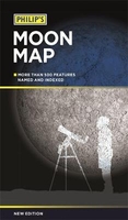
Philip`s Moon Map 2018

* The essential map for all Moonwatchers* Superbly detailed map of the Moon`s visible surface* 500 Moon features located, with index* Craters, seas, mountains, peaks and valleys* Landing sites of manned and unmanned spacecraft located* Helpful text aids moonwatching* Plus map of the far side of the Moon* Maps drawn by lunar expert Dr. John Murray
RIP - This product is no longer available on our network. It was last seen on 25.09.2019

This page now acts as a permanent archive for this product. Add more information using the comments box below to ensure it can still be found by future generations.

Use our search facility to see if it is available from an alternative contributor.
  • Availability: Out Of Stock
  • Supplier: Stanfords
  • SKU: 9781849074889
Availability: In Stock
£7.99

Product Description

* The essential map for all Moonwatchers* Superbly detailed map of the Moon`s visible surface* 500 Moon features located, with index* Craters, seas, mountains, peaks & valleys* Landing sites of manned & unmanned spacecraft located* Helpful text aids moonwatching* Plus map of the far side of the Moon* Maps drawn by lunar expert Dr. John Murray

Reviews/Comments

Add New

Intelligent Comparison

Oooops!
We couldn't find anything!
Perhaps this product's unique.... Or perhaps we are still looking for comparisons!
Click to bump this page and we'll hurry up.

Price History

Vouchers

No voucher codes found.
Do you know a voucher code for this product or supplier? Add it to Insights for others to use.

Facebook

Jargon Buster

Supplier Information

Stanfords
Stanfords was established in 1853 and opened their iconic Covent Garden flagship store in 1901. They have become the top retailer of maps, travel books and accessories in the UK and arguably offer the largest selection of maps and travel books worldwide. Famous names such as Captain Robert Falcon Scott, Ranulph Fiennes and Michael Palin have purchased from Stanfords. They now have a shop in Bristol and both stores together with other venues operate a calendar of events including talks, book signings and exhibitions. As a specialist map retailer, the map selection is comprehensive and includes road maps, street maps and walking maps from worldwide destinations, as well as a selection of world atlases and wall maps. Books include travel guides and travel literature. Stanfords also stock globes, from miniatures made of blue marble to magnificent floor-standing globes. The website features a selection of interesting articles on travel topics.
Page Updated: 2023-11-12 20:15:36

Community Generated Product Tags

Oh No! The productWIKI community hasn't generated any tags for this product yet!
Menu